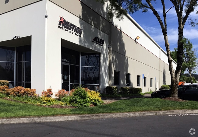
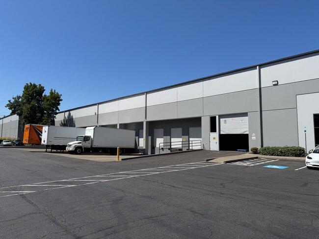
Property Record
7930 Sw Burns Way, Wilsonville, OR 97070
Current Lease Availabilities
NEARBY LISTINGS FOR SALE OR LEASE
Property Detail
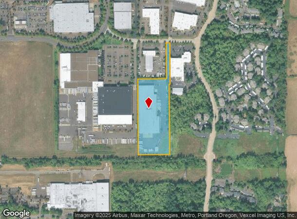
7930 Sw Burns Way
Portland-Vancouver-Hillsboro, OR-WA
Partition Plat
00805597
1993-133 PARTITION PLAT PARCEL 1
Industrialgeneral
Clackamas
X
Oregon
41067C0609E
1
2025
7.35 AC
2025
Wilsonville
024402
Portland
DEMOGRAPHICS near 7930 Sw Burns Way
1 Mile
3 Mile
5 Mile
2024 Total Population
3,844
38,706
87,313
2029 Population
3,902
39,297
88,249
Pop Growth 2024-2029
+ 1.51%
+ 1.53%
+ 1.07%
Average Age
37
40
41
2024 Total Households
1,146
14,594
33,342
HH Growth 2024-2029
+ 1.75%
+ 1.63%
+ 1.15%
Median Household Inc
$98,801
$106,891
$102,341
Avg Household Size
2.40
2.50
2.50
2024 Avg HH Vehicles
2.00
2.00
2.00
Median Home Value
$652,174
$609,958
$618,006
Median Year Built
1997
1995
1992
Nearby Places
Map Layers
Map Styles
 Street
 Aerial
- Restaurants
- Banks
- Shops
- Fitness
- Groceries
PUBLIC TRANSPORTATION
COMMUTER RAIL
Wilsonville (Westside Express Service - Tri-County Metropolitan Transportation District of Oregon Rail (TriMet Rail))
DRIVE
WALK
Distance
Wilsonville (Westside Express Service - Tri-County Metropolitan Transportation District of Oregon Rail (TriMet Rail))
8 min
2.8 mi
Tualatin (Westside Express Service - Tri-County Metropolitan Transportation District of Oregon Rail (TriMet Rail))
DRIVE
WALK
Distance
Tualatin (Westside Express Service - Tri-County Metropolitan Transportation District of Oregon Rail (TriMet Rail))
10 min
4.4 mi
AIRPORT
Portland International
DRIVE
WALK
Distance
Portland International
42 min
27.3 mi
Nearby Properties
Address
Land Use
TOTAL SIZE
Lot Size
Zoning
Address
Land Use
TOTAL SIZE
Lot Size
Zoning
508,000 SF
69.72 AC
PFC
Address
Land Use
TOTAL SIZE
Lot Size
Zoning
20.21 AC
FDAHI
Address
Land Use
TOTAL SIZE
Lot Size
Zoning
9.76 AC
PDI
Address
Land Use
TOTAL SIZE
Lot Size
Zoning
54.36 AC
PDI
Address
Land Use
TOTAL SIZE
Lot Size
Zoning
16.18 AC
PDR4
Address
Land Use
TOTAL SIZE
Lot Size
Zoning
21.25 AC
PDR5
Address
Land Use
TOTAL SIZE
Lot Size
Zoning
216,000 SF
64.68 AC
RL
Address
Land Use
TOTAL SIZE
Lot Size
Zoning
Address
Land Use
TOTAL SIZE
Lot Size
Zoning
26.06 AC
PDI
Address
Land Use
TOTAL SIZE
Lot Size
Zoning
24.75 AC
PDI
Address
Land Use
TOTAL SIZE
Lot Size
Zoning
Address
Land Use
TOTAL SIZE
Lot Size
Zoning
18.49 AC
TC
Address
Land Use
TOTAL SIZE
Lot Size
Zoning
24.67 AC
PDR6
Address
Land Use
TOTAL SIZE
Lot Size
Zoning
20.20 AC
PDR6
Address
Land Use
TOTAL SIZE
Lot Size
Zoning
14.44 AC
PDI
Address
Land Use
TOTAL SIZE
Lot Size
Zoning
26.18 AC
PDI
Address
Land Use
TOTAL SIZE
Lot Size
Zoning
87.02 AC
PDI
Address
Land Use
TOTAL SIZE
Lot Size
Zoning
Address
Land Use
TOTAL SIZE
Lot Size
Zoning
14.05 AC
PDR5
Address
Land Use
TOTAL SIZE
Lot Size
Zoning
3,474 SF
23.31 AC
PDI
Address
Land Use
TOTAL SIZE
Lot Size
Zoning
Address
Land Use
TOTAL SIZE
Lot Size
Zoning
18.55 AC
EI
Address
Land Use
TOTAL SIZE
Lot Size
Zoning
9,918 SF
25.16 AC
PDR5
Address
Land Use
TOTAL SIZE
Lot Size
Zoning
20.89 AC
PDR5
Address
Land Use
TOTAL SIZE
Lot Size
Zoning
12.32 AC
PDR5
Address
Land Use
TOTAL SIZE
Lot Size
Zoning
3.41 AC
PDR4
Address
Land Use
TOTAL SIZE
Lot Size
Zoning
20.84 AC
PDI
Address
Land Use
TOTAL SIZE
Lot Size
Zoning
Address
Land Use
TOTAL SIZE
Lot Size
Zoning
14 AC
PDR6
Address
Land Use
TOTAL SIZE
Lot Size
Zoning
The World's #1 Commercial Real Estate Marketplace
Connect with us
© 2026 CoStar Group
The information above has been obtained from sources believed reliable. While we do not doubt its accuracy we have not verified it and make no guarantee, warranty or representation about it. It is your responsibility to independently confirm its accuracy and completeness. Any projections, opinions, assumptions, or estimates used are for example only and do not represent the current or future performance of the property. The value of this transaction to you depends on tax and other factors which should be evaluated by your tax, financial, and legal advisors. You and your advisors should conduct a careful, independent investigation of the property to determine to your satisfaction the suitability of the property for your needs.