Property Record
7931 Paxton Ave, Tinley Park, IL 60477

NEARBY LISTINGS FOR SALE OR LEASE
Property Detail
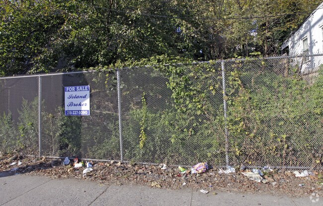
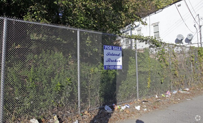
7931 Paxton Ave
00035-0118
Staten Island
Commercialofficeresidentialmixeduse
New York
X
118
3604970189F
0.06 AC
2024
Staten Island
2025
Long Island (New York)
001100
New York-Jersey City-White Plains, NY-NJ
2,017 SF
DEMOGRAPHICS near 7931 Paxton Ave
1 Mile
3 Mile
5 Mile
2024 Total Population
42,078
246,607
736,991
2029 Population
41,721
241,246
698,258
Pop Growth 2024-2029
(0.85%)
(2.17%)
(5.26%)
Average Age
40
40
39
2024 Total Households
15,385
90,600
252,252
HH Growth 2024-2029
(0.64%)
(2.45%)
(5.40%)
Median Household Inc
$63,000
$74,743
$70,465
Avg Household Size
2.50
2.60
2.80
2024 Avg HH Vehicles
1.00
1.00
1.00
Median Home Value
$578,138
$596,846
$655,299
Median Year Built
1953
1956
1952
Nearby Places
Map Layers
Map Styles
 Street
 Aerial
- Restaurants
- Banks
- Shops
- Fitness
- Groceries
PUBLIC TRANSPORTATION
COMMUTER RAIL
Tinley Park - 80Th Avenue Station (Rock Island District Line - Northeast Illinois Regional Commuter Railroad (Metra))
DRIVE
WALK
Distance
Tinley Park - 80Th Avenue Station (Rock Island District Line - Northeast Illinois Regional Commuter Railroad (Metra))
6 min
2.1 mi
Tinley Park Station (Rock Island District Line - Northeast Illinois Regional Commuter Railroad (Metra))
DRIVE
WALK
Distance
Tinley Park Station (Rock Island District Line - Northeast Illinois Regional Commuter Railroad (Metra))
6 min
2.3 mi
AIRPORT
Chicago Midway International
DRIVE
WALK
Distance
Chicago Midway International
30 min
18.0 mi
Chicago O'Hare International
DRIVE
WALK
Distance
Chicago O'Hare International
53 min
32.2 mi
Freight Ports
Port Milwaukee
DRIVE
WALK
Distance
Port Milwaukee
135 min
108.6 mi
Nearby Properties
Address
Land Use
TOTAL SIZE
Lot Size
Zoning
Address
Land Use
TOTAL SIZE
Lot Size
Zoning
298,700 SF
Address
Land Use
TOTAL SIZE
Lot Size
Zoning
30.10 AC
Address
Land Use
TOTAL SIZE
Lot Size
Zoning
266,729 SF
20.64 AC
Address
Land Use
TOTAL SIZE
Lot Size
Zoning
188,930 SF
9.40 AC
Address
Land Use
TOTAL SIZE
Lot Size
Zoning
Address
Land Use
TOTAL SIZE
Lot Size
Zoning
216,735 SF
11.33 AC
Address
Land Use
TOTAL SIZE
Lot Size
Zoning
103,110 SF
9.12 AC
Address
Land Use
TOTAL SIZE
Lot Size
Zoning
68,954 SF
Address
Land Use
TOTAL SIZE
Lot Size
Zoning
168,708 SF
14.74 AC
Address
Land Use
TOTAL SIZE
Lot Size
Zoning
67,394 SF
6.72 AC
Address
Land Use
TOTAL SIZE
Lot Size
Zoning
6.16 AC
Address
Land Use
TOTAL SIZE
Lot Size
Zoning
155,657 SF
15.68 AC
Address
Land Use
TOTAL SIZE
Lot Size
Zoning
911,379 SF
51.23 AC
Address
Land Use
TOTAL SIZE
Lot Size
Zoning
Address
Land Use
TOTAL SIZE
Lot Size
Zoning
238,068 SF
13.96 AC
Address
Land Use
TOTAL SIZE
Lot Size
Zoning
134,148 SF
5 AC
Address
Land Use
TOTAL SIZE
Lot Size
Zoning
454,002 SF
10.50 AC
Address
Land Use
TOTAL SIZE
Lot Size
Zoning
200,815 SF
10 AC
Address
Land Use
TOTAL SIZE
Lot Size
Zoning
135,849 SF
12.77 AC
Address
Land Use
TOTAL SIZE
Lot Size
Zoning
132,193 SF
16.49 AC
Address
Land Use
TOTAL SIZE
Lot Size
Zoning
Address
Land Use
TOTAL SIZE
Lot Size
Zoning
280,313 SF
12.75 AC
Address
Land Use
TOTAL SIZE
Lot Size
Zoning
122,846 SF
17.42 AC
Address
Land Use
TOTAL SIZE
Lot Size
Zoning
23.67 AC
Address
Land Use
TOTAL SIZE
Lot Size
Zoning
114,484 SF
14.88 AC
Address
Land Use
TOTAL SIZE
Lot Size
Zoning
108,890 SF
10.01 AC
Address
Land Use
TOTAL SIZE
Lot Size
Zoning
8.50 AC
Address
Land Use
TOTAL SIZE
Lot Size
Zoning
92,499 SF
5.29 AC
Address
Land Use
TOTAL SIZE
Lot Size
Zoning
176,762 SF
6.43 AC
Address
Land Use
TOTAL SIZE
Lot Size
Zoning
273,000 SF
20.69 AC
The World's #1 Commercial Real Estate Marketplace
Connect with us
© 2025 CoStar Group
The information above has been obtained from sources believed reliable. While we do not doubt its accuracy we have not verified it and make no guarantee, warranty or representation about it. It is your responsibility to independently confirm its accuracy and completeness. Any projections, opinions, assumptions, or estimates used are for example only and do not represent the current or future performance of the property. The value of this transaction to you depends on tax and other factors which should be evaluated by your tax, financial, and legal advisors. You and your advisors should conduct a careful, independent investigation of the property to determine to your satisfaction the suitability of the property for your needs.