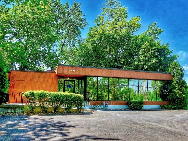
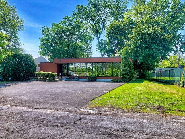
Property Record
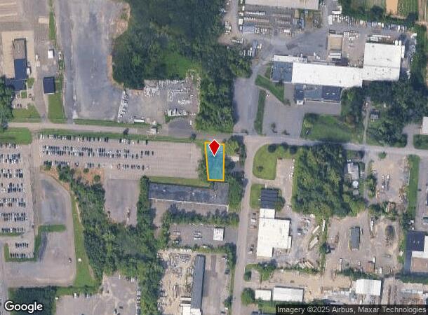
794 Watervliet Shaker Rd, Latham, NY 12110
NEARBY LISTINGS FOR SALE OR LEASE
Property Detail
794 Watervliet Shaker Rd
012689-030-000-0003-032-000-0000
N-W SHA RD E-792 C-69-11
Officebuilding
Albany
X
New York
36001C0181D
32.000
2025
0.26 AC
2024
E Outer Albany County
013703
Albany/Schenectady/Troy
2,228 SF
Albany-Schenectady-Troy, NY
DEMOGRAPHICS near 794 Watervliet Shaker Rd
1 Mile
3 Mile
5 Mile
2024 Total Population
1,480
47,739
141,293
2029 Population
1,493
47,459
140,649
Pop Growth 2024-2029
+ 0.88%
(0.59%)
(0.46%)
Average Age
42
43
41
2024 Total Households
618
19,295
56,162
HH Growth 2024-2029
+ 0.49%
(0.65%)
(0.56%)
Median Household Inc
$86,526
$93,187
$82,169
Avg Household Size
2.30
2.30
2.20
2024 Avg HH Vehicles
2.00
2.00
2.00
Median Home Value
$289,006
$280,207
$265,128
Median Year Built
1981
1971
1969
Nearby Places
- Restaurants
- Banks
- Shops
- Fitness
- Groceries
PUBLIC TRANSPORTATION
COMMUTER RAIL
DRIVE
WALK
Distance
23 min
9.9 mi
AIRPORT
Albany International
DRIVE
WALK
Distance
Albany International
8 min
3.0 mi
SALE & LEASE HISTORY
LISTING DATE
SALE/LEASE

May 25, 2018
For Sale
Nearby Properties
Address
Land Use
TOTAL SIZE
Lot Size
Zoning
Address
Land Use
TOTAL SIZE
Lot Size
Zoning
821,670 SF
803.50 AC
17
Address
Land Use
TOTAL SIZE
Lot Size
Zoning
18,340 SF
159.79 AC
04 - FARM
Address
Land Use
TOTAL SIZE
Lot Size
Zoning
10,216 SF
48.37 AC
16
Address
Land Use
TOTAL SIZE
Lot Size
Zoning
154,580 SF
89.34 AC
16
Address
Land Use
TOTAL SIZE
Lot Size
Zoning
373,296 SF
11.70 AC
46
Address
Land Use
TOTAL SIZE
Lot Size
Zoning
365,400 SF
73.90 AC
04 - FARM
Address
Land Use
TOTAL SIZE
Lot Size
Zoning
226,171 SF
26.39 AC
12
Address
Land Use
TOTAL SIZE
Lot Size
Zoning
301,834 SF
9 AC
26
Address
Land Use
TOTAL SIZE
Lot Size
Zoning
266,600 SF
22.60 AC
47
Address
Land Use
TOTAL SIZE
Lot Size
Zoning
242,630 SF
18.50 AC
16
Address
Land Use
TOTAL SIZE
Lot Size
Zoning
84,242 SF
43.60 AC
12
Address
Land Use
TOTAL SIZE
Lot Size
Zoning
25,786 SF
8 AC
17
Address
Land Use
TOTAL SIZE
Lot Size
Zoning
167,222 SF
15.65 AC
14
Address
Land Use
TOTAL SIZE
Lot Size
Zoning
77.50 AC
M1
Address
Land Use
TOTAL SIZE
Lot Size
Zoning
162,500 SF
19.90 AC
17
Address
Land Use
TOTAL SIZE
Lot Size
Zoning
256,101 SF
9 AC
12
Address
Land Use
TOTAL SIZE
Lot Size
Zoning
141,570 SF
4.43 AC
12
Address
Land Use
TOTAL SIZE
Lot Size
Zoning
264,473 SF
26.40 AC
25
Address
Land Use
TOTAL SIZE
Lot Size
Zoning
238,709 SF
55.82 AC
04 - FARM
Address
Land Use
TOTAL SIZE
Lot Size
Zoning
83,120 SF
126.75 AC
25
Address
Land Use
TOTAL SIZE
Lot Size
Zoning
151,287 SF
11.20 AC
12
Address
Land Use
TOTAL SIZE
Lot Size
Zoning
73,736 SF
7.58 AC
14
Address
Land Use
TOTAL SIZE
Lot Size
Zoning
214,716 SF
28.40 AC
19
Address
Land Use
TOTAL SIZE
Lot Size
Zoning
272,520 SF
20.70 AC
16
Address
Land Use
TOTAL SIZE
Lot Size
Zoning
9,774 SF
49.20 AC
43
Address
Land Use
TOTAL SIZE
Lot Size
Zoning
80,891 SF
3.02 AC
04 - FARM
Address
Land Use
TOTAL SIZE
Lot Size
Zoning
14,112 SF
24.70 AC
25
Address
Land Use
TOTAL SIZE
Lot Size
Zoning
53,852 SF
43.35 AC
25
Address
Land Use
TOTAL SIZE
Lot Size
Zoning
25,112 SF
13.16 AC
04 - FARM
Address
Land Use
TOTAL SIZE
Lot Size
Zoning
159,580 SF
23.20 AC
04 - FARM
The World's #1 Commercial Real Estate Marketplace
Connect with us
© 2025 CoStar Group
The information above has been obtained from sources believed reliable. While we do not doubt its accuracy we have not verified it and make no guarantee, warranty or representation about it. It is your responsibility to independently confirm its accuracy and completeness. Any projections, opinions, assumptions, or estimates used are for example only and do not represent the current or future performance of the property. The value of this transaction to you depends on tax and other factors which should be evaluated by your tax, financial, and legal advisors. You and your advisors should conduct a careful, independent investigation of the property to determine to your satisfaction the suitability of the property for your needs.