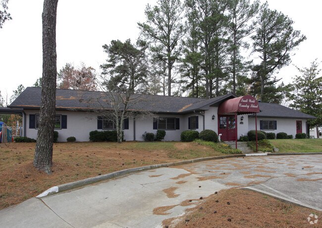
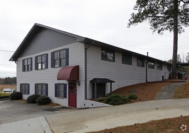
Property Record
7946 Highway 92, Woodstock, GA 30189
NEARBY LISTINGS FOR SALE OR LEASE
Property Detail
7946 Highway 92
015N06-00000-295-000-0000
LL 1220 15TH D
Commercialnec
Cherokee
X
Georgia
13057C0333E
1.88 AC
2025
Cherokee/Woodstock
2025
Atlanta
091013
Atlanta-Sandy Springs-Roswell, GA
12,240 SF
DEMOGRAPHICS near 7946 Highway 92
1 Mile
3 Mile
5 Mile
2024 Total Population
6,823
79,807
184,952
2029 Population
7,775
87,551
200,329
Pop Growth 2024-2029
+ 13.95%
+ 9.70%
+ 8.31%
Average Age
40
39
39
2024 Total Households
2,656
29,750
67,417
HH Growth 2024-2029
+ 14.50%
+ 10.00%
+ 8.52%
Median Household Inc
$90,094
$86,425
$91,588
Avg Household Size
2.50
2.60
2.60
2024 Avg HH Vehicles
2.00
2.00
2.00
Median Home Value
$286,214
$295,776
$310,120
Median Year Built
1992
1993
1993
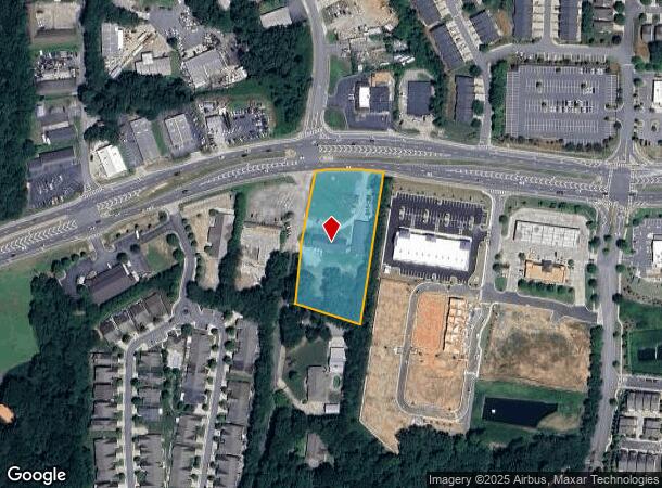
Nearby Places
Map Layers
Map Styles
 Street
 Aerial
- Restaurants
- Banks
- Shops
- Fitness
- Groceries
SALE & LEASE HISTORY
LISTING DATE
SALE/LEASE

Mar 15, 2023
For Lease
Nearby Properties
Address
Land Use
TOTAL SIZE
Lot Size
Zoning
Address
Land Use
TOTAL SIZE
Lot Size
Zoning
523,803 SF
148.37 AC
R-40
Address
Land Use
TOTAL SIZE
Lot Size
Zoning
56,439 SF
13.69 AC
GC
Address
Land Use
TOTAL SIZE
Lot Size
Zoning
189,621 SF
12.16 AC
R-40
Address
Land Use
TOTAL SIZE
Lot Size
Zoning
228,644 SF
7.88 AC
DT-CBD
Address
Land Use
TOTAL SIZE
Lot Size
Zoning
309,011 SF
64.20 AC
PUD
Address
Land Use
TOTAL SIZE
Lot Size
Zoning
175,587 SF
17.71 AC
RTH
Address
Land Use
TOTAL SIZE
Lot Size
Zoning
197,890 SF
14.60 AC
R-4
Address
Land Use
TOTAL SIZE
Lot Size
Zoning
181,704 SF
17.56 AC
DT-MRA
Address
Land Use
TOTAL SIZE
Lot Size
Zoning
188,105 SF
25.86 AC
R-5
Address
Land Use
TOTAL SIZE
Lot Size
Zoning
201,331 SF
15.48 AC
RM16
Address
Land Use
TOTAL SIZE
Lot Size
Zoning
367,587 SF
26.87 AC
RM-12
Address
Land Use
TOTAL SIZE
Lot Size
Zoning
346,900 SF
104.10 AC
CD
Address
Land Use
TOTAL SIZE
Lot Size
Zoning
360,937 SF
32.56 AC
RM-12
Address
Land Use
TOTAL SIZE
Lot Size
Zoning
235,861 SF
31.92 AC
RM10
Address
Land Use
TOTAL SIZE
Lot Size
Zoning
280,546 SF
26.91 AC
RM-12
Address
Land Use
TOTAL SIZE
Lot Size
Zoning
238,600 SF
21.10 AC
R-3
Address
Land Use
TOTAL SIZE
Lot Size
Zoning
91,547 SF
18.48 AC
R-3
Address
Land Use
TOTAL SIZE
Lot Size
Zoning
195,033 SF
22.85 AC
RM-8
Address
Land Use
TOTAL SIZE
Lot Size
Zoning
181,526 SF
6.52 AC
RM-12
Address
Land Use
TOTAL SIZE
Lot Size
Zoning
255,460 SF
20.28 AC
RM16
Address
Land Use
TOTAL SIZE
Lot Size
Zoning
232,415 SF
19.23 AC
RM-12
Address
Land Use
TOTAL SIZE
Lot Size
Zoning
131,024 SF
6.32 AC
RM-12
Address
Land Use
TOTAL SIZE
Lot Size
Zoning
229,440 SF
13 AC
OI
Address
Land Use
TOTAL SIZE
Lot Size
Zoning
113,849 SF
7.46 AC
R-5
Address
Land Use
TOTAL SIZE
Lot Size
Zoning
85,671 SF
12.25 AC
RM10
Address
Land Use
TOTAL SIZE
Lot Size
Zoning
194,729 SF
29.67 AC
GC
Address
Land Use
TOTAL SIZE
Lot Size
Zoning
134,017 SF
32.51 AC
AG
Address
Land Use
TOTAL SIZE
Lot Size
Zoning
63,264 SF
8 AC
PUD
Address
Land Use
TOTAL SIZE
Lot Size
Zoning
132,022 SF
12.69 AC
GC
Address
Land Use
TOTAL SIZE
Lot Size
Zoning
5.46 AC
RSL
The World's #1 Commercial Real Estate Marketplace
Connect with us
© 2025 CoStar Group
The information above has been obtained from sources believed reliable. While we do not doubt its accuracy we have not verified it and make no guarantee, warranty or representation about it. It is your responsibility to independently confirm its accuracy and completeness. Any projections, opinions, assumptions, or estimates used are for example only and do not represent the current or future performance of the property. The value of this transaction to you depends on tax and other factors which should be evaluated by your tax, financial, and legal advisors. You and your advisors should conduct a careful, independent investigation of the property to determine to your satisfaction the suitability of the property for your needs.