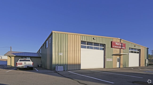
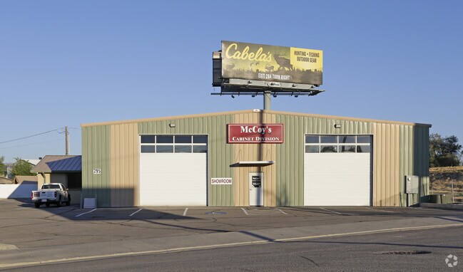
Property Record
795 N 400 E, Lehi, UT 84043

Property Detail
795 N 400 E
Provo-Orem-Lehi, UT
COM & S 154.5 FT FR NW COR. LOT 3, BLK. 94, PLAT A, LEHI CITY SURVEY; E 143 FT; N 54 DEG 51 40 W 173.01 FT; S 13 FT; ALONG A CURVE TO R (CHORD BEARS: S 34 DEG 20 51 E 34.15 FT, RADIUS = 30 FT); ALONG A CURVE TO R (CHORD BEARS: S 8 DEG 3 39 E 8.97 FT,
01-090-0093
Utah
Warehouse
Utah
2024
3
2025
0.77 AC
000102
Utah County
8,091 SF
Salt Lake City
NEARBY LISTINGS FOR SALE OR LEASE
DEMOGRAPHICS near 795 N 400 E
1 mile
3 mile
5 mile
2025 Total Population
11,931
91,547
196,793
2030 Population
13,003
101,096
218,569
Pop Growth 2025-2030
+ 8.98%
+ 10.43%
+ 11.07%
Average Age
34
32
31
2025 Total Households
3,474
24,595
54,421
HH Growth 2025-2030
+ 9.73%
+ 11.19%
+ 11.84%
Median Household Inc
$98,174
$129,743
$126,464
Avg Household Size
3.40
3.70
3.60
2025 Avg HH Vehicles
2.00
3.00
2.00
Median Home Value
$624,531
$675,181
$676,542
Median Year Built
1992
2004
2008
Nearby Places
Map Layers
Map Styles
 Street
 Aerial
Transit
 Traffic
 Biking
Places
Listings with unknown addresses are not visible on the map
- Restaurants
- Banks
- Shops
- Fitness
- Groceries
PUBLIC TRANSPORTATION
COMMUTER RAIL
American Fork Station (FrontRunner - Utah Transit Authority (UTA))
Drive
Walk
Distance
American Fork Station (FrontRunner - Utah Transit Authority (UTA))
6 min
2.8 mi
Lehi Station (FrontRunner - Utah Transit Authority (UTA))
Drive
Walk
Distance
Lehi Station (FrontRunner - Utah Transit Authority (UTA))
10 min
6.2 mi
AIRPORT
Provo Municipal
Drive
Walk
Distance
Provo Municipal
22 min
18.0 mi
Salt Lake City International
Drive
Walk
Distance
Salt Lake City International
40 min
34.2 mi
Freight Ports
Port of Stockton
Drive
Walk
Distance
Port of Stockton
740 min
724.6 mi
Nearby Properties
Address
Land Use
TOTAL SIZE
Lot Size
Zoning
Address
Land Use
TOTAL SIZE
Lot Size
Zoning
2,586,860 SF
99.85 AC
Address
Land Use
TOTAL SIZE
Lot Size
Zoning
264,805 SF
16.20 AC
Address
Land Use
TOTAL SIZE
Lot Size
Zoning
130,480 SF
27.19 AC
Address
Land Use
TOTAL SIZE
Lot Size
Zoning
130,480 SF
25.12 AC
Address
Land Use
TOTAL SIZE
Lot Size
Zoning
376,499 SF
5.22 AC
Address
Land Use
TOTAL SIZE
Lot Size
Zoning
301,411 SF
13.27 AC
Address
Land Use
TOTAL SIZE
Lot Size
Zoning
166,233 SF
8.70 AC
Address
Land Use
TOTAL SIZE
Lot Size
Zoning
545,572 SF
182.84 AC
Address
Land Use
TOTAL SIZE
Lot Size
Zoning
281,215 SF
15.30 AC
Address
Land Use
TOTAL SIZE
Lot Size
Zoning
359,445 SF
6.46 AC
Address
Land Use
TOTAL SIZE
Lot Size
Zoning
186,256 SF
4.19 AC
Address
Land Use
TOTAL SIZE
Lot Size
Zoning
131,961 SF
7.57 AC
Address
Land Use
TOTAL SIZE
Lot Size
Zoning
194,033 SF
7.76 AC
Address
Land Use
TOTAL SIZE
Lot Size
Zoning
194,767 SF
7.35 AC
Address
Land Use
TOTAL SIZE
Lot Size
Zoning
216,478 SF
7.38 AC
Address
Land Use
TOTAL SIZE
Lot Size
Zoning
305,553 SF
13.08 AC
Address
Land Use
TOTAL SIZE
Lot Size
Zoning
206,456 SF
6.55 AC
Address
Land Use
TOTAL SIZE
Lot Size
Zoning
215,516 SF
4.93 AC
Address
Land Use
TOTAL SIZE
Lot Size
Zoning
181,908 SF
1.43 AC
Address
Land Use
TOTAL SIZE
Lot Size
Zoning
147,368 SF
6.91 AC
Address
Land Use
TOTAL SIZE
Lot Size
Zoning
304,991 SF
7.05 AC
Address
Land Use
TOTAL SIZE
Lot Size
Zoning
149,591 SF
7.07 AC
Address
Land Use
TOTAL SIZE
Lot Size
Zoning
9.80 AC
Address
Land Use
TOTAL SIZE
Lot Size
Zoning
227,030 SF
21.91 AC
Address
Land Use
TOTAL SIZE
Lot Size
Zoning
165,821 SF
12.29 AC
Address
Land Use
TOTAL SIZE
Lot Size
Zoning
150,068 SF
5.05 AC
Address
Land Use
TOTAL SIZE
Lot Size
Zoning
146,675 SF
1.09 AC
Address
Land Use
TOTAL SIZE
Lot Size
Zoning
201,838 SF
8.83 AC
Address
Land Use
TOTAL SIZE
Lot Size
Zoning
98,726 SF
2.85 AC
Address
Land Use
TOTAL SIZE
Lot Size
Zoning
149,937 SF
13.49 AC
The World's #1 Commercial Real Estate Marketplace
Connect with us
© 2026 CoStar Group
The information above has been obtained from sources believed reliable. While we do not doubt its accuracy we have not verified it and make no guarantee, warranty or representation about it. It is your responsibility to independently confirm its accuracy and completeness. Any projections, opinions, assumptions, or estimates used are for example only and do not represent the current or future performance of the property. The value of this transaction to you depends on tax and other factors which should be evaluated by your tax, financial, and legal advisors. You and your advisors should conduct a careful, independent investigation of the property to determine to your satisfaction the suitability of the property for your needs.