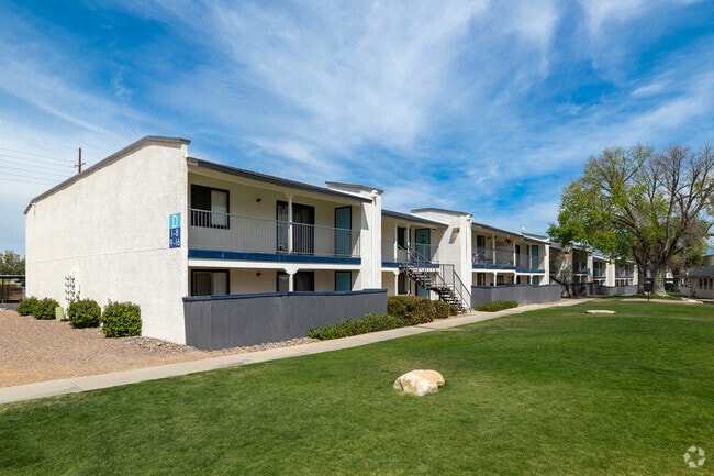
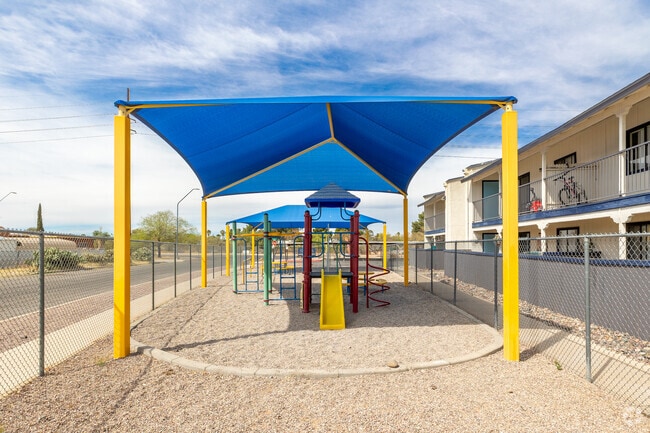
Property Record
7950 E Stella Rd, Tucson, AZ 85730

Save to a Folder
{{folder.Name}}
{{folder.ListingIds.length}} Properties
{{folder.ListingIds.length}} Property
Create a New Folder
Property Detail
7950 E Stella Rd
136-19-194A
LAKESIDE NO 2-ALL OF BLOCK 3 & 16 ALLEY LYG ADJ TO & NW
Apartment
Pima
R3
Arizona
AH Areas with a 1% annual chance of shallow flooding, usually in the form of a pond, withan average depth ranging from 1 to 3 feet. These areas have a 26% chance of flooding over the life of a 30-year mortgage.
183
2025
5.82 AC
2026
Lakeside Park
004036
Tucson
131,673 SF
Tucson, AZ
NEARBY LISTINGS FOR SALE OR LEASE
-
-
View all Tucson listings for sale on LoopNet.com
DEMOGRAPHICS near 7950 E Stella Rd
1 mile
3 mile
5 mile
2025 Total Population
16,608
90,638
191,661
2030 Population
16,848
92,295
196,199
Pop Growth 2025-2030
+ 1.45%
+ 1.83%
+ 2.37%
Average Age
41
40
41
2025 Total Households
6,888
38,204
82,448
HH Growth 2025-2030
+ 1.60%
+ 2.01%
+ 2.41%
Median Household Inc
$57,869
$61,074
$63,308
Avg Household Size
2.30
2.30
2.20
2025 Avg HH Vehicles
2.00
2.00
2.00
Median Home Value
$244,843
$266,414
$306,463
Median Year Built
1977
1976
1978
Nearby Places
Map Layers
Map Styles
 Street
 Aerial
Layers
 Traffic
 Biking
Places
Listings with unknown addresses are not visible on the map
- Restaurants
- Banks
- Shops
- Fitness
- Groceries
PUBLIC TRANSPORTATION
AIRPORT
Tucson International
Drive
Walk
Distance
Tucson International
20 min
11.1 mi
Freight Ports
Port of San Diego
Drive
Walk
Distance
Port of San Diego
452 min
418.5 mi
Nearby Properties
Address
Land Use
TOTAL SIZE
Lot Size
Zoning
Address
Land Use
TOTAL SIZE
Lot Size
Zoning
2,315,205 SF
628.02 AC
I1
Address
Land Use
TOTAL SIZE
Lot Size
Zoning
222,434 SF
19.43 AC
Address
Land Use
TOTAL SIZE
Lot Size
Zoning
41,486 SF
0.93 AC
C2
Address
Land Use
TOTAL SIZE
Lot Size
Zoning
157,473 SF
56.40 AC
SR
Address
Land Use
TOTAL SIZE
Lot Size
Zoning
504,584 SF
18.17 AC
O3
Address
Land Use
TOTAL SIZE
Lot Size
Zoning
26,554 SF
5.08 AC
I1
Address
Land Use
TOTAL SIZE
Lot Size
Zoning
209,980 SF
6.16 AC
C2
Address
Land Use
TOTAL SIZE
Lot Size
Zoning
318,290 SF
32 AC
R1
Address
Land Use
TOTAL SIZE
Lot Size
Zoning
273,640 SF
21.20 AC
O3
Address
Land Use
TOTAL SIZE
Lot Size
Zoning
188,350 SF
10.81 AC
Address
Land Use
TOTAL SIZE
Lot Size
Zoning
88,579 SF
9.59 AC
Address
Land Use
TOTAL SIZE
Lot Size
Zoning
128,894 SF
10.06 AC
C1
Address
Land Use
TOTAL SIZE
Lot Size
Zoning
268,026 SF
16 AC
R3
Address
Land Use
TOTAL SIZE
Lot Size
Zoning
259,360 SF
45 AC
R1
Address
Land Use
TOTAL SIZE
Lot Size
Zoning
171,301 SF
6.36 AC
C3
Address
Land Use
TOTAL SIZE
Lot Size
Zoning
83,067 SF
37.84 AC
RX1
Address
Land Use
TOTAL SIZE
Lot Size
Zoning
144,316 SF
14.71 AC
C2
Address
Land Use
TOTAL SIZE
Lot Size
Zoning
15,893 SF
2.86 AC
I1
Address
Land Use
TOTAL SIZE
Lot Size
Zoning
165,096 SF
13.04 AC
C2
Address
Land Use
TOTAL SIZE
Lot Size
Zoning
6,120 SF
5.50 AC
C2
Address
Land Use
TOTAL SIZE
Lot Size
Zoning
115,098 SF
14.68 AC
C1
Address
Land Use
TOTAL SIZE
Lot Size
Zoning
56,535 SF
420.93 AC
Address
Land Use
TOTAL SIZE
Lot Size
Zoning
6,659 SF
146.53 AC
MH2
Address
Land Use
TOTAL SIZE
Lot Size
Zoning
289,691 SF
15.63 AC
R3
Address
Land Use
TOTAL SIZE
Lot Size
Zoning
142,448 SF
11.54 AC
C2
Address
Land Use
TOTAL SIZE
Lot Size
Zoning
389,728 SF
6.50 AC
R3
Address
Land Use
TOTAL SIZE
Lot Size
Zoning
176,387 SF
8.11 AC
C2
Address
Land Use
TOTAL SIZE
Lot Size
Zoning
147,456 SF
10.18 AC
R3
Address
Land Use
TOTAL SIZE
Lot Size
Zoning
84,159 SF
15.16 AC
RX1
Address
Land Use
TOTAL SIZE
Lot Size
Zoning
214,282 SF
10.31 AC
C1
The World's #1 Commercial Real Estate Marketplace
Connect with us
© 2026 CoStar Group
The information above has been obtained from sources believed reliable. While we do not doubt its accuracy we have not verified it and make no guarantee, warranty or representation about it. It is your responsibility to independently confirm its accuracy and completeness. Any projections, opinions, assumptions, or estimates used are for example only and do not represent the current or future performance of the property. The value of this transaction to you depends on tax and other factors which should be evaluated by your tax, financial, and legal advisors. You and your advisors should conduct a careful, independent investigation of the property to determine to your satisfaction the suitability of the property for your needs.