Property Record
7950 Seward Rd, Fairfield, OH 45011
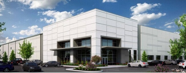

Property Detail
7950 Seward Rd
Cincinnati, OH-KY-IN
9380 ENT SEE TIF PCL 035T - SEWARD RD TIF
A0300-007-000-035
BUTLER
Warehouse
Ohio
2024
23.73 AC
2025
Tri-County
010909
Cincinnati/Dayton
319,568 SF
NEARBY LISTINGS FOR SALE OR LEASE
DEMOGRAPHICS near 7950 Seward Rd
1 mile
3 mile
5 mile
2025 Total Population
4,942
51,240
169,077
2030 Population
5,045
52,758
173,944
Pop Growth 2025-2030
+ 2.08%
+ 2.96%
+ 2.88%
Average Age
40
39
39
2025 Total Households
1,680
18,903
62,958
HH Growth 2025-2030
+ 1.96%
+ 3.09%
+ 3.00%
Median Household Inc
$116,459
$94,791
$85,686
Avg Household Size
2.90
2.60
2.60
2025 Avg HH Vehicles
2.00
2.00
2.00
Median Home Value
$293,052
$310,486
$275,208
Median Year Built
1994
1993
1981
Nearby Places
Map Layers
Map Styles
 Street
 Aerial
Layers
 Traffic
 Biking
Places
Listings with unknown addresses are not visible on the map
- Restaurants
- Banks
- Shops
- Fitness
- Groceries
PUBLIC TRANSPORTATION
AIRPORT
Cincinnati/Northern Kentucky International
Drive
Walk
Distance
Cincinnati/Northern Kentucky International
60 min
37.5 mi
Freight Ports
Port of Toledo
Drive
Walk
Distance
Port of Toledo
224 min
191.0 mi
SALE & LEASE HISTORY
LISTING DATE
SALE/LEASE

Mar 03, 2022
For Lease
Nearby Properties
Address
Land Use
TOTAL SIZE
Lot Size
Zoning
Address
Land Use
TOTAL SIZE
Lot Size
Zoning
1,398,190 SF
54.91 AC
Address
Land Use
TOTAL SIZE
Lot Size
Zoning
28.80 AC
Address
Land Use
TOTAL SIZE
Lot Size
Zoning
559,332 SF
29.30 AC
Address
Land Use
TOTAL SIZE
Lot Size
Zoning
706,768 SF
35.92 AC
Address
Land Use
TOTAL SIZE
Lot Size
Zoning
914,426 SF
41.39 AC
Address
Land Use
TOTAL SIZE
Lot Size
Zoning
510,080 SF
60.87 AC
Address
Land Use
TOTAL SIZE
Lot Size
Zoning
18.77 AC
Address
Land Use
TOTAL SIZE
Lot Size
Zoning
176,055 SF
31.46 AC
Address
Land Use
TOTAL SIZE
Lot Size
Zoning
334,887 SF
16.16 AC
Address
Land Use
TOTAL SIZE
Lot Size
Zoning
39.89 AC
Address
Land Use
TOTAL SIZE
Lot Size
Zoning
283,527 SF
28.17 AC
Address
Land Use
TOTAL SIZE
Lot Size
Zoning
467,263 SF
27.27 AC
ADV
Address
Land Use
TOTAL SIZE
Lot Size
Zoning
54.77 AC
Address
Land Use
TOTAL SIZE
Lot Size
Zoning
350,772 SF
23.62 AC
Address
Land Use
TOTAL SIZE
Lot Size
Zoning
31,930 SF
21.19 AC
Address
Land Use
TOTAL SIZE
Lot Size
Zoning
32,372 SF
32.90 AC
Address
Land Use
TOTAL SIZE
Lot Size
Zoning
567,230 SF
31.45 AC
Address
Land Use
TOTAL SIZE
Lot Size
Zoning
438,182 SF
28.80 AC
Address
Land Use
TOTAL SIZE
Lot Size
Zoning
629,044 SF
35.83 AC
Address
Land Use
TOTAL SIZE
Lot Size
Zoning
482,499 SF
27.83 AC
Address
Land Use
TOTAL SIZE
Lot Size
Zoning
319,568 SF
23.73 AC
Address
Land Use
TOTAL SIZE
Lot Size
Zoning
417,137 SF
47.57 AC
Address
Land Use
TOTAL SIZE
Lot Size
Zoning
357,452 SF
26.77 AC
Address
Land Use
TOTAL SIZE
Lot Size
Zoning
321,806 SF
15.72 AC
Address
Land Use
TOTAL SIZE
Lot Size
Zoning
433,277 SF
25.66 AC
Address
Land Use
TOTAL SIZE
Lot Size
Zoning
5,208 SF
41.56 AC
Address
Land Use
TOTAL SIZE
Lot Size
Zoning
506,870 SF
22.20 AC
Address
Land Use
TOTAL SIZE
Lot Size
Zoning
287,433 SF
23.36 AC
Address
Land Use
TOTAL SIZE
Lot Size
Zoning
310,074 SF
21.65 AC
Address
Land Use
TOTAL SIZE
Lot Size
Zoning
364,524 SF
16.99 AC
The World's #1 Commercial Real Estate Marketplace
Connect with us
© 2026 CoStar Group
The information above has been obtained from sources believed reliable. While we do not doubt its accuracy we have not verified it and make no guarantee, warranty or representation about it. It is your responsibility to independently confirm its accuracy and completeness. Any projections, opinions, assumptions, or estimates used are for example only and do not represent the current or future performance of the property. The value of this transaction to you depends on tax and other factors which should be evaluated by your tax, financial, and legal advisors. You and your advisors should conduct a careful, independent investigation of the property to determine to your satisfaction the suitability of the property for your needs.