Property Record
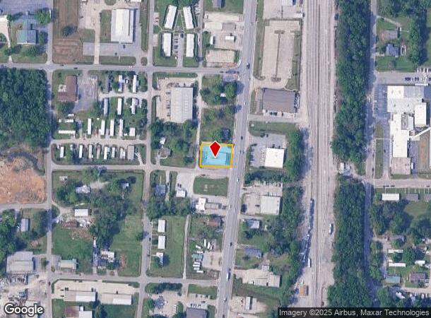
7950 Highway 31 S, Calera, AL 35040
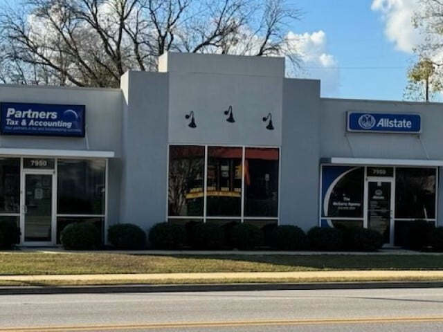
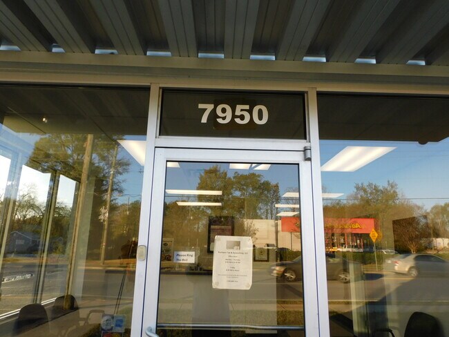
This Property Is For Sale
NEARBY LISTINGS FOR SALE OR LEASE
-
-
View all Calera listings for sale on LoopNet.com
Property Detail
7950 Highway 31 S
Birmingham-Hoover, AL
Dunstans
285211001020000
SEC/TWNSHP/RAN 21 22S 02W NBRHD: 03 CALERA COMMERCIAL (DOWNTOWN) R-2
Officebuilding
Shelby
X
Alabama
01021C0050E
1
2024
0.34 AC
2024
I-65 Corr/S Shelby County
030504
Birmingham
3,544 SF
DEMOGRAPHICS near 7950 Highway 31 S
1 Mile
3 Mile
5 Mile
2024 Total Population
3,479
11,201
23,783
2029 Population
3,766
12,289
25,837
Pop Growth 2024-2029
+ 8.25%
+ 9.71%
+ 8.64%
Average Age
36
37
37
2024 Total Households
1,314
4,044
8,884
HH Growth 2024-2029
+ 8.37%
+ 9.84%
+ 8.75%
Median Household Inc
$52,148
$67,570
$69,949
Avg Household Size
2.60
2.70
2.60
2024 Avg HH Vehicles
2.00
2.00
2.00
Median Home Value
$173,917
$192,087
$191,067
Median Year Built
2000
2002
2003
Nearby Places
- Restaurants
- Banks
- Shops
- Fitness
- Groceries
PUBLIC TRANSPORTATION
AIRPORT
Birmingham-Shuttlesworth International
DRIVE
WALK
Distance
Birmingham-Shuttlesworth International
47 min
37.1 mi
Nearby Properties
Address
Land Use
TOTAL SIZE
Lot Size
Zoning
Address
Land Use
TOTAL SIZE
Lot Size
Zoning
205,546 SF
14.10 AC
Address
Land Use
TOTAL SIZE
Lot Size
Zoning
368,066 SF
20.66 AC
Address
Land Use
TOTAL SIZE
Lot Size
Zoning
1,880 SF
7.80 AC
Address
Land Use
TOTAL SIZE
Lot Size
Zoning
85,144 SF
2.94 AC
Address
Land Use
TOTAL SIZE
Lot Size
Zoning
104,643 SF
5.39 AC
Address
Land Use
TOTAL SIZE
Lot Size
Zoning
53,022 SF
2.20 AC
Address
Land Use
TOTAL SIZE
Lot Size
Zoning
8,328 SF
6.89 AC
Address
Land Use
TOTAL SIZE
Lot Size
Zoning
73,825 SF
15 AC
Address
Land Use
TOTAL SIZE
Lot Size
Zoning
33,440 SF
5.08 AC
Address
Land Use
TOTAL SIZE
Lot Size
Zoning
38,429 SF
4.28 AC
Address
Land Use
TOTAL SIZE
Lot Size
Zoning
38,816 SF
33.96 AC
Address
Land Use
TOTAL SIZE
Lot Size
Zoning
40,295 SF
0.56 AC
Address
Land Use
TOTAL SIZE
Lot Size
Zoning
36,430 SF
4.10 AC
Address
Land Use
TOTAL SIZE
Lot Size
Zoning
Address
Land Use
TOTAL SIZE
Lot Size
Zoning
2,400 SF
13 AC
Address
Land Use
TOTAL SIZE
Lot Size
Zoning
66,260 SF
3.84 AC
Address
Land Use
TOTAL SIZE
Lot Size
Zoning
14,700 SF
12 AC
Address
Land Use
TOTAL SIZE
Lot Size
Zoning
8,120 SF
24 AC
Address
Land Use
TOTAL SIZE
Lot Size
Zoning
17,950 SF
8.89 AC
Address
Land Use
TOTAL SIZE
Lot Size
Zoning
47,480 SF
19.86 AC
Address
Land Use
TOTAL SIZE
Lot Size
Zoning
10,268 SF
5 AC
Address
Land Use
TOTAL SIZE
Lot Size
Zoning
14,300 SF
5.15 AC
Address
Land Use
TOTAL SIZE
Lot Size
Zoning
9,945 SF
2.27 AC
Address
Land Use
TOTAL SIZE
Lot Size
Zoning
5,105 SF
1.32 AC
Address
Land Use
TOTAL SIZE
Lot Size
Zoning
7,474 SF
2.20 AC
Address
Land Use
TOTAL SIZE
Lot Size
Zoning
25,980 SF
2.43 AC
Address
Land Use
TOTAL SIZE
Lot Size
Zoning
14,058 SF
21 AC
Address
Land Use
TOTAL SIZE
Lot Size
Zoning
13,304 SF
1.41 AC
The World's #1 Commercial Real Estate Marketplace
Connect with us
© 2025 CoStar Group
The information above has been obtained from sources believed reliable. While we do not doubt its accuracy we have not verified it and make no guarantee, warranty or representation about it. It is your responsibility to independently confirm its accuracy and completeness. Any projections, opinions, assumptions, or estimates used are for example only and do not represent the current or future performance of the property. The value of this transaction to you depends on tax and other factors which should be evaluated by your tax, financial, and legal advisors. You and your advisors should conduct a careful, independent investigation of the property to determine to your satisfaction the suitability of the property for your needs.