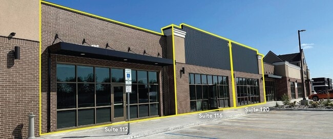
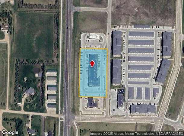
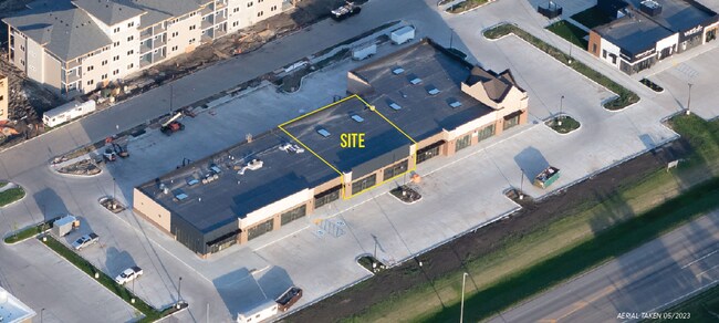
Property Record
7951 Jacks Way, Horace, ND 58047

NEARBY LISTINGS FOR SALE OR LEASE
Property Detail
7951 Jacks Way
Fargo, ND-MN
Lakeview Heights
15-0381-00040-000
LOT: 4 BLOCK: 1 ADDITION: LAKEVIEW HEIGHTS 4TH ADDITION ADDITIONAL: LAKEVIEW HEIGHTS 4TH ADDN LT 4 BLK 1 **5-11-22 REPLAT FRM 15-0379-00020-000, 00030-000, 00040-010 & 00040-020 PER PLAT DOC#1662516 FOR 2022
Realpropertynec
Cass
2024
North Dakota
2024
4
040503
Fargo
21,576 SF
Other Market Areas
DEMOGRAPHICS near 7951 Jacks Way
1 Mile
3 Mile
5 Mile
2024 Total Population
1,849
10,209
62,182
2029 Population
2,015
11,032
67,382
Pop Growth 2024-2029
+ 8.98%
+ 8.06%
+ 8.36%
Average Age
36
33
33
2024 Total Households
633
3,417
24,365
HH Growth 2024-2029
+ 9.32%
+ 8.57%
+ 8.91%
Median Household Inc
$131,991
$133,515
$93,017
Avg Household Size
2.90
3.00
2.50
2024 Avg HH Vehicles
3.00
2.00
2.00
Median Home Value
$411,834
$400,595
$347,305
Median Year Built
2001
2010
2010
Nearby Places
Map Layers
Map Styles
 Street
 Aerial
- Restaurants
- Banks
- Shops
- Fitness
- Groceries
PUBLIC TRANSPORTATION
AIRPORT
Hector International
DRIVE
WALK
Distance
Hector International
27 min
16.4 mi
Freight Ports
Port Milwaukee
DRIVE
WALK
Distance
Port Milwaukee
642 min
581.8 mi
SALE & LEASE HISTORY
LISTING DATE
SALE/LEASE

Oct 27, 2021
For Lease
Nearby Properties
Address
Land Use
TOTAL SIZE
Lot Size
Zoning
Address
Land Use
TOTAL SIZE
Lot Size
Zoning
42,366 SF
Address
Land Use
TOTAL SIZE
Lot Size
Zoning
1,784 SF
Address
Land Use
TOTAL SIZE
Lot Size
Zoning
18.05 AC
Address
Land Use
TOTAL SIZE
Lot Size
Zoning
Address
Land Use
TOTAL SIZE
Lot Size
Zoning
Address
Land Use
TOTAL SIZE
Lot Size
Zoning
Address
Land Use
TOTAL SIZE
Lot Size
Zoning
55,062 SF
3.67 AC
GC
Address
Land Use
TOTAL SIZE
Lot Size
Zoning
53,272 SF
9.34 AC
Address
Land Use
TOTAL SIZE
Lot Size
Zoning
3.17 AC
Address
Land Use
TOTAL SIZE
Lot Size
Zoning
1.98 AC
Address
Land Use
TOTAL SIZE
Lot Size
Zoning
1.43 AC
Address
Land Use
TOTAL SIZE
Lot Size
Zoning
1,812 SF
76.82 AC
Address
Land Use
TOTAL SIZE
Lot Size
Zoning
4.07 AC
Address
Land Use
TOTAL SIZE
Lot Size
Zoning
Address
Land Use
TOTAL SIZE
Lot Size
Zoning
44,656 SF
1.94 AC
MR3
Address
Land Use
TOTAL SIZE
Lot Size
Zoning
3,320 SF
3.48 AC
GC
Address
Land Use
TOTAL SIZE
Lot Size
Zoning
1.90 AC
GC
Address
Land Use
TOTAL SIZE
Lot Size
Zoning
Address
Land Use
TOTAL SIZE
Lot Size
Zoning
1.96 AC
GC
Address
Land Use
TOTAL SIZE
Lot Size
Zoning
11,000 SF
2.71 AC
GC
Address
Land Use
TOTAL SIZE
Lot Size
Zoning
0.73 AC
Address
Land Use
TOTAL SIZE
Lot Size
Zoning
1.32 AC
Address
Land Use
TOTAL SIZE
Lot Size
Zoning
Address
Land Use
TOTAL SIZE
Lot Size
Zoning
14,400 SF
4.83 AC
Address
Land Use
TOTAL SIZE
Lot Size
Zoning
21,000 SF
2.58 AC
GC
Address
Land Use
TOTAL SIZE
Lot Size
Zoning
Address
Land Use
TOTAL SIZE
Lot Size
Zoning
19,311 SF
3.56 AC
GC
Address
Land Use
TOTAL SIZE
Lot Size
Zoning
21,664 SF
3.24 AC
Address
Land Use
TOTAL SIZE
Lot Size
Zoning
12,000 SF
1.24 AC
GC
The World's #1 Commercial Real Estate Marketplace
Connect with us
© 2026 CoStar Group
The information above has been obtained from sources believed reliable. While we do not doubt its accuracy we have not verified it and make no guarantee, warranty or representation about it. It is your responsibility to independently confirm its accuracy and completeness. Any projections, opinions, assumptions, or estimates used are for example only and do not represent the current or future performance of the property. The value of this transaction to you depends on tax and other factors which should be evaluated by your tax, financial, and legal advisors. You and your advisors should conduct a careful, independent investigation of the property to determine to your satisfaction the suitability of the property for your needs.