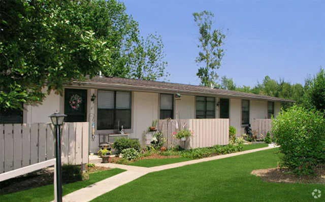
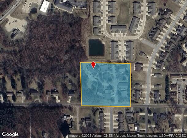
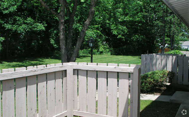
Property Record
798 Straub Rd W, Mansfield, OH 44904
NEARBY LISTINGS FOR SALE OR LEASE
-
-
View all Mansfield listings for sale on LoopNet.com
Property Detail
798 Straub Rd W
056-92-143-02-026
MANSFIELD CITY LEX LSD SW A 4.58 LT 12 PT
Apartment
Richland
X
Ohio
39117C0100F
12
2024
4.39 AC
2024
Lexington
002101
Cleveland
16,128 SF
Mansfield, OH
DEMOGRAPHICS near 798 Straub Rd W
1 Mile
3 Mile
5 Mile
2024 Total Population
5,924
27,572
61,206
2029 Population
5,924
27,570
61,528
Pop Growth 2024-2029
0.00%
(0.01%)
+ 0.53%
Average Age
46
44
41
2024 Total Households
2,779
12,522
26,864
HH Growth 2024-2029
+ 0.07%
(0.02%)
+ 0.50%
Median Household Inc
$49,942
$48,595
$44,832
Avg Household Size
2.10
2.10
2.20
2024 Avg HH Vehicles
2.00
2.00
2.00
Median Home Value
$168,215
$148,449
$132,488
Median Year Built
1974
1963
1961
Nearby Places
Map Layers
Map Styles
 Street
 Aerial
- Restaurants
- Banks
- Shops
- Fitness
- Groceries
Nearby Properties
Address
Land Use
TOTAL SIZE
Lot Size
Zoning
Address
Land Use
TOTAL SIZE
Lot Size
Zoning
492,672 SF
6.83 AC
Address
Land Use
TOTAL SIZE
Lot Size
Zoning
139,809 SF
0.99 AC
Address
Land Use
TOTAL SIZE
Lot Size
Zoning
215,214 SF
18.28 AC
Address
Land Use
TOTAL SIZE
Lot Size
Zoning
92,587 SF
48.78 AC
Address
Land Use
TOTAL SIZE
Lot Size
Zoning
32,728 SF
56.23 AC
Address
Land Use
TOTAL SIZE
Lot Size
Zoning
48,602 SF
14.66 AC
Address
Land Use
TOTAL SIZE
Lot Size
Zoning
12.96 AC
Address
Land Use
TOTAL SIZE
Lot Size
Zoning
151,500 SF
6.41 AC
Address
Land Use
TOTAL SIZE
Lot Size
Zoning
66,940 SF
12.40 AC
Address
Land Use
TOTAL SIZE
Lot Size
Zoning
107,754 SF
3.38 AC
Address
Land Use
TOTAL SIZE
Lot Size
Zoning
76,069 SF
8 AC
Address
Land Use
TOTAL SIZE
Lot Size
Zoning
152,142 SF
22.22 AC
Address
Land Use
TOTAL SIZE
Lot Size
Zoning
88,556 SF
12.32 AC
Address
Land Use
TOTAL SIZE
Lot Size
Zoning
2,948 SF
10.62 AC
Address
Land Use
TOTAL SIZE
Lot Size
Zoning
33,194 SF
5 AC
Address
Land Use
TOTAL SIZE
Lot Size
Zoning
188,928 SF
18.94 AC
Address
Land Use
TOTAL SIZE
Lot Size
Zoning
16,578 SF
8.23 AC
Address
Land Use
TOTAL SIZE
Lot Size
Zoning
39,696 SF
2.03 AC
Address
Land Use
TOTAL SIZE
Lot Size
Zoning
25,061 SF
4.30 AC
Address
Land Use
TOTAL SIZE
Lot Size
Zoning
78,288 SF
20.76 AC
Address
Land Use
TOTAL SIZE
Lot Size
Zoning
50,832 SF
1.64 AC
Address
Land Use
TOTAL SIZE
Lot Size
Zoning
1,035 SF
12.53 AC
Address
Land Use
TOTAL SIZE
Lot Size
Zoning
6,400 SF
7.83 AC
Address
Land Use
TOTAL SIZE
Lot Size
Zoning
79,731 SF
10.43 AC
Address
Land Use
TOTAL SIZE
Lot Size
Zoning
39,168 SF
8.02 AC
Address
Land Use
TOTAL SIZE
Lot Size
Zoning
25,895 SF
2.65 AC
Address
Land Use
TOTAL SIZE
Lot Size
Zoning
32,499 SF
13.60 AC
Address
Land Use
TOTAL SIZE
Lot Size
Zoning
116,383 SF
63.86 AC
Address
Land Use
TOTAL SIZE
Lot Size
Zoning
27,040 SF
133.36 AC
Address
Land Use
TOTAL SIZE
Lot Size
Zoning
23,660 SF
63.86 AC
The World's #1 Commercial Real Estate Marketplace
Connect with us
© 2025 CoStar Group
The information above has been obtained from sources believed reliable. While we do not doubt its accuracy we have not verified it and make no guarantee, warranty or representation about it. It is your responsibility to independently confirm its accuracy and completeness. Any projections, opinions, assumptions, or estimates used are for example only and do not represent the current or future performance of the property. The value of this transaction to you depends on tax and other factors which should be evaluated by your tax, financial, and legal advisors. You and your advisors should conduct a careful, independent investigation of the property to determine to your satisfaction the suitability of the property for your needs.