Property Record
7983 Eldorado Rd, Prior Lake, MN 55372
Save to a Folder
{{folder.Name}}
{{folder.ListingIds.length}} Properties
{{folder.ListingIds.length}} Property
Create a New Folder
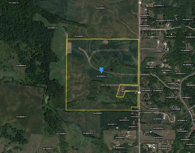
Property Detail
7983 Eldorado Rd
Minneapolis-St. Paul-Bloomington, MN-WI
BLOCK 002 LOT 008 THE RANCH OF CREDIT RIVER
4-139-009-0
SCOTT
Residentialacreage
Minnesota
B and X Area of moderate flood hazard, usually the area between the limits of the 100-year and 500-year floods.
8
2026
2.51 AC
2026
Scott County Outlying
081002
Minneapolis/St Paul
NEARBY LISTINGS FOR SALE OR LEASE
DEMOGRAPHICS near 7983 Eldorado Rd
1 mile
3 mile
5 mile
2025 Total Population
762
6,833
32,437
2030 Population
793
7,067
33,420
Pop Growth 2025-2030
+ 4.07%
+ 3.42%
+ 3.03%
Average Age
41
41
40
2025 Total Households
242
2,231
11,318
HH Growth 2025-2030
+ 4.13%
+ 3.41%
+ 3.15%
Median Household Inc
$148,912
$150,625
$133,015
Avg Household Size
3.10
3.00
2.80
2025 Avg HH Vehicles
3.00
3.00
2.00
Median Home Value
$738,853
$680,843
$544,548
Median Year Built
1998
1997
1997
Nearby Places
Map Layers
Map Styles
 Street
 Aerial
Layers
 Traffic
 Biking
Places
Listings with unknown addresses are not visible on the map
- Restaurants
- Banks
- Shops
- Fitness
- Groceries
PUBLIC TRANSPORTATION
AIRPORT
Minneapolis-St Paul International/Wold-Chamberlain
Drive
Walk
Distance
Minneapolis-St Paul International/Wold-Chamberlain
33 min
24.3 mi
Freight Ports
Port Milwaukee
Drive
Walk
Distance
Port Milwaukee
391 min
349.5 mi
Nearby Properties
Address
Land Use
TOTAL SIZE
Lot Size
Zoning
Address
Land Use
TOTAL SIZE
Lot Size
Zoning
162,819 SF
10.63 AC
Address
Land Use
TOTAL SIZE
Lot Size
Zoning
53,110 SF
11.89 AC
Address
Land Use
TOTAL SIZE
Lot Size
Zoning
151,109 SF
14.55 AC
Address
Land Use
TOTAL SIZE
Lot Size
Zoning
100,536 SF
6.68 AC
Address
Land Use
TOTAL SIZE
Lot Size
Zoning
104,491 SF
10.13 AC
Address
Land Use
TOTAL SIZE
Lot Size
Zoning
56,437 SF
3.17 AC
Address
Land Use
TOTAL SIZE
Lot Size
Zoning
89,775 SF
10.79 AC
Address
Land Use
TOTAL SIZE
Lot Size
Zoning
10,297 SF
258.56 AC
RR-2
Address
Land Use
TOTAL SIZE
Lot Size
Zoning
2,132 SF
17 AC
UER
Address
Land Use
TOTAL SIZE
Lot Size
Zoning
59,808 SF
12.68 AC
I-1
Address
Land Use
TOTAL SIZE
Lot Size
Zoning
48,180 SF
3.50 AC
Address
Land Use
TOTAL SIZE
Lot Size
Zoning
30,295 SF
3.39 AC
Address
Land Use
TOTAL SIZE
Lot Size
Zoning
21,718 SF
3.06 AC
Address
Land Use
TOTAL SIZE
Lot Size
Zoning
27,686 SF
19.04 AC
UER
Address
Land Use
TOTAL SIZE
Lot Size
Zoning
35,614 SF
1.96 AC
Address
Land Use
TOTAL SIZE
Lot Size
Zoning
2,440 SF
163.17 AC
UER
Address
Land Use
TOTAL SIZE
Lot Size
Zoning
12,462 SF
4.18 AC
Address
Land Use
TOTAL SIZE
Lot Size
Zoning
22,261 SF
2.50 AC
Address
Land Use
TOTAL SIZE
Lot Size
Zoning
8,855 SF
155.16 AC
UER
Address
Land Use
TOTAL SIZE
Lot Size
Zoning
20,483 SF
2.51 AC
Address
Land Use
TOTAL SIZE
Lot Size
Zoning
140.40 AC
RR-1
Address
Land Use
TOTAL SIZE
Lot Size
Zoning
7,536 SF
3.89 AC
Address
Land Use
TOTAL SIZE
Lot Size
Zoning
15,966 SF
2.01 AC
Address
Land Use
TOTAL SIZE
Lot Size
Zoning
3,901 SF
80 AC
A-1
Address
Land Use
TOTAL SIZE
Lot Size
Zoning
7,005 SF
3.10 AC
Address
Land Use
TOTAL SIZE
Lot Size
Zoning
19,350 SF
3.33 AC
Address
Land Use
TOTAL SIZE
Lot Size
Zoning
100.25 AC
RR-2
Address
Land Use
TOTAL SIZE
Lot Size
Zoning
123.62 AC
RR-1
Address
Land Use
TOTAL SIZE
Lot Size
Zoning
47,448 SF
7.43 AC
The World's #1 Commercial Real Estate Marketplace
Connect with us
© 2026 CoStar Group
The information above has been obtained from sources believed reliable. While we do not doubt its accuracy we have not verified it and make no guarantee, warranty or representation about it. It is your responsibility to independently confirm its accuracy and completeness. Any projections, opinions, assumptions, or estimates used are for example only and do not represent the current or future performance of the property. The value of this transaction to you depends on tax and other factors which should be evaluated by your tax, financial, and legal advisors. You and your advisors should conduct a careful, independent investigation of the property to determine to your satisfaction the suitability of the property for your needs.