Property Record
799 State Rd, North Dartmouth, MA 02747

NEARBY LISTINGS FOR SALE OR LEASE
Property Detail
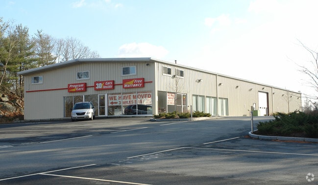
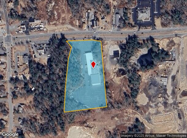
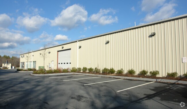
799 State Rd
Vehiclerentalsvehiclesales
Bristol
X
Massachusetts
25005C0368G
5.23 AC
2025
Attleboro/New Bedford
2025
Boston
653101
Providence-Warwick, RI-MA
24,328 SF
DART-000163-000060
DEMOGRAPHICS near 799 State Rd
1 Mile
3 Mile
5 Mile
2024 Total Population
2,140
14,924
55,080
2029 Population
2,123
14,822
54,409
Pop Growth 2024-2029
(0.79%)
(0.68%)
(1.22%)
Average Age
44
43
43
2024 Total Households
949
5,519
21,134
HH Growth 2024-2029
(0.84%)
(0.62%)
(1.25%)
Median Household Inc
$81,681
$91,811
$82,748
Avg Household Size
2.20
2.40
2.50
2024 Avg HH Vehicles
2.00
2.00
2.00
Median Home Value
$430,645
$431,082
$389,900
Median Year Built
1977
1975
1967
Nearby Places
Map Layers
Map Styles
 Street
 Aerial
- Restaurants
- Banks
- Shops
- Fitness
- Groceries
PUBLIC TRANSPORTATION
AIRPORT
Rhode Island Tf Green International
DRIVE
WALK
Distance
Rhode Island Tf Green International
49 min
32.4 mi
Freight Ports
Port of New Bedford Harbor
DRIVE
WALK
Distance
Port of New Bedford Harbor
14 min
8.6 mi
Nearby Properties
Address
Land Use
TOTAL SIZE
Lot Size
Zoning
Address
Land Use
TOTAL SIZE
Lot Size
Zoning
120,000 SF
705.15 AC
SRB
Address
Land Use
TOTAL SIZE
Lot Size
Zoning
40.61 AC
GB
Address
Land Use
TOTAL SIZE
Lot Size
Zoning
36.70 AC
E1
Address
Land Use
TOTAL SIZE
Lot Size
Zoning
104.64 AC
LI
Address
Land Use
TOTAL SIZE
Lot Size
Zoning
30.28 AC
GB
Address
Land Use
TOTAL SIZE
Lot Size
Zoning
40.65 AC
GB
Address
Land Use
TOTAL SIZE
Lot Size
Zoning
3,792 SF
33 AC
GB
Address
Land Use
TOTAL SIZE
Lot Size
Zoning
14,840 SF
26.26 AC
SRA
Address
Land Use
TOTAL SIZE
Lot Size
Zoning
12.94 AC
GB
Address
Land Use
TOTAL SIZE
Lot Size
Zoning
15.97 AC
GB
Address
Land Use
TOTAL SIZE
Lot Size
Zoning
174,416 SF
29.20 AC
CEMETA
Address
Land Use
TOTAL SIZE
Lot Size
Zoning
126,745 SF
15.82 AC
GB
Address
Land Use
TOTAL SIZE
Lot Size
Zoning
111,708 SF
17 AC
GB
Address
Land Use
TOTAL SIZE
Lot Size
Zoning
146,599 SF
22.98 AC
GB
Address
Land Use
TOTAL SIZE
Lot Size
Zoning
17.54 AC
GB
Address
Land Use
TOTAL SIZE
Lot Size
Zoning
106,755 SF
17.01 AC
GB
Address
Land Use
TOTAL SIZE
Lot Size
Zoning
163,802 SF
13.26 AC
OI
Address
Land Use
TOTAL SIZE
Lot Size
Zoning
70,690 SF
3.03 AC
GB
Address
Land Use
TOTAL SIZE
Lot Size
Zoning
65,424 SF
10.69 AC
SRB
Address
Land Use
TOTAL SIZE
Lot Size
Zoning
141,102 SF
9.35 AC
GB
Address
Land Use
TOTAL SIZE
Lot Size
Zoning
62,336 SF
9.85 AC
SRB
Address
Land Use
TOTAL SIZE
Lot Size
Zoning
26,010 SF
6.80 AC
GB
Address
Land Use
TOTAL SIZE
Lot Size
Zoning
11.33 AC
GB
Address
Land Use
TOTAL SIZE
Lot Size
Zoning
136,785 SF
21.77 AC
GB
Address
Land Use
TOTAL SIZE
Lot Size
Zoning
51,709 SF
2.32 AC
GB
Address
Land Use
TOTAL SIZE
Lot Size
Zoning
21,805 SF
1.12 AC
OI
Address
Land Use
TOTAL SIZE
Lot Size
Zoning
47,956 SF
3.50 AC
GB
Address
Land Use
TOTAL SIZE
Lot Size
Zoning
27,538 SF
4.25 AC
GB
Address
Land Use
TOTAL SIZE
Lot Size
Zoning
7.05 AC
OI
Address
Land Use
TOTAL SIZE
Lot Size
Zoning
The World's #1 Commercial Real Estate Marketplace
Connect with us
© 2025 CoStar Group
The information above has been obtained from sources believed reliable. While we do not doubt its accuracy we have not verified it and make no guarantee, warranty or representation about it. It is your responsibility to independently confirm its accuracy and completeness. Any projections, opinions, assumptions, or estimates used are for example only and do not represent the current or future performance of the property. The value of this transaction to you depends on tax and other factors which should be evaluated by your tax, financial, and legal advisors. You and your advisors should conduct a careful, independent investigation of the property to determine to your satisfaction the suitability of the property for your needs.