Property Record
7990 E Tanque Verde Rd, Tucson, AZ 85749


Property Detail
7990 E Tanque Verde Rd
114-49-042H
THAT PART E2 W2 SW4 SW4 LYG N OF WOODLAND HILLS NO 2 & S OF TANQUE VERDE RD & ADJ TO ALLEY 3.18 AC SEC 33-13-15
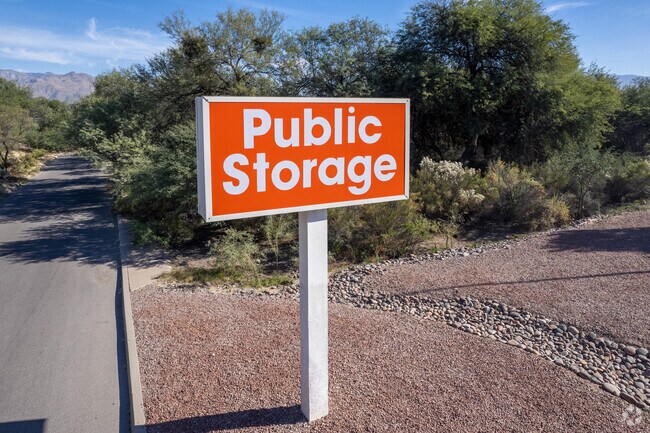
Publicstorage
Pima
C2
Arizona
C and X Area of minimal flood hazard, usually depicted on FIRMs as above the 500-year flood level.
10
2025
3.18 AC
2026
East Tucson
004047
Tucson
79,285 SF
Tucson, AZ
NEARBY LISTINGS FOR SALE OR LEASE
-
-
View all Tucson listings for sale on LoopNet.com
DEMOGRAPHICS near 7990 E Tanque Verde Rd
1 mile
3 mile
5 mile
2025 Total Population
8,832
81,009
205,785
2030 Population
8,987
82,989
210,450
Pop Growth 2025-2030
+ 1.75%
+ 2.44%
+ 2.27%
Average Age
46
45
44
2025 Total Households
4,310
39,611
94,844
HH Growth 2025-2030
+ 1.81%
+ 2.56%
+ 2.43%
Median Household Inc
$80,221
$66,765
$68,993
Avg Household Size
2.00
2.00
2.10
2025 Avg HH Vehicles
2.00
2.00
2.00
Median Home Value
$388,271
$374,057
$352,114
Median Year Built
1985
1980
1978
Nearby Places
Map Layers
Map Styles
 Street
 Aerial
Layers
 Traffic
 Biking
Places
Listings with unknown addresses are not visible on the map
- Restaurants
- Banks
- Shops
- Fitness
- Groceries
PUBLIC TRANSPORTATION
AIRPORT
Tucson International
Drive
Walk
Distance
Tucson International
29 min
15.8 mi
Freight Ports
Port of San Diego
Drive
Walk
Distance
Port of San Diego
451 min
416.2 mi
Nearby Properties
Address
Land Use
TOTAL SIZE
Lot Size
Zoning
Address
Land Use
TOTAL SIZE
Lot Size
Zoning
684,356 SF
19.65 AC
PAD13
Address
Land Use
TOTAL SIZE
Lot Size
Zoning
96,125 SF
15.38 AC
SR
Address
Land Use
TOTAL SIZE
Lot Size
Zoning
308,730 SF
10.15 AC
Address
Land Use
TOTAL SIZE
Lot Size
Zoning
504,584 SF
18.17 AC
O3
Address
Land Use
TOTAL SIZE
Lot Size
Zoning
427,088 SF
19.78 AC
R3
Address
Land Use
TOTAL SIZE
Lot Size
Zoning
310,878 SF
29.30 AC
TR
Address
Land Use
TOTAL SIZE
Lot Size
Zoning
256,775 SF
6.69 AC
C1
Address
Land Use
TOTAL SIZE
Lot Size
Zoning
322,009 SF
17.96 AC
Address
Land Use
TOTAL SIZE
Lot Size
Zoning
364,128 SF
11.55 AC
O3
Address
Land Use
TOTAL SIZE
Lot Size
Zoning
109,335 SF
7.83 AC
PAD13
Address
Land Use
TOTAL SIZE
Lot Size
Zoning
1,804 SF
8.29 AC
R3
Address
Land Use
TOTAL SIZE
Lot Size
Zoning
276,903 SF
37.62 AC
RX1
Address
Land Use
TOTAL SIZE
Lot Size
Zoning
240,585 SF
18.16 AC
R2
Address
Land Use
TOTAL SIZE
Lot Size
Zoning
264,788 SF
12.63 AC
R3
Address
Land Use
TOTAL SIZE
Lot Size
Zoning
162,630 SF
15.14 AC
Address
Land Use
TOTAL SIZE
Lot Size
Zoning
180,149 SF
17.48 AC
PAD3
Address
Land Use
TOTAL SIZE
Lot Size
Zoning
288,749 SF
21.55 AC
CR2
Address
Land Use
TOTAL SIZE
Lot Size
Zoning
286,164 SF
5.80 AC
C3
Address
Land Use
TOTAL SIZE
Lot Size
Zoning
238,953 SF
14.13 AC
CB1
Address
Land Use
TOTAL SIZE
Lot Size
Zoning
160,678 SF
16.12 AC
Address
Land Use
TOTAL SIZE
Lot Size
Zoning
171,301 SF
6.36 AC
C3
Address
Land Use
TOTAL SIZE
Lot Size
Zoning
146,302 SF
27.52 AC
CR1
Address
Land Use
TOTAL SIZE
Lot Size
Zoning
84,514 SF
4.77 AC
Address
Land Use
TOTAL SIZE
Lot Size
Zoning
11,074 SF
0.94 AC
C1
Address
Land Use
TOTAL SIZE
Lot Size
Zoning
219,353 SF
10.96 AC
C1
Address
Land Use
TOTAL SIZE
Lot Size
Zoning
218,742 SF
9.88 AC
C1
Address
Land Use
TOTAL SIZE
Lot Size
Zoning
253,982 SF
12.14 AC
SR
Address
Land Use
TOTAL SIZE
Lot Size
Zoning
165,096 SF
13.04 AC
C2
Address
Land Use
TOTAL SIZE
Lot Size
Zoning
97,407 SF
4.35 AC
C3
Address
Land Use
TOTAL SIZE
Lot Size
Zoning
117,758 SF
5.80 AC
The World's #1 Commercial Real Estate Marketplace
Connect with us
© 2026 CoStar Group
The information above has been obtained from sources believed reliable. While we do not doubt its accuracy we have not verified it and make no guarantee, warranty or representation about it. It is your responsibility to independently confirm its accuracy and completeness. Any projections, opinions, assumptions, or estimates used are for example only and do not represent the current or future performance of the property. The value of this transaction to you depends on tax and other factors which should be evaluated by your tax, financial, and legal advisors. You and your advisors should conduct a careful, independent investigation of the property to determine to your satisfaction the suitability of the property for your needs.