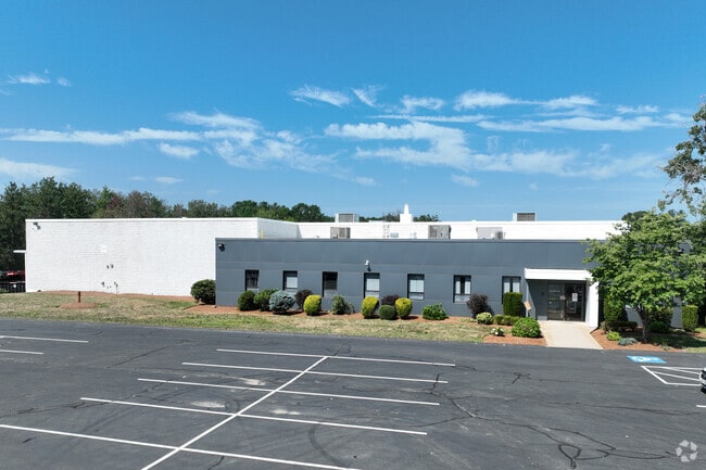
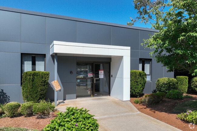
Property Record
7R Connector Rd, Andover, MA 01810
NEARBY LISTINGS FOR SALE OR LEASE
Property Detail
7R Connector Rd
ANDO-000160-000012-A000000
Essex
Industrialacreage
Massachusetts
X
a
25009C0356G
1.61 AC
2024
Lawrence/Andover
2024
Boston
254301
Boston-Cambridge-Newton, MA-NH
DEMOGRAPHICS near 7R Connector Rd
1 Mile
3 Mile
5 Mile
2024 Total Population
2,421
32,189
109,256
2029 Population
2,416
32,038
108,596
Pop Growth 2024-2029
(0.21%)
(0.47%)
(0.60%)
Average Age
41
42
42
2024 Total Households
792
11,674
39,190
HH Growth 2024-2029
(0.51%)
(0.57%)
(0.69%)
Median Household Inc
$185,838
$136,974
$129,318
Avg Household Size
3.00
2.70
2.70
2024 Avg HH Vehicles
2.00
2.00
2.00
Median Home Value
$747,544
$683,133
$643,723
Median Year Built
1976
1977
1975
Nearby Places
Map Layers
Map Styles
 Street
 Aerial
- Restaurants
- Banks
- Shops
- Fitness
- Groceries
PUBLIC TRANSPORTATION
COMMUTER RAIL
Ballardvale (Haverhill Line - Massachusetts Bay Transportation Authority Commuter Rail (Purple Line))
DRIVE
WALK
Distance
Ballardvale (Haverhill Line - Massachusetts Bay Transportation Authority Commuter Rail (Purple Line))
3 min
1.4 mi
North Wilmington (Haverhill Line - Massachusetts Bay Transportation Authority Commuter Rail (Purple Line))
DRIVE
WALK
Distance
North Wilmington (Haverhill Line - Massachusetts Bay Transportation Authority Commuter Rail (Purple Line))
7 min
3.6 mi
AIRPORT
General Edward Lawrence Logan International
DRIVE
WALK
Distance
General Edward Lawrence Logan International
32 min
22.5 mi
Manchester Boston Regional
DRIVE
WALK
Distance
Manchester Boston Regional
50 min
33.3 mi
Freight Ports
Port of Boston
DRIVE
WALK
Distance
Port of Boston
33 min
22.3 mi
SALE & LEASE HISTORY
LISTING DATE
SALE/LEASE

Sep 09, 2021
For Lease
Nov 14, 2016
For Lease
May 08, 2018
For Lease
Mar 14, 2019
For Lease
Mar 06, 2017
For Sale
Jan 02, 2025
For Lease
Nearby Properties
Address
Land Use
TOTAL SIZE
Lot Size
Zoning
Address
Land Use
TOTAL SIZE
Lot Size
Zoning
502,199 SF
47.78 AC
IO
Address
Land Use
TOTAL SIZE
Lot Size
Zoning
0.24 AC
SRC
Address
Land Use
TOTAL SIZE
Lot Size
Zoning
44.42 AC
LS
Address
Land Use
TOTAL SIZE
Lot Size
Zoning
272,632 SF
22.49 AC
IND
Address
Land Use
TOTAL SIZE
Lot Size
Zoning
341,215 SF
16.94 AC
IND
Address
Land Use
TOTAL SIZE
Lot Size
Zoning
591,906 SF
153.43 AC
IA
Address
Land Use
TOTAL SIZE
Lot Size
Zoning
314,278 SF
595.78 AC
SRB
Address
Land Use
TOTAL SIZE
Lot Size
Zoning
19.04 AC
MFD
Address
Land Use
TOTAL SIZE
Lot Size
Zoning
509.76 AC
IA
Address
Land Use
TOTAL SIZE
Lot Size
Zoning
308.52 AC
IA
Address
Land Use
TOTAL SIZE
Lot Size
Zoning
343,105 SF
60.18 AC
IND
Address
Land Use
TOTAL SIZE
Lot Size
Zoning
140,376 SF
2,026.22 AC
SRB
Address
Land Use
TOTAL SIZE
Lot Size
Zoning
78,384 SF
34.20 AC
IO
Address
Land Use
TOTAL SIZE
Lot Size
Zoning
221,927 SF
27.88 AC
IND
Address
Land Use
TOTAL SIZE
Lot Size
Zoning
161,736 SF
13.91 AC
Address
Land Use
TOTAL SIZE
Lot Size
Zoning
193.30 AC
IA
Address
Land Use
TOTAL SIZE
Lot Size
Zoning
447,869 SF
27.06 AC
ID
Address
Land Use
TOTAL SIZE
Lot Size
Zoning
14 AC
SRB
Address
Land Use
TOTAL SIZE
Lot Size
Zoning
224.38 AC
SRB
Address
Land Use
TOTAL SIZE
Lot Size
Zoning
484,857 SF
42.05 AC
HI
Address
Land Use
TOTAL SIZE
Lot Size
Zoning
150,000 SF
30.73 AC
LS
Address
Land Use
TOTAL SIZE
Lot Size
Zoning
238,042 SF
28 AC
IND
Address
Land Use
TOTAL SIZE
Lot Size
Zoning
129,522 SF
20.22 AC
SRB
Address
Land Use
TOTAL SIZE
Lot Size
Zoning
9.80 AC
R40
Address
Land Use
TOTAL SIZE
Lot Size
Zoning
180,640 SF
16.24 AC
ID2
Address
Land Use
TOTAL SIZE
Lot Size
Zoning
124,741 SF
13.35 AC
HB
Address
Land Use
TOTAL SIZE
Lot Size
Zoning
107,001 SF
21.82 AC
MN
Address
Land Use
TOTAL SIZE
Lot Size
Zoning
26.32 AC
IA
Address
Land Use
TOTAL SIZE
Lot Size
Zoning
30,240 SF
5.78 AC
LS
Address
Land Use
TOTAL SIZE
Lot Size
Zoning
133,877 SF
16.30 AC
IND
The World's #1 Commercial Real Estate Marketplace
Connect with us
© 2026 CoStar Group
The information above has been obtained from sources believed reliable. While we do not doubt its accuracy we have not verified it and make no guarantee, warranty or representation about it. It is your responsibility to independently confirm its accuracy and completeness. Any projections, opinions, assumptions, or estimates used are for example only and do not represent the current or future performance of the property. The value of this transaction to you depends on tax and other factors which should be evaluated by your tax, financial, and legal advisors. You and your advisors should conduct a careful, independent investigation of the property to determine to your satisfaction the suitability of the property for your needs.