Property Record
Vac/7Th Ste Vic Ave, Lancaster, CA 93535
This Property Is For Sale
NEARBY LISTINGS FOR SALE OR LEASE
Property Detail
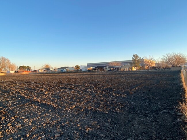
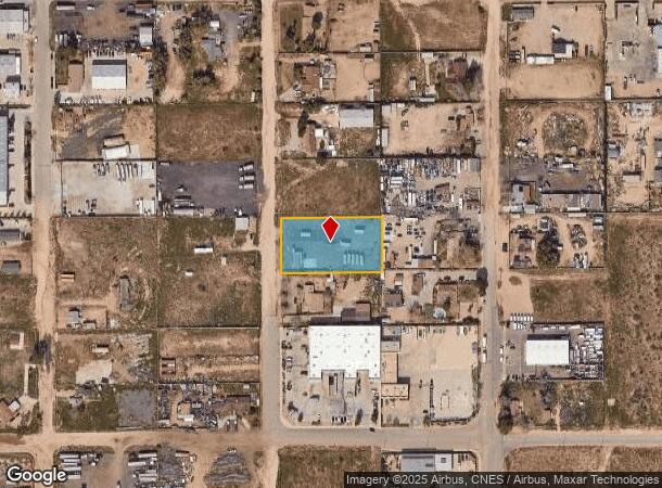
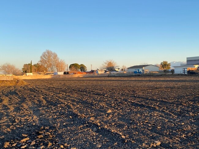
Vac/7Th Ste Vic Ave
Los Angeles-Long Beach-Glendale, CA
Parcel Map No. 12153
3126-015-040
*TR=PARCEL MAP AS PER BK 124 P 21 OF P M LOT 1
Industrialacreage
Los Angeles
X
California
06037C0450F
1
2024
1.15 AC
2025
Antelope Valley
900508
Los Angeles
1,749 SF
DEMOGRAPHICS near Vac/7Th Ste Vic Ave
1 Mile
3 Mile
5 Mile
2024 Total Population
1,518
64,509
165,927
2029 Population
1,481
63,348
161,716
Pop Growth 2024-2029
(2.44%)
(1.80%)
(2.54%)
Average Age
35
36
37
2024 Total Households
461
20,850
52,607
HH Growth 2024-2029
(2.82%)
(1.41%)
(2.55%)
Median Household Inc
$58,301
$53,322
$57,010
Avg Household Size
3.30
3.00
3.00
2024 Avg HH Vehicles
2.00
2.00
2.00
Median Home Value
$268,269
$264,823
$301,278
Median Year Built
1988
1984
1983
Nearby Places
Map Layers
Map Styles
 Street
 Aerial
- Restaurants
- Banks
- Shops
- Fitness
- Groceries
PUBLIC TRANSPORTATION
COMMUTER RAIL
Lancaster (Antelope Valley Line - Southern California Regional Rail Authority (Metrolink))
DRIVE
WALK
Distance
Lancaster (Antelope Valley Line - Southern California Regional Rail Authority (Metrolink))
7 min
3.6 mi
Palmdale (Antelope Valley Line - Southern California Regional Rail Authority (Metrolink))
DRIVE
WALK
Distance
Palmdale (Antelope Valley Line - Southern California Regional Rail Authority (Metrolink))
10 min
5.5 mi
Freight Ports
Port of Long Beach
DRIVE
WALK
Distance
Port of Long Beach
110 min
93.4 mi
Nearby Properties
Address
Land Use
TOTAL SIZE
Lot Size
Zoning
Address
Land Use
TOTAL SIZE
Lot Size
Zoning
2,861,890 SF
528.69 AC
POMA-A25*
Address
Land Use
TOTAL SIZE
Lot Size
Zoning
133,783 SF
48.02 AC
LRLI
Address
Land Use
TOTAL SIZE
Lot Size
Zoning
234,378 SF
15.25 AC
Address
Land Use
TOTAL SIZE
Lot Size
Zoning
143,852 SF
8.58 AC
LRHDR*
Address
Land Use
TOTAL SIZE
Lot Size
Zoning
160,028 SF
10.81 AC
LRMDR*
Address
Land Use
TOTAL SIZE
Lot Size
Zoning
179,304 SF
12.43 AC
LRMDR*
Address
Land Use
TOTAL SIZE
Lot Size
Zoning
126,102 SF
8.57 AC
LRRA7000*
Address
Land Use
TOTAL SIZE
Lot Size
Zoning
74,213 SF
4.46 AC
LRA17000*
Address
Land Use
TOTAL SIZE
Lot Size
Zoning
81,668 SF
5.67 AC
LRRPD65002
Address
Land Use
TOTAL SIZE
Lot Size
Zoning
876,730 SF
20.85 AC
LRCP
Address
Land Use
TOTAL SIZE
Lot Size
Zoning
123,924 SF
19.01 AC
LRA22*
Address
Land Use
TOTAL SIZE
Lot Size
Zoning
166,272 SF
8.71 AC
LRRA7000*
Address
Land Use
TOTAL SIZE
Lot Size
Zoning
132,584 SF
8.66 AC
LRMDR*
Address
Land Use
TOTAL SIZE
Lot Size
Zoning
170,697 SF
9.29 AC
LRRPD12U*
Address
Land Use
TOTAL SIZE
Lot Size
Zoning
90,429 SF
4.59 AC
LRHDR*
Address
Land Use
TOTAL SIZE
Lot Size
Zoning
90,429 SF
4.38 AC
LRHDR*
Address
Land Use
TOTAL SIZE
Lot Size
Zoning
481,066 SF
11.88 AC
LRRA7500*
Address
Land Use
TOTAL SIZE
Lot Size
Zoning
97,566 SF
8.81 AC
LRC3*
Address
Land Use
TOTAL SIZE
Lot Size
Zoning
101,136 SF
4.18 AC
LRSP
Address
Land Use
TOTAL SIZE
Lot Size
Zoning
127,975 SF
4.77 AC
LRC3DP*
Address
Land Use
TOTAL SIZE
Lot Size
Zoning
81,606 SF
3.55 AC
LRSP80-02*
Address
Land Use
TOTAL SIZE
Lot Size
Zoning
103,824 SF
3.58 AC
LRSP80-02*
Address
Land Use
TOTAL SIZE
Lot Size
Zoning
135,028 SF
12.10 AC
LRC3*
Address
Land Use
TOTAL SIZE
Lot Size
Zoning
58,986 SF
4.11 AC
LRRPD65002
Address
Land Use
TOTAL SIZE
Lot Size
Zoning
1,256 SF
158.45 AC
PDM2 1/2*
Address
Land Use
TOTAL SIZE
Lot Size
Zoning
Address
Land Use
TOTAL SIZE
Lot Size
Zoning
74,702 SF
3.54 AC
LRSP80-02*
Address
Land Use
TOTAL SIZE
Lot Size
Zoning
95,620 SF
3.59 AC
LRSP80-02*
Address
Land Use
TOTAL SIZE
Lot Size
Zoning
153,664 SF
9.23 AC
Address
Land Use
TOTAL SIZE
Lot Size
Zoning
88,730 SF
10.03 AC
LRSP*
The World's #1 Commercial Real Estate Marketplace
Connect with us
© 2025 CoStar Group
The information above has been obtained from sources believed reliable. While we do not doubt its accuracy we have not verified it and make no guarantee, warranty or representation about it. It is your responsibility to independently confirm its accuracy and completeness. Any projections, opinions, assumptions, or estimates used are for example only and do not represent the current or future performance of the property. The value of this transaction to you depends on tax and other factors which should be evaluated by your tax, financial, and legal advisors. You and your advisors should conduct a careful, independent investigation of the property to determine to your satisfaction the suitability of the property for your needs.