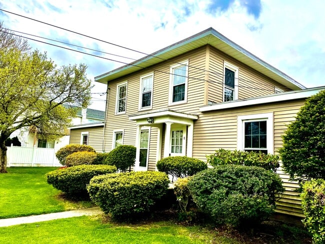
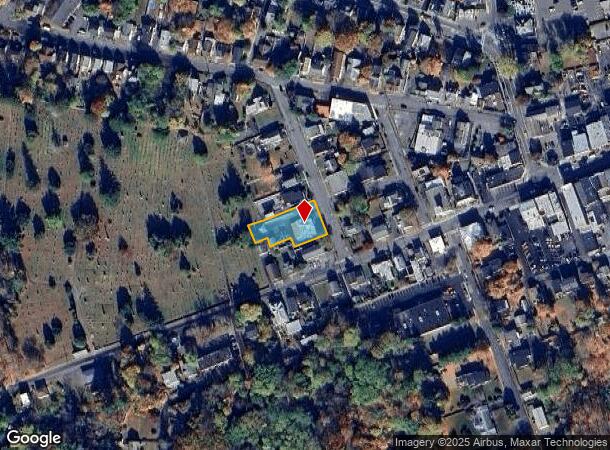
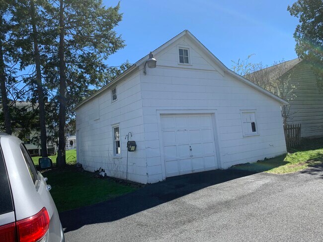
Property Record
8 2Nd St, Saugerties, NY 12477
NEARBY LISTINGS FOR SALE OR LEASE
-
-
View all Saugerties listings for sale on LoopNet.com
Property Detail
8 2Nd St
4801-018.061-0008-027.100-0000
Boundary Map Survey For Robert Siracusan
Apartment
Ulster
X
New York
36111C0305E
27.100
2025
0.43 AC
2024
Hudson Valley Area
950200
Other Market Areas
4,308 SF
Kingston, NY
DEMOGRAPHICS near 8 2Nd St
1 mile
3 mile
5 mile
2024 Total Population
4,669
11,973
20,921
2029 Population
4,667
11,861
20,868
Pop Growth 2024-2029
(0.04%)
(0.94%)
(0.25%)
Average Age
44
44
45
2024 Total Households
2,133
5,258
8,990
HH Growth 2024-2029
(0.05%)
(0.89%)
(0.26%)
Median Household Inc
$59,132
$64,246
$74,082
Avg Household Size
2.10
2.20
2.30
2024 Avg HH Vehicles
2.00
2.00
2.00
Median Home Value
$306,443
$288,800
$305,621
Median Year Built
1948
1960
1963
Nearby Places
Map Layers
Map Styles
 Street
 Aerial
Transit
 Traffic
 Biking
Places
Listings with unknown addresses are not visible on the map
- Restaurants
- Banks
- Shops
- Fitness
- Groceries
SALE & LEASE HISTORY
LISTING DATE
SALE/LEASE

May 06, 2021
For Sale
Nearby Properties
Address
Land Use
TOTAL SIZE
Lot Size
Zoning
Address
Land Use
TOTAL SIZE
Lot Size
Zoning
183,246 SF
42.20 AC
02 - SINGL
Address
Land Use
TOTAL SIZE
Lot Size
Zoning
12,489 SF
15.10 AC
02 - SINGL
Address
Land Use
TOTAL SIZE
Lot Size
Zoning
19.70 AC
04
Address
Land Use
TOTAL SIZE
Lot Size
Zoning
19,280 SF
35.45 AC
LC
Address
Land Use
TOTAL SIZE
Lot Size
Zoning
31,824 SF
84 AC
LDR
Address
Land Use
TOTAL SIZE
Lot Size
Zoning
78.11 AC
WC
Address
Land Use
TOTAL SIZE
Lot Size
Zoning
8,879 SF
62.91 AC
LD
Address
Land Use
TOTAL SIZE
Lot Size
Zoning
7.90 AC
03 - MULTI
Address
Land Use
TOTAL SIZE
Lot Size
Zoning
11,659 SF
78.90 AC
LDR
Address
Land Use
TOTAL SIZE
Lot Size
Zoning
7,994 SF
13.70 AC
23
Address
Land Use
TOTAL SIZE
Lot Size
Zoning
54,461 SF
2.50 AC
03 - MULTI
Address
Land Use
TOTAL SIZE
Lot Size
Zoning
11,045 SF
39.60 AC
07 - MIXED
Address
Land Use
TOTAL SIZE
Lot Size
Zoning
45,441 SF
4.80 AC
05 - COMME
Address
Land Use
TOTAL SIZE
Lot Size
Zoning
8,316 SF
71.60 AC
LDR
Address
Land Use
TOTAL SIZE
Lot Size
Zoning
7,275 SF
63.90 AC
Address
Land Use
TOTAL SIZE
Lot Size
Zoning
19,210 SF
23.30 AC
LC
Address
Land Use
TOTAL SIZE
Lot Size
Zoning
11,080 SF
13.01 AC
LC
Address
Land Use
TOTAL SIZE
Lot Size
Zoning
77,033 SF
7.40 AC
05 - COMME
Address
Land Use
TOTAL SIZE
Lot Size
Zoning
41,213 SF
7.90 AC
02
Address
Land Use
TOTAL SIZE
Lot Size
Zoning
2,548 SF
8 AC
05 - COMME
Address
Land Use
TOTAL SIZE
Lot Size
Zoning
2,276 SF
99.63 AC
R1A
Address
Land Use
TOTAL SIZE
Lot Size
Zoning
56,845 SF
17.70 AC
02 - SINGL
Address
Land Use
TOTAL SIZE
Lot Size
Zoning
7,444 SF
12.16 AC
LC
Address
Land Use
TOTAL SIZE
Lot Size
Zoning
6,300 SF
86.50 AC
LDR
Address
Land Use
TOTAL SIZE
Lot Size
Zoning
48,670 SF
10.10 AC
05 - COMME
Address
Land Use
TOTAL SIZE
Lot Size
Zoning
21.70 AC
LC
Address
Land Use
TOTAL SIZE
Lot Size
Zoning
36,004 SF
7.10 AC
05 - COMME
Address
Land Use
TOTAL SIZE
Lot Size
Zoning
33.30 AC
04 - FARM
Address
Land Use
TOTAL SIZE
Lot Size
Zoning
47,688 SF
5.55 AC
05 - COMME
Address
Land Use
TOTAL SIZE
Lot Size
Zoning
13.90 AC
WC
The World's #1 Commercial Real Estate Marketplace
Connect with us
© 2026 CoStar Group
The information above has been obtained from sources believed reliable. While we do not doubt its accuracy we have not verified it and make no guarantee, warranty or representation about it. It is your responsibility to independently confirm its accuracy and completeness. Any projections, opinions, assumptions, or estimates used are for example only and do not represent the current or future performance of the property. The value of this transaction to you depends on tax and other factors which should be evaluated by your tax, financial, and legal advisors. You and your advisors should conduct a careful, independent investigation of the property to determine to your satisfaction the suitability of the property for your needs.