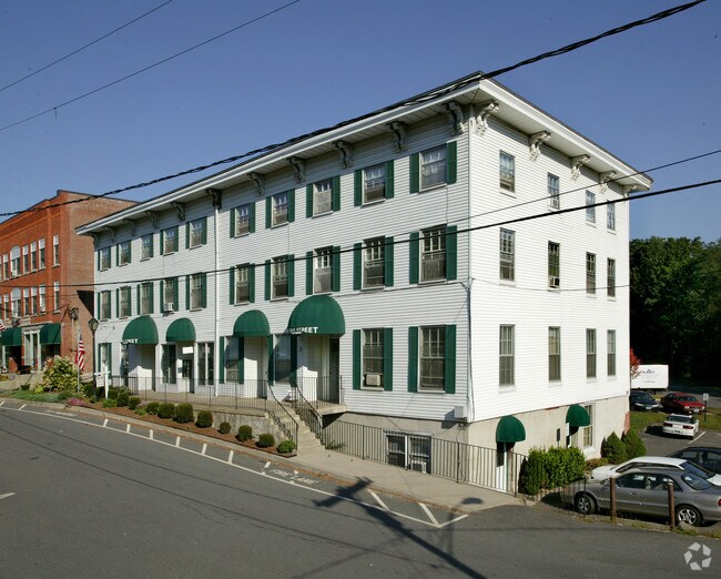
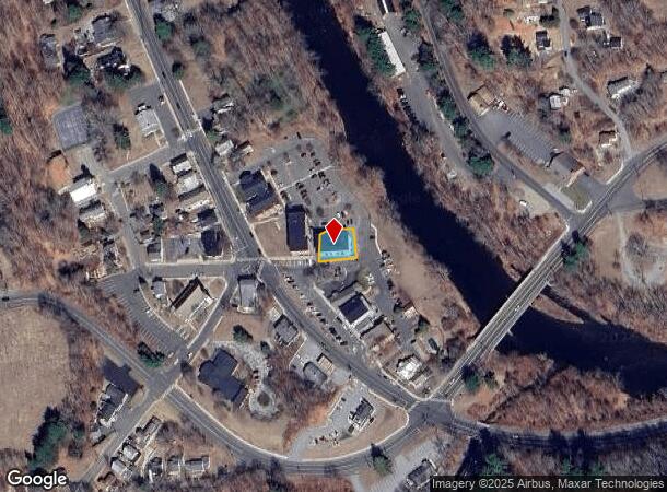
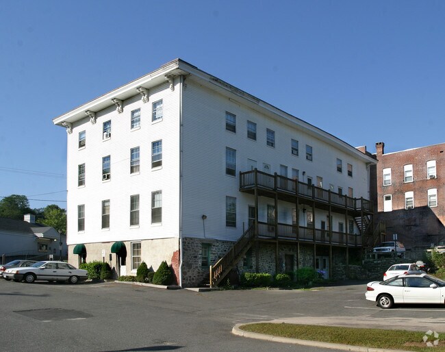
Property Record
8 Bridge St, New Hartford, CT 06057
NEARBY LISTINGS FOR SALE OR LEASE
Property Detail
8 Bridge St
Torrington, CT
Litchfield
NHAR-000036B-000119-000001
Connecticut
Apartmenthouse5plusunits
1
2025
0.20 AC
2025
New Hartford/NE Litchfld
306100
Hartford
12,126 SF
DEMOGRAPHICS near 8 Bridge St
1 Mile
3 Mile
5 Mile
2024 Total Population
1,140
5,136
16,065
2029 Population
1,114
5,085
15,989
Pop Growth 2024-2029
(2.28%)
(0.99%)
(0.47%)
Average Age
44
45
44
2024 Total Households
512
2,130
6,410
HH Growth 2024-2029
(2.34%)
(1.08%)
(0.56%)
Median Household Inc
$67,894
$98,076
$103,094
Avg Household Size
2.20
2.40
2.40
2024 Avg HH Vehicles
2.00
2.00
2.00
Median Home Value
$266,666
$328,725
$317,561
Median Year Built
1962
1975
1976
Nearby Places
Map Layers
Map Styles
 Street
 Aerial
- Restaurants
- Banks
- Shops
- Fitness
- Groceries
PUBLIC TRANSPORTATION
AIRPORT
Bradley International
DRIVE
WALK
Distance
Bradley International
47 min
24.5 mi
Freight Ports
Port of New Haven
DRIVE
WALK
Distance
Port of New Haven
70 min
47.6 mi
Nearby Properties
Address
Land Use
TOTAL SIZE
Lot Size
Zoning
Address
Land Use
TOTAL SIZE
Lot Size
Zoning
2,295.68 AC
MDC
Address
Land Use
TOTAL SIZE
Lot Size
Zoning
9.50 AC
RC/PVC
Address
Land Use
TOTAL SIZE
Lot Size
Zoning
200,152 SF
21.10 AC
I
Address
Land Use
TOTAL SIZE
Lot Size
Zoning
25.33 AC
IP
Address
Land Use
TOTAL SIZE
Lot Size
Zoning
147,940 SF
24.45 AC
I
Address
Land Use
TOTAL SIZE
Lot Size
Zoning
17,262 SF
0.50 AC
NHCZ
Address
Land Use
TOTAL SIZE
Lot Size
Zoning
30,243 SF
4 AC
I
Address
Land Use
TOTAL SIZE
Lot Size
Zoning
432.91 AC
PS/UD
Address
Land Use
TOTAL SIZE
Lot Size
Zoning
39.10 AC
R-1.5
Address
Land Use
TOTAL SIZE
Lot Size
Zoning
23,829 SF
7.53 AC
R-15
Address
Land Use
TOTAL SIZE
Lot Size
Zoning
8.91 AC
B2
Address
Land Use
TOTAL SIZE
Lot Size
Zoning
370.51 AC
MDC
Address
Land Use
TOTAL SIZE
Lot Size
Zoning
58,419 SF
8.80 AC
IP
Address
Land Use
TOTAL SIZE
Lot Size
Zoning
1,624 SF
2.63 AC
I
Address
Land Use
TOTAL SIZE
Lot Size
Zoning
14 AC
NHCZ
Address
Land Use
TOTAL SIZE
Lot Size
Zoning
38,258 SF
5.70 AC
B-2
Address
Land Use
TOTAL SIZE
Lot Size
Zoning
53.47 AC
I-2
Address
Land Use
TOTAL SIZE
Lot Size
Zoning
9,010 SF
19.26 AC
RC/PVC
Address
Land Use
TOTAL SIZE
Lot Size
Zoning
3.09 AC
R-1.5
Address
Land Use
TOTAL SIZE
Lot Size
Zoning
Address
Land Use
TOTAL SIZE
Lot Size
Zoning
9,780 SF
1.76 AC
B-2
Address
Land Use
TOTAL SIZE
Lot Size
Zoning
257 AC
MDC
Address
Land Use
TOTAL SIZE
Lot Size
Zoning
53.57 AC
R4
Address
Land Use
TOTAL SIZE
Lot Size
Zoning
0.81 AC
NHCZ
Address
Land Use
TOTAL SIZE
Lot Size
Zoning
123.30 AC
R2
Address
Land Use
TOTAL SIZE
Lot Size
Zoning
5 AC
RC/PVC
Address
Land Use
TOTAL SIZE
Lot Size
Zoning
8,681 SF
1.31 AC
NHCZ
Address
Land Use
TOTAL SIZE
Lot Size
Zoning
67.80 AC
RA-2
Address
Land Use
TOTAL SIZE
Lot Size
Zoning
11,900 SF
13.79 AC
I-3
Address
Land Use
TOTAL SIZE
Lot Size
Zoning
0.80 AC
R-15
The World's #1 Commercial Real Estate Marketplace
Connect with us
© 2026 CoStar Group
The information above has been obtained from sources believed reliable. While we do not doubt its accuracy we have not verified it and make no guarantee, warranty or representation about it. It is your responsibility to independently confirm its accuracy and completeness. Any projections, opinions, assumptions, or estimates used are for example only and do not represent the current or future performance of the property. The value of this transaction to you depends on tax and other factors which should be evaluated by your tax, financial, and legal advisors. You and your advisors should conduct a careful, independent investigation of the property to determine to your satisfaction the suitability of the property for your needs.