Property Record
8 Bruce K Smalls Dr, Beaufort, SC 29906
NEARBY LISTINGS FOR SALE OR LEASE
-
-
View all Beaufort listings for sale on LoopNet.com
Property Detail
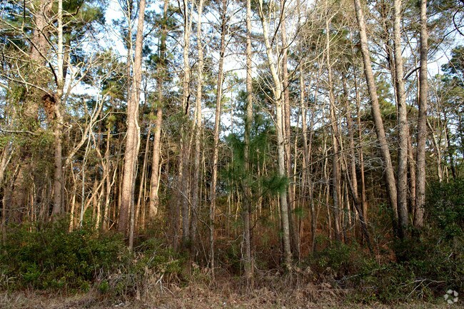
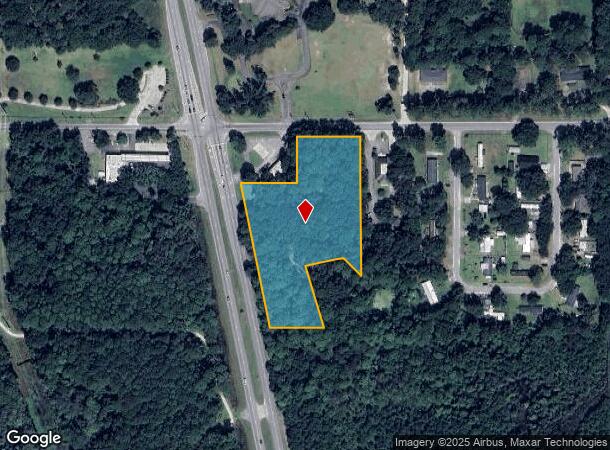
8 Bruce K Smalls Dr
Other Market Areas
Us Hwy 21 N. Commercial Corrid
Hilton Head Island-Bluffton-Beaufort, SC
POR LT 21-22-28 SEC 15 1N2W TIMBER*SPLIT 9/85 10.1 AC 20/18C SPLIT 10/8 5.66 AC
R100-020-000-0018-0000
Beaufort
Commercialnec
South Carolina
2025
21-22
2024
3.71 AC
000200
Hilton Head/Beaufort
DEMOGRAPHICS near 8 Bruce K Smalls Dr
1 Mile
3 Mile
5 Mile
2024 Total Population
1,307
7,276
19,916
2029 Population
1,445
7,843
21,783
Pop Growth 2024-2029
+ 10.56%
+ 7.79%
+ 9.37%
Average Age
39
34
36
2024 Total Households
488
1,977
6,833
HH Growth 2024-2029
+ 10.04%
+ 9.61%
+ 9.82%
Median Household Inc
$50,889
$49,571
$51,272
Avg Household Size
2.60
2.60
2.50
2024 Avg HH Vehicles
2.00
2.00
2.00
Median Home Value
$150,877
$145,714
$198,422
Median Year Built
1996
1994
1991
Nearby Places
Map Layers
Map Styles
 Street
 Aerial
- Restaurants
- Banks
- Shops
- Fitness
- Groceries
PUBLIC TRANSPORTATION
AIRPORT
Hilton Head
DRIVE
WALK
Distance
Hilton Head
53 min
39.8 mi
Savannah/Hilton Head International
DRIVE
WALK
Distance
Savannah/Hilton Head International
65 min
48.6 mi
Freight Ports
Georgia Ports - Savannah
DRIVE
WALK
Distance
Georgia Ports - Savannah
64 min
47.3 mi
SALE & LEASE HISTORY
LISTING DATE
SALE/LEASE

Sep 24, 2016
For Sale
Jun 07, 2017
For Sale
Nearby Properties
Address
Land Use
TOTAL SIZE
Lot Size
Zoning
Address
Land Use
TOTAL SIZE
Lot Size
Zoning
4,613 AC
6601
Address
Land Use
TOTAL SIZE
Lot Size
Zoning
64,000 SF
5.92 AC
Address
Land Use
TOTAL SIZE
Lot Size
Zoning
85,127 SF
35.70 AC
6611
Address
Land Use
TOTAL SIZE
Lot Size
Zoning
124,500 SF
72.60 AC
6101
Address
Land Use
TOTAL SIZE
Lot Size
Zoning
59,100 SF
5.13 AC
6611
Address
Land Use
TOTAL SIZE
Lot Size
Zoning
117.17 AC
9999
Address
Land Use
TOTAL SIZE
Lot Size
Zoning
16,002 SF
10.30 AC
6611
Address
Land Use
TOTAL SIZE
Lot Size
Zoning
10,040 SF
20.53 AC
6611
Address
Land Use
TOTAL SIZE
Lot Size
Zoning
10,043 SF
3 AC
Address
Land Use
TOTAL SIZE
Lot Size
Zoning
41,439 SF
27.75 AC
6611
Address
Land Use
TOTAL SIZE
Lot Size
Zoning
34,450 SF
10.07 AC
6601
Address
Land Use
TOTAL SIZE
Lot Size
Zoning
2,250 SF
1.59 AC
6611
Address
Land Use
TOTAL SIZE
Lot Size
Zoning
113 SF
16.85 AC
6611
Address
Land Use
TOTAL SIZE
Lot Size
Zoning
12,000 SF
13.88 AC
6611
Address
Land Use
TOTAL SIZE
Lot Size
Zoning
64,722 SF
14.24 AC
6611
Address
Land Use
TOTAL SIZE
Lot Size
Zoning
8,566 SF
66.43 AC
6611
Address
Land Use
TOTAL SIZE
Lot Size
Zoning
59.88 AC
Address
Land Use
TOTAL SIZE
Lot Size
Zoning
1,568 SF
64.85 AC
4211
Address
Land Use
TOTAL SIZE
Lot Size
Zoning
69,113 SF
57.52 AC
6611
Address
Land Use
TOTAL SIZE
Lot Size
Zoning
48,960 SF
13.29 AC
6611
Address
Land Use
TOTAL SIZE
Lot Size
Zoning
2,448 SF
6.40 AC
6611
Address
Land Use
TOTAL SIZE
Lot Size
Zoning
24,530 SF
1.34 AC
6611
Address
Land Use
TOTAL SIZE
Lot Size
Zoning
98.11 AC
6101
Address
Land Use
TOTAL SIZE
Lot Size
Zoning
5,229 SF
8.79 AC
6611
Address
Land Use
TOTAL SIZE
Lot Size
Zoning
54,908 SF
7.41 AC
6611
Address
Land Use
TOTAL SIZE
Lot Size
Zoning
26,600 SF
7.42 AC
6611
Address
Land Use
TOTAL SIZE
Lot Size
Zoning
13.36 AC
6611
Address
Land Use
TOTAL SIZE
Lot Size
Zoning
4,374 SF
2.60 AC
6601
Address
Land Use
TOTAL SIZE
Lot Size
Zoning
35,000 SF
8.99 AC
6611
The World's #1 Commercial Real Estate Marketplace
Connect with us
© 2026 CoStar Group
The information above has been obtained from sources believed reliable. While we do not doubt its accuracy we have not verified it and make no guarantee, warranty or representation about it. It is your responsibility to independently confirm its accuracy and completeness. Any projections, opinions, assumptions, or estimates used are for example only and do not represent the current or future performance of the property. The value of this transaction to you depends on tax and other factors which should be evaluated by your tax, financial, and legal advisors. You and your advisors should conduct a careful, independent investigation of the property to determine to your satisfaction the suitability of the property for your needs.