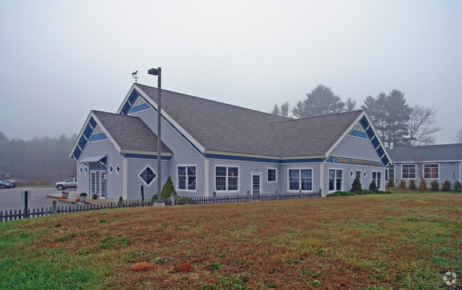
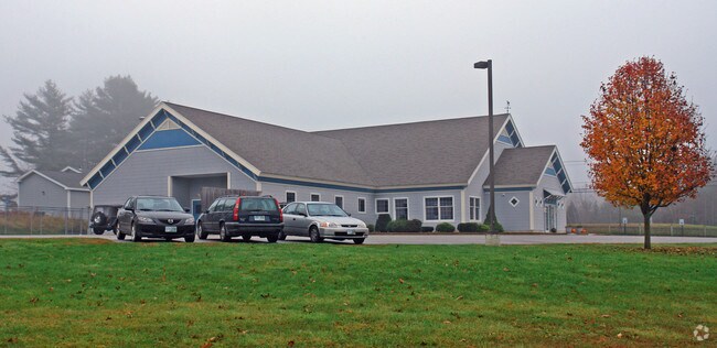
Property Record
8 Main St, Newfields, NH 03856

Property Detail
8 Main St
NFIE-000202-000000-000008-000022-TL
ROCKINGHAM
Commercialbuilding
New Hampshire
C - CO
8
B and X Area of moderate flood hazard, usually the area between the limits of the 100-year and 500-year floods.
1.72 AC
2025
Rockingham
2025
Boston
067505
Boston-Cambridge-Newton, MA-NH
6,472 SF
NEARBY LISTINGS FOR SALE OR LEASE
DEMOGRAPHICS near 8 Main St
1 mile
3 mile
5 mile
2025 Total Population
700
14,500
34,834
2030 Population
704
14,676
35,319
Pop Growth 2025-2030
+ 0.57%
+ 1.21%
+ 1.39%
Average Age
43
42
44
2025 Total Households
251
6,032
14,489
HH Growth 2025-2030
+ 0.40%
+ 1.18%
+ 1.30%
Median Household Inc
$178,571
$111,369
$111,860
Avg Household Size
2.80
2.40
2.40
2025 Avg HH Vehicles
3.00
2.00
2.00
Median Home Value
$689,655
$569,862
$588,213
Median Year Built
1990
1984
1982
Nearby Places
Map Layers
Map Styles
 Street
 Aerial
Transit
 Traffic
 Biking
Places
Listings with unknown addresses are not visible on the map
- Restaurants
- Banks
- Shops
- Fitness
- Groceries
PUBLIC TRANSPORTATION
COMMUTER RAIL
Drive
Walk
Distance
12 min
5.2 mi
Drive
Walk
Distance
19 min
7.9 mi
AIRPORT
Portsmouth International at Pease
Drive
Walk
Distance
Portsmouth International at Pease
21 min
10.0 mi
Manchester Boston Regional
Drive
Walk
Distance
Manchester Boston Regional
53 min
36.4 mi
Freight Ports
Port of Boston
Drive
Walk
Distance
Port of Boston
80 min
57.4 mi
Nearby Properties
Address
Land Use
TOTAL SIZE
Lot Size
Zoning
Address
Land Use
TOTAL SIZE
Lot Size
Zoning
87,917 SF
29.26 AC
RA
Address
Land Use
TOTAL SIZE
Lot Size
Zoning
103,968 SF
2.18 AC
M1
Address
Land Use
TOTAL SIZE
Lot Size
Zoning
77,254 SF
25.83 AC
M3
Address
Land Use
TOTAL SIZE
Lot Size
Zoning
34,095 SF
3 AC
B1
Address
Land Use
TOTAL SIZE
Lot Size
Zoning
Address
Land Use
TOTAL SIZE
Lot Size
Zoning
34,008 SF
5.22 AC
R3
Address
Land Use
TOTAL SIZE
Lot Size
Zoning
11,396 SF
8.96 AC
PRE P
Address
Land Use
TOTAL SIZE
Lot Size
Zoning
329,504 SF
30 AC
I - IN
Address
Land Use
TOTAL SIZE
Lot Size
Zoning
36,192 SF
4.89 AC
R3
Address
Land Use
TOTAL SIZE
Lot Size
Zoning
22,546 SF
2.94 AC
R2
Address
Land Use
TOTAL SIZE
Lot Size
Zoning
50,960 SF
11.50 AC
R2
Address
Land Use
TOTAL SIZE
Lot Size
Zoning
25,679 SF
10.25 AC
PRE P
Address
Land Use
TOTAL SIZE
Lot Size
Zoning
45,330 SF
1 AC
R3
Address
Land Use
TOTAL SIZE
Lot Size
Zoning
44,280 SF
1 AC
R3
Address
Land Use
TOTAL SIZE
Lot Size
Zoning
44,568 SF
1 AC
R3
Address
Land Use
TOTAL SIZE
Lot Size
Zoning
3,078 SF
13.31 AC
M3
Address
Land Use
TOTAL SIZE
Lot Size
Zoning
27,177 SF
6.61 AC
GCBD
Address
Land Use
TOTAL SIZE
Lot Size
Zoning
9,240 SF
2.25 AC
R3
Address
Land Use
TOTAL SIZE
Lot Size
Zoning
3,393 SF
6 AC
RA - R
Address
Land Use
TOTAL SIZE
Lot Size
Zoning
27,882 SF
11.54 AC
GCBD
Address
Land Use
TOTAL SIZE
Lot Size
Zoning
29,177 SF
5 AC
GCBD
Address
Land Use
TOTAL SIZE
Lot Size
Zoning
34,008 SF
5.93 AC
R3
Address
Land Use
TOTAL SIZE
Lot Size
Zoning
118,291 SF
5.52 AC
I - IN
Address
Land Use
TOTAL SIZE
Lot Size
Zoning
25,194 SF
8.97 AC
R1
Address
Land Use
TOTAL SIZE
Lot Size
Zoning
32,431 SF
2.05 AC
GCBD
Address
Land Use
TOTAL SIZE
Lot Size
Zoning
29,606 SF
1.53 AC
R3
Address
Land Use
TOTAL SIZE
Lot Size
Zoning
22,488 SF
2.11 AC
R3
Address
Land Use
TOTAL SIZE
Lot Size
Zoning
144 SF
17 AC
R2
Address
Land Use
TOTAL SIZE
Lot Size
Zoning
29,904 SF
1 AC
R3
Address
Land Use
TOTAL SIZE
Lot Size
Zoning
23,549 SF
2.20 AC
R - RE
The World's #1 Commercial Real Estate Marketplace
Connect with us
© 2026 CoStar Group
The information above has been obtained from sources believed reliable. While we do not doubt its accuracy we have not verified it and make no guarantee, warranty or representation about it. It is your responsibility to independently confirm its accuracy and completeness. Any projections, opinions, assumptions, or estimates used are for example only and do not represent the current or future performance of the property. The value of this transaction to you depends on tax and other factors which should be evaluated by your tax, financial, and legal advisors. You and your advisors should conduct a careful, independent investigation of the property to determine to your satisfaction the suitability of the property for your needs.