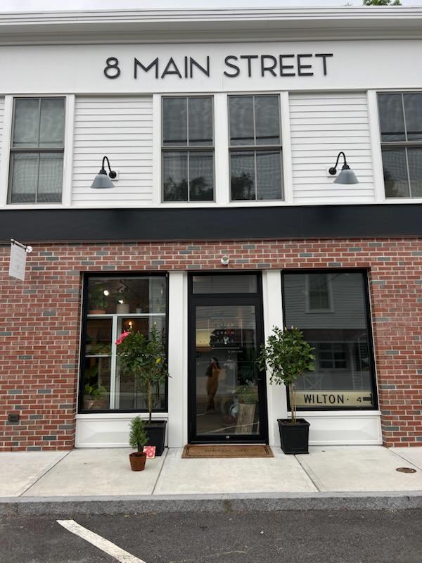
Property Record
8 Main St, Redding, CT 06896


Property Detail
8 Main St
REDD-000046-000000-000060
Western Ct
Commercialbuilding
Connecticut
BC
60
B and X Area of moderate flood hazard, usually the area between the limits of the 100-year and 500-year floods.
0.66 AC
2025
Ridgefield
2025
Westchester/So Connecticut
240100
Bridgeport-Stamford-Danbury, CT
5,817 SF
NEARBY LISTINGS FOR SALE OR LEASE
DEMOGRAPHICS near 8 Main St
1 mile
3 mile
5 mile
2025 Total Population
3,120
13,232
42,642
2030 Population
3,272
13,673
43,842
Pop Growth 2025-2030
+ 4.87%
+ 3.33%
+ 2.81%
Average Age
45
43
43
2025 Total Households
1,255
4,728
15,145
HH Growth 2025-2030
+ 5.02%
+ 3.45%
+ 2.84%
Median Household Inc
$160,287
$184,985
$181,709
Avg Household Size
2.50
2.80
2.80
2025 Avg HH Vehicles
2.00
2.00
2.00
Median Home Value
$761,816
$837,662
$855,183
Median Year Built
1978
1973
1972
Nearby Places
Map Layers
Map Styles
 Street
 Aerial
Transit
 Traffic
 Biking
Places
Listings with unknown addresses are not visible on the map
- Restaurants
- Banks
- Shops
- Fitness
- Groceries
PUBLIC TRANSPORTATION
COMMUTER RAIL
Branchville Station (New Haven Line - Metro-North Commuter Railroad Company (Metro-North))
Drive
Walk
Distance
Branchville Station (New Haven Line - Metro-North Commuter Railroad Company (Metro-North))
3 min
1.4 mi
Cannondale Station (New Haven Line - Metro-North Commuter Railroad Company (Metro-North))
Drive
Walk
Distance
Cannondale Station (New Haven Line - Metro-North Commuter Railroad Company (Metro-North))
6 min
3.6 mi
AIRPORT
Westchester County
Drive
Walk
Distance
Westchester County
44 min
30.2 mi
Tweed/New Haven
Drive
Walk
Distance
Tweed/New Haven
63 min
41.8 mi
Freight Ports
Port of New Haven
Drive
Walk
Distance
Port of New Haven
58 min
38.9 mi
SALE & LEASE HISTORY
LISTING DATE
SALE/LEASE

Jan 20, 2021
For Lease
Jan 16, 2023
For Lease
Aug 08, 2022
For Lease
Nearby Properties
Address
Land Use
TOTAL SIZE
Lot Size
Zoning
Address
Land Use
TOTAL SIZE
Lot Size
Zoning
8.92 AC
R-2
Address
Land Use
TOTAL SIZE
Lot Size
Zoning
53,960 SF
12.50 AC
B-2
Address
Land Use
TOTAL SIZE
Lot Size
Zoning
1,200 SF
75.12 AC
R-2
Address
Land Use
TOTAL SIZE
Lot Size
Zoning
469 AC
C
Address
Land Use
TOTAL SIZE
Lot Size
Zoning
143,837 SF
7.96 AC
SB
Address
Land Use
TOTAL SIZE
Lot Size
Zoning
36,260 SF
4.77 AC
GB
Address
Land Use
TOTAL SIZE
Lot Size
Zoning
6.10 AC
GB
Address
Land Use
TOTAL SIZE
Lot Size
Zoning
73,918 SF
5.95 AC
R-2
Address
Land Use
TOTAL SIZE
Lot Size
Zoning
29,370 SF
2.59 AC
B-1
Address
Land Use
TOTAL SIZE
Lot Size
Zoning
4,312 SF
0.40 AC
Address
Land Use
TOTAL SIZE
Lot Size
Zoning
123.30 AC
R-2
Address
Land Use
TOTAL SIZE
Lot Size
Zoning
5,008 SF
8.03 AC
R-2
Address
Land Use
TOTAL SIZE
Lot Size
Zoning
10,396 SF
4.87 AC
R-1
Address
Land Use
TOTAL SIZE
Lot Size
Zoning
14,211 SF
5.44 AC
GB
Address
Land Use
TOTAL SIZE
Lot Size
Zoning
44,000 SF
4.84 AC
B-2
Address
Land Use
TOTAL SIZE
Lot Size
Zoning
0.18 AC
HMC
Address
Land Use
TOTAL SIZE
Lot Size
Zoning
85.88 AC
C
Address
Land Use
TOTAL SIZE
Lot Size
Zoning
37.93 AC
R-2
Address
Land Use
TOTAL SIZE
Lot Size
Zoning
6.96 AC
R-2
Address
Land Use
TOTAL SIZE
Lot Size
Zoning
29.20 AC
C
Address
Land Use
TOTAL SIZE
Lot Size
Zoning
38.44 AC
R-2
Address
Land Use
TOTAL SIZE
Lot Size
Zoning
2.70 AC
R-2
Address
Land Use
TOTAL SIZE
Lot Size
Zoning
3.07 AC
HMC
Address
Land Use
TOTAL SIZE
Lot Size
Zoning
26.80 AC
R-2
Address
Land Use
TOTAL SIZE
Lot Size
Zoning
16,329 SF
1.51 AC
GB
Address
Land Use
TOTAL SIZE
Lot Size
Zoning
62.09 AC
C
Address
Land Use
TOTAL SIZE
Lot Size
Zoning
26.54 AC
R-2
Address
Land Use
TOTAL SIZE
Lot Size
Zoning
48,816 SF
11.88 AC
C
Address
Land Use
TOTAL SIZE
Lot Size
Zoning
9,800 SF
2.32 AC
B-1
Address
Land Use
TOTAL SIZE
Lot Size
Zoning
2,997 SF
3.83 AC
R-2
The World's #1 Commercial Real Estate Marketplace
Connect with us
© 2026 CoStar Group
The information above has been obtained from sources believed reliable. While we do not doubt its accuracy we have not verified it and make no guarantee, warranty or representation about it. It is your responsibility to independently confirm its accuracy and completeness. Any projections, opinions, assumptions, or estimates used are for example only and do not represent the current or future performance of the property. The value of this transaction to you depends on tax and other factors which should be evaluated by your tax, financial, and legal advisors. You and your advisors should conduct a careful, independent investigation of the property to determine to your satisfaction the suitability of the property for your needs.