Property Record
8 N Branford Rd, Branford, CT 06405

This Property Is For Sale
NEARBY LISTINGS FOR SALE OR LEASE
Property Detail
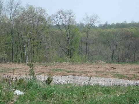
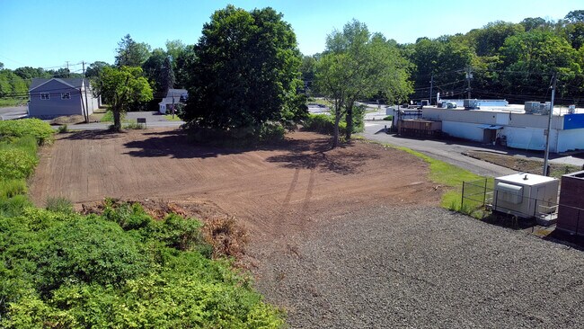
8 N Branford Rd
BRAN-000005G-000002-000002
New Haven
Industrialacreage
Connecticut
AE
2
09009C0466K
1.53 AC
2025
Branford
2025
Westchester/So Connecticut
184700
New Haven-Milford, CT
DEMOGRAPHICS near 8 N Branford Rd
1 Mile
3 Mile
5 Mile
2024 Total Population
2,955
27,308
70,170
2029 Population
2,959
27,341
70,420
Pop Growth 2024-2029
+ 0.14%
+ 0.12%
+ 0.36%
Average Age
46
46
46
2024 Total Households
1,244
12,283
30,521
HH Growth 2024-2029
0.00%
+ 0.06%
+ 0.34%
Median Household Inc
$102,778
$94,539
$87,877
Avg Household Size
2.30
2.20
2.20
2024 Avg HH Vehicles
2.00
2.00
2.00
Median Home Value
$411,742
$365,079
$328,807
Median Year Built
1975
1973
1973
Nearby Places
Map Layers
Map Styles
 Street
 Aerial
- Restaurants
- Banks
- Shops
- Fitness
- Groceries
PUBLIC TRANSPORTATION
COMMUTER RAIL
Branford (Commuter Rail - Shore Line East, Shore Line East - Shore Line East)
DRIVE
WALK
Distance
Branford (Commuter Rail - Shore Line East, Shore Line East - Shore Line East)
6 min
2.8 mi
Guilford (Commuter Rail - Shore Line East)
DRIVE
WALK
Distance
Guilford (Commuter Rail - Shore Line East)
11 min
7.3 mi
AIRPORT
Tweed/New Haven
DRIVE
WALK
Distance
Tweed/New Haven
12 min
6.6 mi
Freight Ports
Port of New Haven
DRIVE
WALK
Distance
Port of New Haven
12 min
7.2 mi
Nearby Properties
Address
Land Use
TOTAL SIZE
Lot Size
Zoning
Address
Land Use
TOTAL SIZE
Lot Size
Zoning
227,335 SF
38.50 AC
Address
Land Use
TOTAL SIZE
Lot Size
Zoning
50.70 AC
R40
Address
Land Use
TOTAL SIZE
Lot Size
Zoning
88.66 AC
I3
Address
Land Use
TOTAL SIZE
Lot Size
Zoning
175,913 SF
29 AC
Address
Land Use
TOTAL SIZE
Lot Size
Zoning
2,295.68 AC
R80
Address
Land Use
TOTAL SIZE
Lot Size
Zoning
7,065 SF
9.44 AC
Address
Land Use
TOTAL SIZE
Lot Size
Zoning
5.50 AC
Address
Land Use
TOTAL SIZE
Lot Size
Zoning
44,676 SF
7 AC
Address
Land Use
TOTAL SIZE
Lot Size
Zoning
70,417 SF
7 AC
R40
Address
Land Use
TOTAL SIZE
Lot Size
Zoning
34,341 SF
5.65 AC
Address
Land Use
TOTAL SIZE
Lot Size
Zoning
10.30 AC
B1
Address
Land Use
TOTAL SIZE
Lot Size
Zoning
5,089 SF
25.20 AC
R18
Address
Land Use
TOTAL SIZE
Lot Size
Zoning
8.29 AC
Address
Land Use
TOTAL SIZE
Lot Size
Zoning
142,136 SF
58.31 AC
R-8
Address
Land Use
TOTAL SIZE
Lot Size
Zoning
4.87 AC
Address
Land Use
TOTAL SIZE
Lot Size
Zoning
124,472 SF
16.60 AC
Address
Land Use
TOTAL SIZE
Lot Size
Zoning
94,311 SF
6.80 AC
Address
Land Use
TOTAL SIZE
Lot Size
Zoning
6,480 SF
15.94 AC
Address
Land Use
TOTAL SIZE
Lot Size
Zoning
14,030 SF
13.20 AC
Address
Land Use
TOTAL SIZE
Lot Size
Zoning
3,588 SF
15.80 AC
Address
Land Use
TOTAL SIZE
Lot Size
Zoning
10.20 AC
Address
Land Use
TOTAL SIZE
Lot Size
Zoning
40,682 SF
7.27 AC
Address
Land Use
TOTAL SIZE
Lot Size
Zoning
7.84 AC
Address
Land Use
TOTAL SIZE
Lot Size
Zoning
2.40 AC
Address
Land Use
TOTAL SIZE
Lot Size
Zoning
Address
Land Use
TOTAL SIZE
Lot Size
Zoning
13.90 AC
Address
Land Use
TOTAL SIZE
Lot Size
Zoning
54,799 SF
4.06 AC
Address
Land Use
TOTAL SIZE
Lot Size
Zoning
15.10 AC
Address
Land Use
TOTAL SIZE
Lot Size
Zoning
7.69 AC
RU1
Address
Land Use
TOTAL SIZE
Lot Size
Zoning
2.02 AC
The World's #1 Commercial Real Estate Marketplace
Connect with us
© 2025 CoStar Group
The information above has been obtained from sources believed reliable. While we do not doubt its accuracy we have not verified it and make no guarantee, warranty or representation about it. It is your responsibility to independently confirm its accuracy and completeness. Any projections, opinions, assumptions, or estimates used are for example only and do not represent the current or future performance of the property. The value of this transaction to you depends on tax and other factors which should be evaluated by your tax, financial, and legal advisors. You and your advisors should conduct a careful, independent investigation of the property to determine to your satisfaction the suitability of the property for your needs.