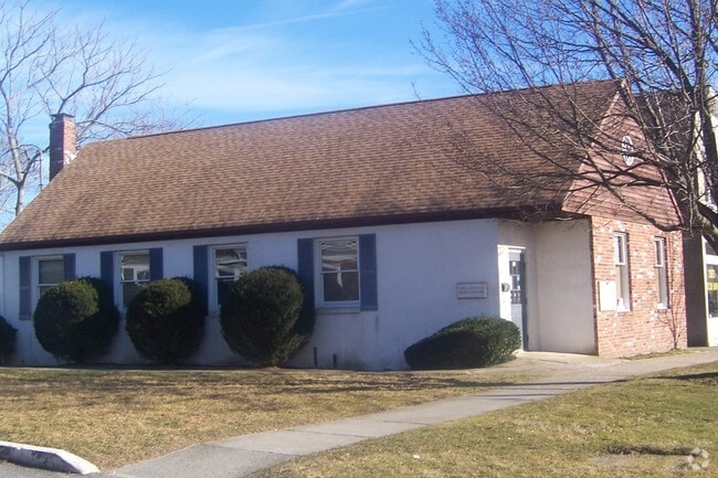
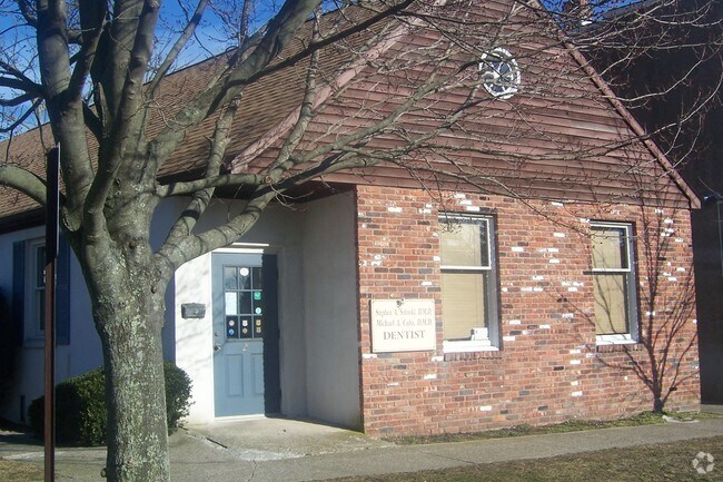
Property Record
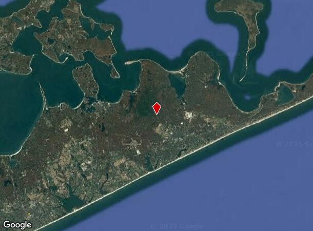
8 N Main St, Southampton, NY 11968

NEARBY LISTINGS FOR SALE OR LEASE
Property Detail
8 N Main St
0904-006-00-03-00-001-000
OWNERS ALSO STEPHEN & ALILNOKI1/2 INTEREST EACH
Commercialbuilding
Suffolk
X
New York
36103C0519H
1
2023
0.22 AC
2024
Eastern Suffolk
200905
Long Island (New York)
1,189 SF
Nassau County-Suffolk County, NY
DEMOGRAPHICS near 8 N Main St
1 Mile
3 Mile
5 Mile
2024 Total Population
6,355
16,856
27,647
2029 Population
6,711
17,888
29,348
Pop Growth 2024-2029
+ 5.60%
+ 6.12%
+ 6.15%
Average Age
45
44
44
2024 Total Households
2,350
6,413
10,578
HH Growth 2024-2029
+ 5.74%
+ 6.13%
+ 6.14%
Median Household Inc
$140,479
$134,600
$142,730
Avg Household Size
2.50
2.50
2.50
2024 Avg HH Vehicles
2.00
2.00
2.00
Median Home Value
$1,097,542
$1,060,605
$1,055,060
Median Year Built
1974
1979
1981
Nearby Places
- Restaurants
- Banks
- Shops
- Fitness
- Groceries
PUBLIC TRANSPORTATION
COMMUTER RAIL
East Hampton Station (Montauk Branch - Long Island Rail Road)
DRIVE
WALK
Distance
East Hampton Station (Montauk Branch - Long Island Rail Road)
6 min
2.7 mi
Amagansett Station (Montauk Branch - Long Island Rail Road)
DRIVE
WALK
Distance
Amagansett Station (Montauk Branch - Long Island Rail Road)
13 min
5.6 mi
Freight Ports
Port of New Haven
DRIVE
WALK
Distance
Port of New Haven
198 min
89.0 mi
Nearby Properties
Address
Land Use
TOTAL SIZE
Lot Size
Zoning
Address
Land Use
TOTAL SIZE
Lot Size
Zoning
2,240 SF
19.46 AC
R40
Address
Land Use
TOTAL SIZE
Lot Size
Zoning
4,132 SF
1.08 AC
R40
Address
Land Use
TOTAL SIZE
Lot Size
Zoning
3,298 SF
0.18 AC
VILLA
Address
Land Use
TOTAL SIZE
Lot Size
Zoning
4,718 SF
1.09 AC
R20
Address
Land Use
TOTAL SIZE
Lot Size
Zoning
53.67 AC
Address
Land Use
TOTAL SIZE
Lot Size
Zoning
3.01 AC
Address
Land Use
TOTAL SIZE
Lot Size
Zoning
17.58 AC
Address
Land Use
TOTAL SIZE
Lot Size
Zoning
1.08 AC
VILLA
Address
Land Use
TOTAL SIZE
Lot Size
Zoning
2,196 SF
0.26 AC
B2
Address
Land Use
TOTAL SIZE
Lot Size
Zoning
2,039 SF
0.29 AC
HO
Address
Land Use
TOTAL SIZE
Lot Size
Zoning
Address
Land Use
TOTAL SIZE
Lot Size
Zoning
0.77 AC
R80
Address
Land Use
TOTAL SIZE
Lot Size
Zoning
226.50 AC
Address
Land Use
TOTAL SIZE
Lot Size
Zoning
Address
Land Use
TOTAL SIZE
Lot Size
Zoning
0.50 AC
R20
Address
Land Use
TOTAL SIZE
Lot Size
Zoning
Address
Land Use
TOTAL SIZE
Lot Size
Zoning
8.10 AC
Address
Land Use
TOTAL SIZE
Lot Size
Zoning
2.10 AC
Address
Land Use
TOTAL SIZE
Lot Size
Zoning
0.82 AC
BD
Address
Land Use
TOTAL SIZE
Lot Size
Zoning
Address
Land Use
TOTAL SIZE
Lot Size
Zoning
62.64 AC
Address
Land Use
TOTAL SIZE
Lot Size
Zoning
209 AC
Address
Land Use
TOTAL SIZE
Lot Size
Zoning
Address
Land Use
TOTAL SIZE
Lot Size
Zoning
0.08 AC
B2
Address
Land Use
TOTAL SIZE
Lot Size
Zoning
1.50 AC
Address
Land Use
TOTAL SIZE
Lot Size
Zoning
1.38 AC
Address
Land Use
TOTAL SIZE
Lot Size
Zoning
9.50 AC
Address
Land Use
TOTAL SIZE
Lot Size
Zoning
Address
Land Use
TOTAL SIZE
Lot Size
Zoning
Address
Land Use
TOTAL SIZE
Lot Size
Zoning
The World's #1 Commercial Real Estate Marketplace
Connect with us
© 2025 CoStar Group
The information above has been obtained from sources believed reliable. While we do not doubt its accuracy we have not verified it and make no guarantee, warranty or representation about it. It is your responsibility to independently confirm its accuracy and completeness. Any projections, opinions, assumptions, or estimates used are for example only and do not represent the current or future performance of the property. The value of this transaction to you depends on tax and other factors which should be evaluated by your tax, financial, and legal advisors. You and your advisors should conduct a careful, independent investigation of the property to determine to your satisfaction the suitability of the property for your needs.