Property Record
8 Red Barn Ln, Walpole, NH 03608
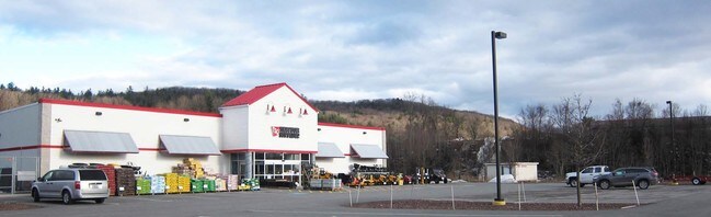

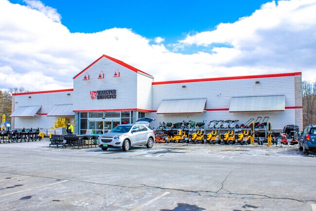
Property Detail
8 Red Barn Ln
WLPO-000012-000000-000013-000002
Cheshire
Commercialbuilding
New Hampshire
COM C
13
B and X Area of moderate flood hazard, usually the area between the limits of the 100-year and 500-year floods.
4.92 AC
2025
Manchester/New Hampshire South Area
2025
Other Market Areas
970200
Keene, NH
19,452 SF
NEARBY LISTINGS FOR SALE OR LEASE
DEMOGRAPHICS near 8 Red Barn Ln
1 mile
3 mile
5 mile
2025 Total Population
472
6,175
9,196
2030 Population
454
6,112
9,102
Pop Growth 2025-2030
(3.81%)
(1.02%)
(1.02%)
Average Age
48
45
45
2025 Total Households
220
2,798
4,112
HH Growth 2025-2030
(3.64%)
(1.07%)
(1.14%)
Median Household Inc
$70,937
$68,147
$72,414
Avg Household Size
2.10
2.20
2.20
2025 Avg HH Vehicles
2.00
2.00
2.00
Median Home Value
$364,999
$252,978
$270,674
Median Year Built
1962
1949
1958
Nearby Places
Map Layers
Map Styles
 Street
 Aerial
Transit
 Traffic
 Biking
Places
Listings with unknown addresses are not visible on the map
- Restaurants
- Banks
- Shops
- Fitness
- Groceries
PUBLIC TRANSPORTATION
COMMUTER RAIL
Bellows Falls Amtrak Station (Vermonter - Amtrak)
Drive
Walk
Distance
Bellows Falls Amtrak Station (Vermonter - Amtrak)
6 min
2.9 mi
Freight Ports
Albany, NY Port
Drive
Walk
Distance
Albany, NY Port
158 min
103.8 mi
SALE & LEASE HISTORY
LISTING DATE
SALE/LEASE

Mar 25, 2022
For Sale
Apr 04, 2017
For Sale
Nearby Properties
Address
Land Use
TOTAL SIZE
Lot Size
Zoning
Address
Land Use
TOTAL SIZE
Lot Size
Zoning
13.51 AC
Address
Land Use
TOTAL SIZE
Lot Size
Zoning
Address
Land Use
TOTAL SIZE
Lot Size
Zoning
Address
Land Use
TOTAL SIZE
Lot Size
Zoning
Address
Land Use
TOTAL SIZE
Lot Size
Zoning
8.30 AC
Address
Land Use
TOTAL SIZE
Lot Size
Zoning
Address
Land Use
TOTAL SIZE
Lot Size
Zoning
16.54 AC
RB R
Address
Land Use
TOTAL SIZE
Lot Size
Zoning
50.80 AC
Address
Land Use
TOTAL SIZE
Lot Size
Zoning
12.40 AC
Address
Land Use
TOTAL SIZE
Lot Size
Zoning
55,037 SF
12.15 AC
COM C
Address
Land Use
TOTAL SIZE
Lot Size
Zoning
Address
Land Use
TOTAL SIZE
Lot Size
Zoning
7,056 SF
80.76 AC
Address
Land Use
TOTAL SIZE
Lot Size
Zoning
28,905 SF
5.85 AC
Address
Land Use
TOTAL SIZE
Lot Size
Zoning
1.90 AC
RB R
Address
Land Use
TOTAL SIZE
Lot Size
Zoning
60,615 SF
0.91 AC
Address
Land Use
TOTAL SIZE
Lot Size
Zoning
176 AC
IND I
Address
Land Use
TOTAL SIZE
Lot Size
Zoning
31,161 SF
2.36 AC
NRB11N
Address
Land Use
TOTAL SIZE
Lot Size
Zoning
31,332 SF
3.34 AC
COM C
Address
Land Use
TOTAL SIZE
Lot Size
Zoning
62,865 SF
5.65 AC
NRB11N
Address
Land Use
TOTAL SIZE
Lot Size
Zoning
Address
Land Use
TOTAL SIZE
Lot Size
Zoning
4.04 AC
COM C
Address
Land Use
TOTAL SIZE
Lot Size
Zoning
9,891 SF
5.10 AC
RUR R
Address
Land Use
TOTAL SIZE
Lot Size
Zoning
8.80 AC
Address
Land Use
TOTAL SIZE
Lot Size
Zoning
15,187 SF
10 AC
NRB11N
Address
Land Use
TOTAL SIZE
Lot Size
Zoning
Address
Land Use
TOTAL SIZE
Lot Size
Zoning
20,063 SF
4.39 AC
RUR R
Address
Land Use
TOTAL SIZE
Lot Size
Zoning
25,902 SF
7.15 AC
IND I
Address
Land Use
TOTAL SIZE
Lot Size
Zoning
12,854 SF
0.27 AC
RB R
Address
Land Use
TOTAL SIZE
Lot Size
Zoning
23,079 SF
0.71 AC
COM C
The World's #1 Commercial Real Estate Marketplace
Connect with us
© 2026 CoStar Group
The information above has been obtained from sources believed reliable. While we do not doubt its accuracy we have not verified it and make no guarantee, warranty or representation about it. It is your responsibility to independently confirm its accuracy and completeness. Any projections, opinions, assumptions, or estimates used are for example only and do not represent the current or future performance of the property. The value of this transaction to you depends on tax and other factors which should be evaluated by your tax, financial, and legal advisors. You and your advisors should conduct a careful, independent investigation of the property to determine to your satisfaction the suitability of the property for your needs.