Property Record
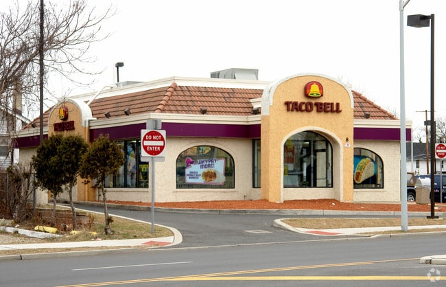
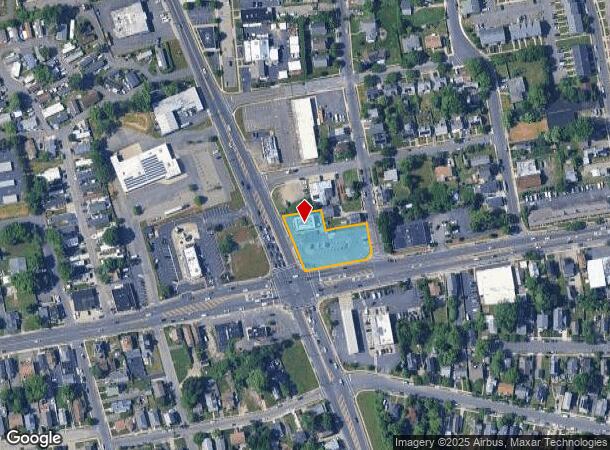
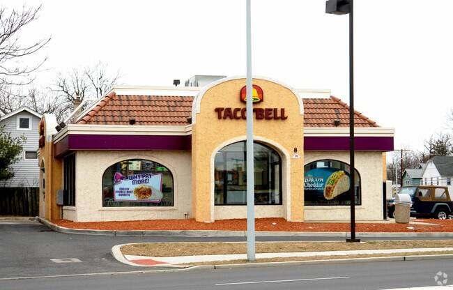
8 State Route 35 N, Neptune, NJ 07753

NEARBY LISTINGS FOR SALE OR LEASE
Property Detail
8 State Route 35 N
35-00514-0000-00005
INCL BLK 213 LOTS 392 - 395 NIT 1A
Restaurantdrivein
Monmouth
X
New Jersey
34025C0334G
5
2024
0.57 AC
2025
Southern Monmouth
807600
Northern New Jersey
2,122 SF
New York-Jersey City-White Plains, NY-NJ
DEMOGRAPHICS near 8 State Route 35 N
1 Mile
3 Mile
5 Mile
2024 Total Population
23,642
85,142
140,686
2029 Population
23,762
86,311
142,489
Pop Growth 2024-2029
+ 0.51%
+ 1.37%
+ 1.28%
Average Age
41
44
44
2024 Total Households
9,580
37,315
60,166
HH Growth 2024-2029
+ 0.74%
+ 1.53%
+ 1.23%
Median Household Inc
$60,532
$85,950
$92,336
Avg Household Size
2.30
2.20
2.30
2024 Avg HH Vehicles
1.00
2.00
2.00
Median Home Value
$384,149
$479,872
$523,497
Median Year Built
1954
1961
1968
Nearby Places
Map Layers
Map Styles
 Street
 Aerial
- Restaurants
- Banks
- Shops
- Fitness
- Groceries
PUBLIC TRANSPORTATION
COMMUTER RAIL
Bradley Beach (North Jersey Coast Line - NJ Transit Commuter Rail (NJ Transit))
DRIVE
WALK
Distance
Bradley Beach (North Jersey Coast Line - NJ Transit Commuter Rail (NJ Transit))
2 min
16 min
0.9 mi
Asbury Park (North Jersey Coast Line - NJ Transit Commuter Rail (NJ Transit))
DRIVE
WALK
Distance
Asbury Park (North Jersey Coast Line - NJ Transit Commuter Rail (NJ Transit))
3 min
18 min
0.9 mi
Freight Ports
New York Container Terminal
DRIVE
WALK
Distance
New York Container Terminal
55 min
42.4 mi
Nearby Properties
Address
Land Use
TOTAL SIZE
Lot Size
Zoning
Address
Land Use
TOTAL SIZE
Lot Size
Zoning
26,282 SF
4.59 AC
C
Address
Land Use
TOTAL SIZE
Lot Size
Zoning
5,776 SF
25.50 AC
PB
Address
Land Use
TOTAL SIZE
Lot Size
Zoning
739,651 SF
27.89 AC
C
Address
Land Use
TOTAL SIZE
Lot Size
Zoning
113.60 AC
WBA
Address
Land Use
TOTAL SIZE
Lot Size
Zoning
65,668 SF
111.60 AC
C50
Address
Land Use
TOTAL SIZE
Lot Size
Zoning
320,341 SF
57.85 AC
C
Address
Land Use
TOTAL SIZE
Lot Size
Zoning
32.19 AC
R-7
Address
Land Use
TOTAL SIZE
Lot Size
Zoning
1.61 AC
R1
Address
Land Use
TOTAL SIZE
Lot Size
Zoning
705 SF
2.01 AC
WPRA
Address
Land Use
TOTAL SIZE
Lot Size
Zoning
1,152 SF
87 SF
WPRA
Address
Land Use
TOTAL SIZE
Lot Size
Zoning
108,641 SF
10.64 AC
C-6
Address
Land Use
TOTAL SIZE
Lot Size
Zoning
1,288 SF
25.49 AC
HD-R
Address
Land Use
TOTAL SIZE
Lot Size
Zoning
5,407 SF
25.60 AC
C-3
Address
Land Use
TOTAL SIZE
Lot Size
Zoning
3,094 SF
277.60 AC
C
Address
Land Use
TOTAL SIZE
Lot Size
Zoning
224,683 SF
21.56 AC
CHS
Address
Land Use
TOTAL SIZE
Lot Size
Zoning
91,173 SF
4.07 AC
R3
Address
Land Use
TOTAL SIZE
Lot Size
Zoning
254,714 SF
3.40 AC
WPRA
Address
Land Use
TOTAL SIZE
Lot Size
Zoning
Address
Land Use
TOTAL SIZE
Lot Size
Zoning
13,200 SF
18.63 AC
PUDR
Address
Land Use
TOTAL SIZE
Lot Size
Zoning
1,487 SF
7.50 AC
R-B
Address
Land Use
TOTAL SIZE
Lot Size
Zoning
15 AC
R-7
Address
Land Use
TOTAL SIZE
Lot Size
Zoning
34,590 SF
18.38 AC
C-2
Address
Land Use
TOTAL SIZE
Lot Size
Zoning
0.88 AC
STNB
Address
Land Use
TOTAL SIZE
Lot Size
Zoning
8.82 AC
R2
Address
Land Use
TOTAL SIZE
Lot Size
Zoning
14,484 SF
163.40 AC
R-1
Address
Land Use
TOTAL SIZE
Lot Size
Zoning
Address
Land Use
TOTAL SIZE
Lot Size
Zoning
27,328 SF
6.79 AC
HB12
Address
Land Use
TOTAL SIZE
Lot Size
Zoning
0.76 AC
R-1
Address
Land Use
TOTAL SIZE
Lot Size
Zoning
7.39 AC
R2
Address
Land Use
TOTAL SIZE
Lot Size
Zoning
8.76 AC
R1
The World's #1 Commercial Real Estate Marketplace
Connect with us
© 2025 CoStar Group
The information above has been obtained from sources believed reliable. While we do not doubt its accuracy we have not verified it and make no guarantee, warranty or representation about it. It is your responsibility to independently confirm its accuracy and completeness. Any projections, opinions, assumptions, or estimates used are for example only and do not represent the current or future performance of the property. The value of this transaction to you depends on tax and other factors which should be evaluated by your tax, financial, and legal advisors. You and your advisors should conduct a careful, independent investigation of the property to determine to your satisfaction the suitability of the property for your needs.