Property Record
8 Tracy Rd, Dayville, CT 06241
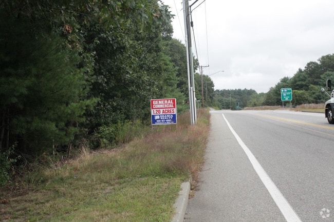

This Property Is For Sale
Property Detail
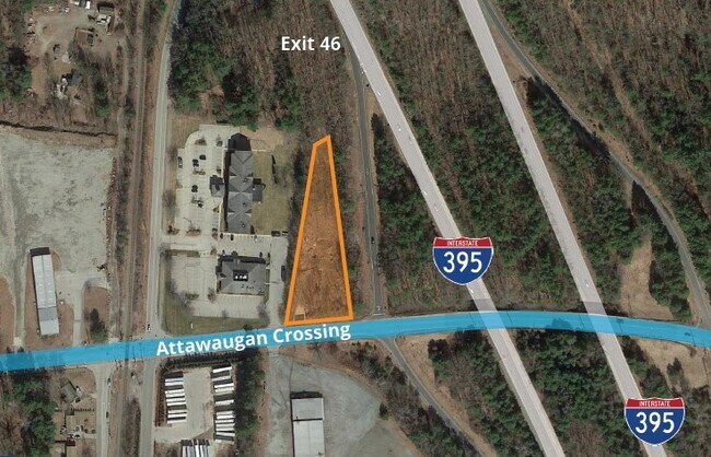
8 Tracy Rd
KILL-000056-000012-000001
WINDHAM
Restaurantbuilding
Connecticut
GC
1
B and X Area of moderate flood hazard, usually the area between the limits of the 100-year and 500-year floods.
1.84 AC
2025
Windham County
2025
Hartford
904400
Willimantic, CT
9,404 SF
NEARBY LISTINGS FOR SALE OR LEASE
DEMOGRAPHICS near 8 Tracy Rd
1 mile
3 mile
5 mile
2025 Total Population
1,263
8,304
29,819
2030 Population
1,312
8,538
30,557
Pop Growth 2025-2030
+ 3.88%
+ 2.82%
+ 2.47%
Average Age
43
43
43
2025 Total Households
495
3,330
12,311
HH Growth 2025-2030
+ 4.04%
+ 2.91%
+ 2.61%
Median Household Inc
$94,196
$91,487
$80,260
Avg Household Size
2.50
2.40
2.30
2025 Avg HH Vehicles
2.00
2.00
2.00
Median Home Value
$314,948
$314,686
$280,085
Median Year Built
1973
1972
1964
Nearby Places
Map Layers
Map Styles
 Street
 Aerial
Layers
 Traffic
 Biking
Places
Listings with unknown addresses are not visible on the map
- Restaurants
- Banks
- Shops
- Fitness
- Groceries
PUBLIC TRANSPORTATION
AIRPORT
Worcester Regional
Drive
Walk
Distance
Worcester Regional
45 min
31.7 mi
Rhode Island Tf Green International
Drive
Walk
Distance
Rhode Island Tf Green International
48 min
36.8 mi
Freight Ports
Port of Davisville, RI
Drive
Walk
Distance
Port of Davisville, RI
60 min
46.1 mi
Nearby Properties
Address
Land Use
TOTAL SIZE
Lot Size
Zoning
Address
Land Use
TOTAL SIZE
Lot Size
Zoning
141.59 AC
RD
Address
Land Use
TOTAL SIZE
Lot Size
Zoning
13.76 AC
M/OD
Address
Land Use
TOTAL SIZE
Lot Size
Zoning
86 AC
LD
Address
Land Use
TOTAL SIZE
Lot Size
Zoning
Address
Land Use
TOTAL SIZE
Lot Size
Zoning
62 AC
LD
Address
Land Use
TOTAL SIZE
Lot Size
Zoning
47 AC
MUI
Address
Land Use
TOTAL SIZE
Lot Size
Zoning
447,300 SF
32.08 AC
I
Address
Land Use
TOTAL SIZE
Lot Size
Zoning
139,010 SF
16.75 AC
MUI
Address
Land Use
TOTAL SIZE
Lot Size
Zoning
307,858 SF
52 AC
I
Address
Land Use
TOTAL SIZE
Lot Size
Zoning
29.78 AC
I
Address
Land Use
TOTAL SIZE
Lot Size
Zoning
169.79 AC
ALZ.L
Address
Land Use
TOTAL SIZE
Lot Size
Zoning
126,601 SF
13.40 AC
MUI
Address
Land Use
TOTAL SIZE
Lot Size
Zoning
210,670 SF
20.74 AC
I
Address
Land Use
TOTAL SIZE
Lot Size
Zoning
864 SF
50 AC
VC/LD
Address
Land Use
TOTAL SIZE
Lot Size
Zoning
6.61 AC
MUI
Address
Land Use
TOTAL SIZE
Lot Size
Zoning
131,792 SF
18.69 AC
I
Address
Land Use
TOTAL SIZE
Lot Size
Zoning
20,644 SF
80.30 AC
AG-2
Address
Land Use
TOTAL SIZE
Lot Size
Zoning
7.07 AC
GC
Address
Land Use
TOTAL SIZE
Lot Size
Zoning
44,160 SF
5.82 AC
RD
Address
Land Use
TOTAL SIZE
Lot Size
Zoning
9.09 AC
I
Address
Land Use
TOTAL SIZE
Lot Size
Zoning
173,650 SF
26.63 AC
I
Address
Land Use
TOTAL SIZE
Lot Size
Zoning
89,872 SF
6.71 AC
LD
Address
Land Use
TOTAL SIZE
Lot Size
Zoning
10.50 AC
GC
Address
Land Use
TOTAL SIZE
Lot Size
Zoning
40,240 SF
1.84 AC
GC
Address
Land Use
TOTAL SIZE
Lot Size
Zoning
49,195 SF
8.57 AC
AG-2
Address
Land Use
TOTAL SIZE
Lot Size
Zoning
85,301 SF
47.97 AC
I
Address
Land Use
TOTAL SIZE
Lot Size
Zoning
12,982 SF
1.54 AC
GC
Address
Land Use
TOTAL SIZE
Lot Size
Zoning
48,032 SF
9.40 AC
LD
Address
Land Use
TOTAL SIZE
Lot Size
Zoning
15 AC
I
Address
Land Use
TOTAL SIZE
Lot Size
Zoning
74,072 SF
8 AC
I
The World's #1 Commercial Real Estate Marketplace
Connect with us
© 2026 CoStar Group
The information above has been obtained from sources believed reliable. While we do not doubt its accuracy we have not verified it and make no guarantee, warranty or representation about it. It is your responsibility to independently confirm its accuracy and completeness. Any projections, opinions, assumptions, or estimates used are for example only and do not represent the current or future performance of the property. The value of this transaction to you depends on tax and other factors which should be evaluated by your tax, financial, and legal advisors. You and your advisors should conduct a careful, independent investigation of the property to determine to your satisfaction the suitability of the property for your needs.