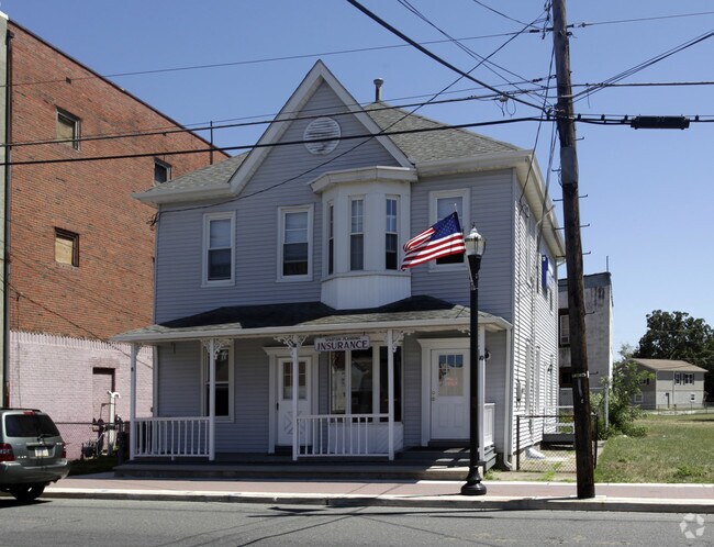
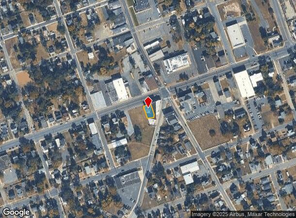
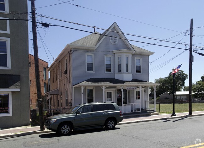
Property Record
8 W Broad St, Paulsboro, NJ 08066
NEARBY LISTINGS FOR SALE OR LEASE
-
-
View all Paulsboro listings for sale on LoopNet.com
Property Detail
8 W Broad St
14-00102-0000-00006
Gloucester
Commercialofficeresidentialmixeduse
New Jersey
X
6
34015C0078F
0.08 AC
2024
Gloucester County
2025
Philadelphia
500400
Philadelphia-Camden-Wilmington, PA-NJ-DE-MD
DEMOGRAPHICS near 8 W Broad St
1 Mile
3 Mile
5 Mile
2024 Total Population
6,109
22,382
87,463
2029 Population
6,294
23,127
89,475
Pop Growth 2024-2029
+ 3.03%
+ 3.33%
+ 2.30%
Average Age
38
41
41
2024 Total Households
2,303
8,872
34,262
HH Growth 2024-2029
+ 3.00%
+ 3.35%
+ 2.33%
Median Household Inc
$57,639
$80,982
$80,945
Avg Household Size
2.60
2.50
2.50
2024 Avg HH Vehicles
1.00
2.00
2.00
Median Home Value
$169,259
$264,336
$223,504
Median Year Built
1949
1972
1966
Nearby Places
Map Layers
Map Styles
 Street
 Aerial
- Restaurants
- Banks
- Shops
- Fitness
- Groceries
PUBLIC TRANSPORTATION
AIRPORT
Philadelphia International
DRIVE
WALK
Distance
Philadelphia International
31 min
18.4 mi
Trenton Mercer
DRIVE
WALK
Distance
Trenton Mercer
68 min
46.5 mi
Freight Ports
Broadway Terminal - Pier 5
DRIVE
WALK
Distance
Broadway Terminal - Pier 5
16 min
10.4 mi
Nearby Properties
Address
Land Use
TOTAL SIZE
Lot Size
Zoning
Address
Land Use
TOTAL SIZE
Lot Size
Zoning
653.90 AC
Address
Land Use
TOTAL SIZE
Lot Size
Zoning
995,943 SF
212.65 AC
Address
Land Use
TOTAL SIZE
Lot Size
Zoning
69.05 AC
M2
Address
Land Use
TOTAL SIZE
Lot Size
Zoning
71.49 AC
Address
Land Use
TOTAL SIZE
Lot Size
Zoning
243.55 AC
M2
Address
Land Use
TOTAL SIZE
Lot Size
Zoning
111.06 AC
MIBP
Address
Land Use
TOTAL SIZE
Lot Size
Zoning
47.40 AC
C2
Address
Land Use
TOTAL SIZE
Lot Size
Zoning
Address
Land Use
TOTAL SIZE
Lot Size
Zoning
10.62 AC
M1
Address
Land Use
TOTAL SIZE
Lot Size
Zoning
53.18 AC
M2
Address
Land Use
TOTAL SIZE
Lot Size
Zoning
40.25 AC
M
Address
Land Use
TOTAL SIZE
Lot Size
Zoning
73.82 AC
M
Address
Land Use
TOTAL SIZE
Lot Size
Zoning
34.58 AC
Address
Land Use
TOTAL SIZE
Lot Size
Zoning
32.88 AC
M1
Address
Land Use
TOTAL SIZE
Lot Size
Zoning
Address
Land Use
TOTAL SIZE
Lot Size
Zoning
Address
Land Use
TOTAL SIZE
Lot Size
Zoning
22.60 AC
R4
Address
Land Use
TOTAL SIZE
Lot Size
Zoning
Address
Land Use
TOTAL SIZE
Lot Size
Zoning
24.27 AC
M2
Address
Land Use
TOTAL SIZE
Lot Size
Zoning
55.38 AC
M2
Address
Land Use
TOTAL SIZE
Lot Size
Zoning
111.40 AC
RRC
Address
Land Use
TOTAL SIZE
Lot Size
Zoning
36.52 AC
M1
Address
Land Use
TOTAL SIZE
Lot Size
Zoning
31 AC
M1
Address
Land Use
TOTAL SIZE
Lot Size
Zoning
302.82 AC
M2
Address
Land Use
TOTAL SIZE
Lot Size
Zoning
19.34 AC
R1
Address
Land Use
TOTAL SIZE
Lot Size
Zoning
27.18 AC
M1
Address
Land Use
TOTAL SIZE
Lot Size
Zoning
30.76 AC
BP
Address
Land Use
TOTAL SIZE
Lot Size
Zoning
30.23 AC
Address
Land Use
TOTAL SIZE
Lot Size
Zoning
5.72 AC
R3
Address
Land Use
TOTAL SIZE
Lot Size
Zoning
5 AC
R1
The World's #1 Commercial Real Estate Marketplace
Connect with us
© 2026 CoStar Group
The information above has been obtained from sources believed reliable. While we do not doubt its accuracy we have not verified it and make no guarantee, warranty or representation about it. It is your responsibility to independently confirm its accuracy and completeness. Any projections, opinions, assumptions, or estimates used are for example only and do not represent the current or future performance of the property. The value of this transaction to you depends on tax and other factors which should be evaluated by your tax, financial, and legal advisors. You and your advisors should conduct a careful, independent investigation of the property to determine to your satisfaction the suitability of the property for your needs.