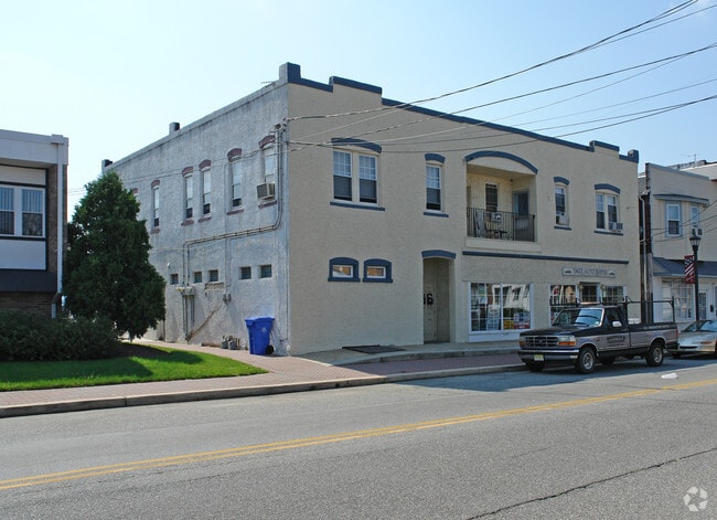
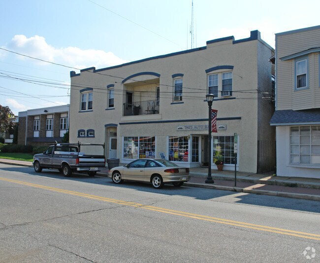
Property Record
8 W High St, Glassboro, NJ 08028
NEARBY LISTINGS FOR SALE OR LEASE
Property Detail
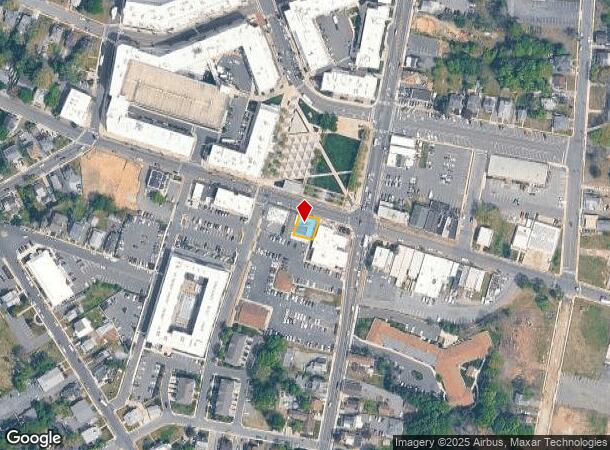
8 W High St
Philadelphia-Camden-Wilmington, PA-NJ-DE-MD
ALSO LOT 5A 8
06-00050-0000-00003
Gloucester
Storemultistory
New Jersey
X
3
34015C0203E
0.12 AC
2024
Gloucester County
2025
Philadelphia
501402
DEMOGRAPHICS near 8 W High St
1 mile
3 mile
5 mile
2024 Total Population
16,109
48,310
99,590
2029 Population
16,854
50,105
103,084
Pop Growth 2024-2029
+ 4.62%
+ 3.72%
+ 3.51%
Average Age
31
38
40
2024 Total Households
3,984
16,217
34,656
HH Growth 2024-2029
+ 6.60%
+ 4.12%
+ 3.73%
Median Household Inc
$61,793
$87,049
$99,950
Avg Household Size
2.40
2.50
2.60
2024 Avg HH Vehicles
2.00
2.00
2.00
Median Home Value
$198,600
$251,594
$276,028
Median Year Built
1977
1978
1981
Nearby Places
Map Layers
Map Styles
 Street
 Aerial
Transit
 Traffic
 Biking
Places
Listings with unknown addresses are not visible on the map
- Restaurants
- Banks
- Shops
- Fitness
- Groceries
PUBLIC TRANSPORTATION
AIRPORT
Philadelphia International
Drive
Walk
Distance
Philadelphia International
41 min
24.6 mi
Atlantic City International
Drive
Walk
Distance
Atlantic City International
72 min
41.3 mi
Freight Ports
Broadway Terminal - Pier 5
Drive
Walk
Distance
Broadway Terminal - Pier 5
25 min
16.1 mi
Nearby Properties
Address
Land Use
TOTAL SIZE
Lot Size
Zoning
Address
Land Use
TOTAL SIZE
Lot Size
Zoning
2,302 SF
61.32 AC
C55
Address
Land Use
TOTAL SIZE
Lot Size
Zoning
96.68 AC
P
Address
Land Use
TOTAL SIZE
Lot Size
Zoning
3.34 AC
R3
Address
Land Use
TOTAL SIZE
Lot Size
Zoning
4.41 AC
Address
Land Use
TOTAL SIZE
Lot Size
Zoning
Address
Land Use
TOTAL SIZE
Lot Size
Zoning
Address
Land Use
TOTAL SIZE
Lot Size
Zoning
4.52 AC
P
Address
Land Use
TOTAL SIZE
Lot Size
Zoning
46.38 AC
P
Address
Land Use
TOTAL SIZE
Lot Size
Zoning
Address
Land Use
TOTAL SIZE
Lot Size
Zoning
25.71 AC
Address
Land Use
TOTAL SIZE
Lot Size
Zoning
Address
Land Use
TOTAL SIZE
Lot Size
Zoning
23.27 AC
C5
Address
Land Use
TOTAL SIZE
Lot Size
Zoning
26.35 AC
R4
Address
Land Use
TOTAL SIZE
Lot Size
Zoning
4.89 AC
RA
Address
Land Use
TOTAL SIZE
Lot Size
Zoning
1.77 AC
Address
Land Use
TOTAL SIZE
Lot Size
Zoning
1.29 AC
Address
Land Use
TOTAL SIZE
Lot Size
Zoning
Address
Land Use
TOTAL SIZE
Lot Size
Zoning
Address
Land Use
TOTAL SIZE
Lot Size
Zoning
22.31 AC
C5
Address
Land Use
TOTAL SIZE
Lot Size
Zoning
14.57 AC
P
Address
Land Use
TOTAL SIZE
Lot Size
Zoning
2.68 AC
P
Address
Land Use
TOTAL SIZE
Lot Size
Zoning
1.52 AC
Address
Land Use
TOTAL SIZE
Lot Size
Zoning
7.57 AC
P
Address
Land Use
TOTAL SIZE
Lot Size
Zoning
Address
Land Use
TOTAL SIZE
Lot Size
Zoning
26.26 AC
P
Address
Land Use
TOTAL SIZE
Lot Size
Zoning
12.01 AC
RA
Address
Land Use
TOTAL SIZE
Lot Size
Zoning
Address
Land Use
TOTAL SIZE
Lot Size
Zoning
21.14 AC
CF/I
Address
Land Use
TOTAL SIZE
Lot Size
Zoning
25.12 AC
PR3
Address
Land Use
TOTAL SIZE
Lot Size
Zoning
20.08 AC
INS
The World's #1 Commercial Real Estate Marketplace
Connect with us
© 2026 CoStar Group
The information above has been obtained from sources believed reliable. While we do not doubt its accuracy we have not verified it and make no guarantee, warranty or representation about it. It is your responsibility to independently confirm its accuracy and completeness. Any projections, opinions, assumptions, or estimates used are for example only and do not represent the current or future performance of the property. The value of this transaction to you depends on tax and other factors which should be evaluated by your tax, financial, and legal advisors. You and your advisors should conduct a careful, independent investigation of the property to determine to your satisfaction the suitability of the property for your needs.