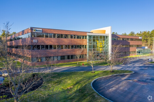
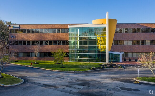
Property Record
80 Central St, Boxborough, MA 01719

Current Lease Availabilities
Property Detail
80 Central St
Officebuilding
Middlesex
OP
Massachusetts
A Areas with a 1% annual chance of flooding and a 26% chance of flooding over the life of a 30-year mortgage.
36.95 AC
2025
Concord/Maynard
2025
Boston
388100
Boston-Cambridge-Newton, MA-NH
150,515 SF
BOXB-000011-000054
NEARBY LISTINGS FOR SALE OR LEASE
DEMOGRAPHICS near 80 Central St
1 mile
3 mile
5 mile
2025 Total Population
1,952
24,442
65,430
2030 Population
2,042
25,528
68,243
Pop Growth 2025-2030
+ 4.61%
+ 4.44%
+ 4.30%
Average Age
42
42
43
2025 Total Households
685
8,952
25,035
HH Growth 2025-2030
+ 4.82%
+ 4.61%
+ 4.43%
Median Household Inc
$194,775
$167,889
$153,296
Avg Household Size
2.80
2.70
2.60
2025 Avg HH Vehicles
2.00
2.00
2.00
Median Home Value
$773,863
$761,285
$736,069
Median Year Built
1964
1975
1976
Nearby Places
Map Layers
Map Styles
 Street
 Aerial
Layers
 Traffic
 Biking
Places
Listings with unknown addresses are not visible on the map
- Restaurants
- Banks
- Shops
- Fitness
- Groceries
PUBLIC TRANSPORTATION
COMMUTER RAIL
South Acton (Fitchburg/South Acton Line - Massachusetts Bay Transportation Authority Commuter Rail (Purple Line))
Drive
Walk
Distance
South Acton (Fitchburg/South Acton Line - Massachusetts Bay Transportation Authority Commuter Rail (Purple Line))
8 min
4.0 mi
Littleton/Route 495 (Fitchburg/South Acton Line - Massachusetts Bay Transportation Authority Commuter Rail (Purple Line))
Drive
Walk
Distance
Littleton/Route 495 (Fitchburg/South Acton Line - Massachusetts Bay Transportation Authority Commuter Rail (Purple Line))
8 min
4.3 mi
AIRPORT
General Edward Lawrence Logan International
Drive
Walk
Distance
General Edward Lawrence Logan International
47 min
29.4 mi
Worcester Regional
Drive
Walk
Distance
Worcester Regional
48 min
34.3 mi
Manchester Boston Regional
Drive
Walk
Distance
Manchester Boston Regional
59 min
38.6 mi
Freight Ports
Port of Boston
Drive
Walk
Distance
Port of Boston
47 min
29.5 mi
Nearby Properties
Address
Land Use
TOTAL SIZE
Lot Size
Zoning
Address
Land Use
TOTAL SIZE
Lot Size
Zoning
197,727 SF
31.55 AC
R2
Address
Land Use
TOTAL SIZE
Lot Size
Zoning
143,640 SF
29.44 AC
IA
Address
Land Use
TOTAL SIZE
Lot Size
Zoning
263,589 SF
8.76 AC
R2
Address
Land Use
TOTAL SIZE
Lot Size
Zoning
7.32 AC
R
Address
Land Use
TOTAL SIZE
Lot Size
Zoning
25.15 AC
R2
Address
Land Use
TOTAL SIZE
Lot Size
Zoning
180,143 SF
41.70 AC
OP
Address
Land Use
TOTAL SIZE
Lot Size
Zoning
20,498 SF
25.75 AC
GI
Address
Land Use
TOTAL SIZE
Lot Size
Zoning
131,607 SF
36.01 AC
Address
Land Use
TOTAL SIZE
Lot Size
Zoning
110,150 SF
18.44 AC
Address
Land Use
TOTAL SIZE
Lot Size
Zoning
105,036 SF
6.84 AC
KC
Address
Land Use
TOTAL SIZE
Lot Size
Zoning
39,250 SF
0.39 AC
R2
Address
Land Use
TOTAL SIZE
Lot Size
Zoning
154,436 SF
18.86 AC
IA
Address
Land Use
TOTAL SIZE
Lot Size
Zoning
55.50 AC
ARC
Address
Land Use
TOTAL SIZE
Lot Size
Zoning
76,623 SF
16.59 AC
R2
Address
Land Use
TOTAL SIZE
Lot Size
Zoning
40 AC
R2
Address
Land Use
TOTAL SIZE
Lot Size
Zoning
71,395 SF
8.37 AC
C
Address
Land Use
TOTAL SIZE
Lot Size
Zoning
38,552 SF
5.34 AC
LB
Address
Land Use
TOTAL SIZE
Lot Size
Zoning
98,125 SF
8.97 AC
IA
Address
Land Use
TOTAL SIZE
Lot Size
Zoning
26.16 AC
R2
Address
Land Use
TOTAL SIZE
Lot Size
Zoning
108,992 SF
23.90 AC
IA
Address
Land Use
TOTAL SIZE
Lot Size
Zoning
161,597 SF
20.67 AC
IA
Address
Land Use
TOTAL SIZE
Lot Size
Zoning
948 AC
AR
Address
Land Use
TOTAL SIZE
Lot Size
Zoning
56,036 SF
17.13 AC
R2
Address
Land Use
TOTAL SIZE
Lot Size
Zoning
40.44 AC
ARC
Address
Land Use
TOTAL SIZE
Lot Size
Zoning
105,163 SF
10.65 AC
OP2
Address
Land Use
TOTAL SIZE
Lot Size
Zoning
60,850 SF
31.75 AC
R
Address
Land Use
TOTAL SIZE
Lot Size
Zoning
98,750 SF
15.48 AC
OP2
Address
Land Use
TOTAL SIZE
Lot Size
Zoning
49,080 SF
2.48 AC
Address
Land Use
TOTAL SIZE
Lot Size
Zoning
69,338 SF
10 AC
IA
The World's #1 Commercial Real Estate Marketplace
Connect with us
© 2026 CoStar Group
The information above has been obtained from sources believed reliable. While we do not doubt its accuracy we have not verified it and make no guarantee, warranty or representation about it. It is your responsibility to independently confirm its accuracy and completeness. Any projections, opinions, assumptions, or estimates used are for example only and do not represent the current or future performance of the property. The value of this transaction to you depends on tax and other factors which should be evaluated by your tax, financial, and legal advisors. You and your advisors should conduct a careful, independent investigation of the property to determine to your satisfaction the suitability of the property for your needs.