Property Record
80 Drivers Way, Pelham, AL 35124
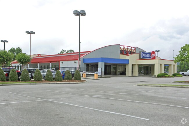

Property Detail
80 Drivers Way
10-9-31-1-001-002-000
BEG NW COR NE1/4 OF NE1/4 E TO W ROW I-65 SLY ALG ROW 1365(S) SW291.65 NWLY211.99 WLY202.77 N TO POB
Autorepair
Shelby
B and X Area of moderate flood hazard, usually the area between the limits of the 100-year and 500-year floods.
Alabama
2025
17.74 AC
2025
I-65 Corr/S Shelby County
030315
Birmingham
18,048 SF
Birmingham, AL
NEARBY LISTINGS FOR SALE OR LEASE
DEMOGRAPHICS near 80 Drivers Way
1 mile
3 mile
5 mile
2025 Total Population
2,654
34,479
82,937
2030 Population
2,721
34,824
83,219
Pop Growth 2025-2030
+ 2.52%
+ 1.00%
+ 0.34%
Average Age
41
40
40
2025 Total Households
1,155
14,645
33,616
HH Growth 2025-2030
+ 2.60%
+ 0.60%
+ 0.03%
Median Household Inc
$82,589
$77,372
$90,759
Avg Household Size
2.20
2.30
2.40
2025 Avg HH Vehicles
2.00
2.00
2.00
Median Home Value
$308,577
$330,704
$365,235
Median Year Built
1985
1989
1989
Nearby Places
Map Layers
Map Styles
 Street
 Aerial
Layers
 Traffic
 Biking
Places
Listings with unknown addresses are not visible on the map
- Restaurants
- Banks
- Shops
- Fitness
- Groceries
PUBLIC TRANSPORTATION
AIRPORT
Birmingham-Shuttlesworth International
Drive
Walk
Distance
Birmingham-Shuttlesworth International
29 min
20.3 mi
Freight Ports
Port of Mobile
Drive
Walk
Distance
Port of Mobile
264 min
242.1 mi
Nearby Properties
Address
Land Use
TOTAL SIZE
Lot Size
Zoning
Address
Land Use
TOTAL SIZE
Lot Size
Zoning
515,818 SF
38 AC
CP
Address
Land Use
TOTAL SIZE
Lot Size
Zoning
501,099 SF
33 AC
PO
Address
Land Use
TOTAL SIZE
Lot Size
Zoning
1,008,008 SF
74 AC
R4
Address
Land Use
TOTAL SIZE
Lot Size
Zoning
442,000 SF
36.22 AC
Address
Land Use
TOTAL SIZE
Lot Size
Zoning
333,513 SF
41 AC
C2
Address
Land Use
TOTAL SIZE
Lot Size
Zoning
267,122 SF
26 AC
PC
Address
Land Use
TOTAL SIZE
Lot Size
Zoning
12,200 SF
28.77 AC
Address
Land Use
TOTAL SIZE
Lot Size
Zoning
69,151 SF
5 AC
PC
Address
Land Use
TOTAL SIZE
Lot Size
Zoning
16,385 SF
4.95 AC
Address
Land Use
TOTAL SIZE
Lot Size
Zoning
186,953 SF
20 AC
PR2
Address
Land Use
TOTAL SIZE
Lot Size
Zoning
210,033 SF
7.85 AC
Address
Land Use
TOTAL SIZE
Lot Size
Zoning
241,232 SF
15 AC
PR2
Address
Land Use
TOTAL SIZE
Lot Size
Zoning
446,170 SF
19 AC
PR2
Address
Land Use
TOTAL SIZE
Lot Size
Zoning
165,474 SF
90 AC
PR2
Address
Land Use
TOTAL SIZE
Lot Size
Zoning
2,199 SF
23 AC
Address
Land Use
TOTAL SIZE
Lot Size
Zoning
238,304 SF
19 AC
PR-2
Address
Land Use
TOTAL SIZE
Lot Size
Zoning
94,094 SF
14.40 AC
PO-P
Address
Land Use
TOTAL SIZE
Lot Size
Zoning
102,342 SF
11 AC
Address
Land Use
TOTAL SIZE
Lot Size
Zoning
200,679 SF
20 AC
PR2
Address
Land Use
TOTAL SIZE
Lot Size
Zoning
191,623 SF
20 AC
R4
Address
Land Use
TOTAL SIZE
Lot Size
Zoning
2,792 SF
15 AC
Address
Land Use
TOTAL SIZE
Lot Size
Zoning
295,144 SF
22 AC
PR-2
Address
Land Use
TOTAL SIZE
Lot Size
Zoning
243,359 SF
16 AC
Address
Land Use
TOTAL SIZE
Lot Size
Zoning
22,726 SF
15.77 AC
Address
Land Use
TOTAL SIZE
Lot Size
Zoning
176,949 SF
19 AC
PC
Address
Land Use
TOTAL SIZE
Lot Size
Zoning
153,682 SF
20 AC
R4
Address
Land Use
TOTAL SIZE
Lot Size
Zoning
230,053 SF
23 AC
Address
Land Use
TOTAL SIZE
Lot Size
Zoning
224,746 SF
46 AC
C2
Address
Land Use
TOTAL SIZE
Lot Size
Zoning
152,735 SF
10 AC
R-4
Address
Land Use
TOTAL SIZE
Lot Size
Zoning
13,992 SF
8.70 AC
The World's #1 Commercial Real Estate Marketplace
Connect with us
© 2026 CoStar Group
The information above has been obtained from sources believed reliable. While we do not doubt its accuracy we have not verified it and make no guarantee, warranty or representation about it. It is your responsibility to independently confirm its accuracy and completeness. Any projections, opinions, assumptions, or estimates used are for example only and do not represent the current or future performance of the property. The value of this transaction to you depends on tax and other factors which should be evaluated by your tax, financial, and legal advisors. You and your advisors should conduct a careful, independent investigation of the property to determine to your satisfaction the suitability of the property for your needs.