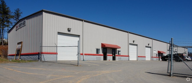
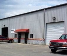
Property Record
80 Emma Sharp Rd, Mills River, NC 28759

Property Detail
80 Emma Sharp Rd
9961882
#06 GREENE PROP
Regionalshoppingcenterormallwithanchorstore
Henderson
9961882~MR
North Carolina
B and X Area of moderate flood hazard, usually the area between the limits of the 100-year and 500-year floods.
1718
2025
1.30 AC
2025
Henderson County
930701
Asheville
14,400 SF
Asheville, NC
NEARBY LISTINGS FOR SALE OR LEASE
DEMOGRAPHICS near 80 Emma Sharp Rd
1 mile
3 mile
5 mile
2025 Total Population
1,320
10,043
37,641
2030 Population
1,373
10,344
38,762
Pop Growth 2025-2030
+ 4.02%
+ 3.00%
+ 2.98%
Average Age
45
44
43
2025 Total Households
524
3,903
15,389
HH Growth 2025-2030
+ 4.01%
+ 3.20%
+ 3.02%
Median Household Inc
$87,980
$90,105
$78,902
Avg Household Size
2.50
2.60
2.40
2025 Avg HH Vehicles
2.00
2.00
2.00
Median Home Value
$412,222
$456,120
$400,171
Median Year Built
1996
1996
1995
Nearby Places
Map Layers
Map Styles
 Street
 Aerial
Transit
 Traffic
 Biking
Places
Listings with unknown addresses are not visible on the map
- Restaurants
- Banks
- Shops
- Fitness
- Groceries
PUBLIC TRANSPORTATION
AIRPORT
Asheville Regional
Drive
Walk
Distance
Asheville Regional
6 min
4.0 mi
Freight Ports
North Charleston Terminal
Drive
Walk
Distance
North Charleston Terminal
276 min
245.4 mi
Nearby Properties
Address
Land Use
TOTAL SIZE
Lot Size
Zoning
Address
Land Use
TOTAL SIZE
Lot Size
Zoning
107,063 SF
567.34 AC
AI
Address
Land Use
TOTAL SIZE
Lot Size
Zoning
58,200 SF
121.14 AC
10003355~R
Address
Land Use
TOTAL SIZE
Lot Size
Zoning
281,505 SF
38.35 AC
10000070~M
Address
Land Use
TOTAL SIZE
Lot Size
Zoning
21.70 AC
10005690~M
Address
Land Use
TOTAL SIZE
Lot Size
Zoning
365,659 SF
38.28 AC
9958527~M-
Address
Land Use
TOTAL SIZE
Lot Size
Zoning
14,704 SF
3.31 AC
10007972~M
Address
Land Use
TOTAL SIZE
Lot Size
Zoning
39.98 AC
10007822~M
Address
Land Use
TOTAL SIZE
Lot Size
Zoning
107,698 SF
25.53 AC
PS
Address
Land Use
TOTAL SIZE
Lot Size
Zoning
3,000 SF
48.13 AC
10010496~M
Address
Land Use
TOTAL SIZE
Lot Size
Zoning
77,152 SF
13.84 AC
9933538~MR
Address
Land Use
TOTAL SIZE
Lot Size
Zoning
112,100 SF
14.22 AC
9975597~MR
Address
Land Use
TOTAL SIZE
Lot Size
Zoning
83,741 SF
24.39 AC
9959040~MR
Address
Land Use
TOTAL SIZE
Lot Size
Zoning
178,825 SF
25.05 AC
1016341~MR
Address
Land Use
TOTAL SIZE
Lot Size
Zoning
237,185 SF
17.57 AC
9962196~MR
Address
Land Use
TOTAL SIZE
Lot Size
Zoning
345,310 SF
16.60 AC
R-2
Address
Land Use
TOTAL SIZE
Lot Size
Zoning
3,190 SF
21.46 AC
1016340~MR
Address
Land Use
TOTAL SIZE
Lot Size
Zoning
22,929 SF
330.68 AC
10011861~R
Address
Land Use
TOTAL SIZE
Lot Size
Zoning
22,929 SF
330.47 AC
10004441~R
Address
Land Use
TOTAL SIZE
Lot Size
Zoning
90,000 SF
9.43 AC
1001311~MR
Address
Land Use
TOTAL SIZE
Lot Size
Zoning
47,129 SF
42.82 AC
10005418~M
Address
Land Use
TOTAL SIZE
Lot Size
Zoning
12.51 AC
1018240~MR
Address
Land Use
TOTAL SIZE
Lot Size
Zoning
142,457 SF
40.51 AC
1016823~MR
Address
Land Use
TOTAL SIZE
Lot Size
Zoning
7.74 AC
10010785~M
Address
Land Use
TOTAL SIZE
Lot Size
Zoning
1,575 SF
18.75 AC
10002245~C
Address
Land Use
TOTAL SIZE
Lot Size
Zoning
118,800 SF
19.15 AC
9975228~MR
Address
Land Use
TOTAL SIZE
Lot Size
Zoning
22,685 SF
6.97 AC
1016853~MR
Address
Land Use
TOTAL SIZE
Lot Size
Zoning
30,771 SF
5.57 AC
9947305~MR
Address
Land Use
TOTAL SIZE
Lot Size
Zoning
23,307 SF
183.97 AC
9933591~MR
Address
Land Use
TOTAL SIZE
Lot Size
Zoning
12.40 AC
10008589~M
Address
Land Use
TOTAL SIZE
Lot Size
Zoning
82,202 SF
9.95 AC
10001357~M
The World's #1 Commercial Real Estate Marketplace
Connect with us
© 2026 CoStar Group
The information above has been obtained from sources believed reliable. While we do not doubt its accuracy we have not verified it and make no guarantee, warranty or representation about it. It is your responsibility to independently confirm its accuracy and completeness. Any projections, opinions, assumptions, or estimates used are for example only and do not represent the current or future performance of the property. The value of this transaction to you depends on tax and other factors which should be evaluated by your tax, financial, and legal advisors. You and your advisors should conduct a careful, independent investigation of the property to determine to your satisfaction the suitability of the property for your needs.