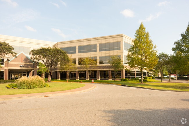
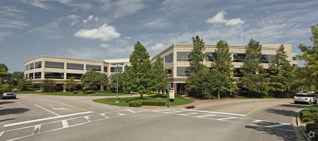
Property Record
80 Humphreys Center Dr, Memphis, TN 38120

Current Lease Availabilities
NEARBY LISTINGS FOR SALE OR LEASE
Property Detail
80 Humphreys Center Dr
08-0008-0-0558
Humphreys Boulevard Pd
Medicalbuilding
S OF WALNUT GROVE RD SEE MAP H-30 (TILE# 360)
AE
Shelby
47157C0313G
Tennessee
2024
0.99 AC
2025
East
021311
Memphis
106,140 SF
Memphis, TN-MS-AR
DEMOGRAPHICS near 80 Humphreys Center Dr
1 Mile
3 Mile
5 Mile
2024 Total Population
3,341
51,511
194,657
2029 Population
3,257
50,190
190,294
Pop Growth 2024-2029
(2.51%)
(2.56%)
(2.24%)
Average Age
45
40
38
2024 Total Households
1,418
22,464
81,098
HH Growth 2024-2029
(2.68%)
(2.65%)
(2.31%)
Median Household Inc
$166,008
$83,716
$64,172
Avg Household Size
2.30
2.20
2.30
2024 Avg HH Vehicles
2.00
2.00
2.00
Median Home Value
$467,932
$315,266
$247,157
Median Year Built
1981
1975
1975
Nearby Places
Map Layers
Map Styles
 Street
 Aerial
- Restaurants
- Banks
- Shops
- Fitness
- Groceries
PUBLIC TRANSPORTATION
AIRPORT
Memphis International
DRIVE
WALK
Distance
Memphis International
21 min
13.7 mi
Nearby Properties
Address
Land Use
TOTAL SIZE
Lot Size
Zoning
Address
Land Use
TOTAL SIZE
Lot Size
Zoning
209,070 SF
5.10 AC
RU-3
Address
Land Use
TOTAL SIZE
Lot Size
Zoning
253,002 SF
2.82 AC
CA
Address
Land Use
TOTAL SIZE
Lot Size
Zoning
1,082,619 SF
34.67 AC
CMP-1
Address
Land Use
TOTAL SIZE
Lot Size
Zoning
290,566 SF
2.51 AC
R-15
Address
Land Use
TOTAL SIZE
Lot Size
Zoning
358,595 SF
3.65 AC
R-15
Address
Land Use
TOTAL SIZE
Lot Size
Zoning
85,062 SF
8.43 AC
CA
Address
Land Use
TOTAL SIZE
Lot Size
Zoning
169,769 SF
3.13 AC
OG-1
Address
Land Use
TOTAL SIZE
Lot Size
Zoning
104,337 SF
7.30 AC
R-15
Address
Land Use
TOTAL SIZE
Lot Size
Zoning
101,654 SF
6.61 AC
R-15
Address
Land Use
TOTAL SIZE
Lot Size
Zoning
657,276 SF
10.18 AC
OG
Address
Land Use
TOTAL SIZE
Lot Size
Zoning
99,768 SF
100.86 AC
EMP
Address
Land Use
TOTAL SIZE
Lot Size
Zoning
2,505 SF
52.59 AC
R-10
Address
Land Use
TOTAL SIZE
Lot Size
Zoning
63,114 SF
7.13 AC
CA
Address
Land Use
TOTAL SIZE
Lot Size
Zoning
99,554 SF
3.26 AC
R-15
Address
Land Use
TOTAL SIZE
Lot Size
Zoning
45.85 AC
CA
Address
Land Use
TOTAL SIZE
Lot Size
Zoning
175,984 SF
22.75 AC
RU-4
Address
Land Use
TOTAL SIZE
Lot Size
Zoning
1,919.25 AC
CA
Address
Land Use
TOTAL SIZE
Lot Size
Zoning
24.72 AC
R-10
Address
Land Use
TOTAL SIZE
Lot Size
Zoning
109,774 SF
8.80 AC
CMU-1
Address
Land Use
TOTAL SIZE
Lot Size
Zoning
66,067 SF
3.01 AC
CMU-3
Address
Land Use
TOTAL SIZE
Lot Size
Zoning
50,534 SF
4.32 AC
O
Address
Land Use
TOTAL SIZE
Lot Size
Zoning
145,980 SF
16.50 AC
RU-3
Address
Land Use
TOTAL SIZE
Lot Size
Zoning
31,562 SF
27.68 AC
R-T
Address
Land Use
TOTAL SIZE
Lot Size
Zoning
113,826 SF
29.01 AC
RU-3
Address
Land Use
TOTAL SIZE
Lot Size
Zoning
96,768 SF
7.98 AC
OG
Address
Land Use
TOTAL SIZE
Lot Size
Zoning
261,479 SF
5.50 AC
RU-3
Address
Land Use
TOTAL SIZE
Lot Size
Zoning
192,560 SF
10.16 AC
CA
Address
Land Use
TOTAL SIZE
Lot Size
Zoning
130,111 SF
5.95 AC
R-15
Address
Land Use
TOTAL SIZE
Lot Size
Zoning
77,965 SF
4.89 AC
OG
Address
Land Use
TOTAL SIZE
Lot Size
Zoning
71,673 SF
1.49 AC
OG
The World's #1 Commercial Real Estate Marketplace
Connect with us
© 2026 CoStar Group
The information above has been obtained from sources believed reliable. While we do not doubt its accuracy we have not verified it and make no guarantee, warranty or representation about it. It is your responsibility to independently confirm its accuracy and completeness. Any projections, opinions, assumptions, or estimates used are for example only and do not represent the current or future performance of the property. The value of this transaction to you depends on tax and other factors which should be evaluated by your tax, financial, and legal advisors. You and your advisors should conduct a careful, independent investigation of the property to determine to your satisfaction the suitability of the property for your needs.