Property Record
80 Jackson Flat Rd, Hope, RI 02831


Property Detail
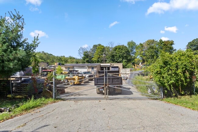
80 Jackson Flat Rd
SCIT-000002-000039-000000
Providence
Commercialnec
Rhode Island
BG
39-0
B and X Area of moderate flood hazard, usually the area between the limits of the 100-year and 500-year floods.
1.80 AC
2025
Foster/Scituate
2025
Providence
013201
Providence-Warwick, RI-MA
NEARBY LISTINGS FOR SALE OR LEASE
DEMOGRAPHICS near 80 Jackson Flat Rd
1 mile
3 mile
5 mile
2025 Total Population
3,076
36,652
104,116
2030 Population
3,168
37,335
106,449
Pop Growth 2025-2030
+ 2.99%
+ 1.86%
+ 2.24%
Average Age
43
41
43
2025 Total Households
1,157
14,937
42,771
HH Growth 2025-2030
+ 3.03%
+ 1.77%
+ 2.20%
Median Household Inc
$139,393
$94,346
$93,018
Avg Household Size
2.60
2.40
2.30
2025 Avg HH Vehicles
2.00
2.00
2.00
Median Home Value
$467,799
$373,091
$375,027
Median Year Built
1968
1960
1971
Nearby Places
Map Layers
Map Styles
 Street
 Aerial
Transit
 Traffic
 Biking
Places
Listings with unknown addresses are not visible on the map
- Restaurants
- Banks
- Shops
- Fitness
- Groceries
PUBLIC TRANSPORTATION
COMMUTER RAIL
Drive
Walk
Distance
15 min
8.3 mi
AIRPORT
Rhode Island Tf Green International
Drive
Walk
Distance
Rhode Island Tf Green International
21 min
10.6 mi
Freight Ports
Port of Davisville, RI
Drive
Walk
Distance
Port of Davisville, RI
30 min
15.6 mi
SALE & LEASE HISTORY
LISTING DATE
SALE/LEASE

Dec 07, 2023
For Sale
Nearby Properties
Address
Land Use
TOTAL SIZE
Lot Size
Zoning
Address
Land Use
TOTAL SIZE
Lot Size
Zoning
11.48 AC
R-10
Address
Land Use
TOTAL SIZE
Lot Size
Zoning
11.63 AC
R-10
Address
Land Use
TOTAL SIZE
Lot Size
Zoning
240,425 SF
104.76 AC
R-10
Address
Land Use
TOTAL SIZE
Lot Size
Zoning
225,075 SF
4.29 AC
6000
Address
Land Use
TOTAL SIZE
Lot Size
Zoning
169,035 SF
4 AC
6000
Address
Land Use
TOTAL SIZE
Lot Size
Zoning
123,035 SF
99 AC
R-20
Address
Land Use
TOTAL SIZE
Lot Size
Zoning
137,992 SF
1.30 AC
B
Address
Land Use
TOTAL SIZE
Lot Size
Zoning
6.36 AC
CI
Address
Land Use
TOTAL SIZE
Lot Size
Zoning
11.80 AC
R-10
Address
Land Use
TOTAL SIZE
Lot Size
Zoning
103,936 SF
2.13 AC
R-6
Address
Land Use
TOTAL SIZE
Lot Size
Zoning
10.46 AC
R-10
Address
Land Use
TOTAL SIZE
Lot Size
Zoning
80,563 SF
15.09 AC
R-10
Address
Land Use
TOTAL SIZE
Lot Size
Zoning
43,809 SF
75.59 AC
S1
Address
Land Use
TOTAL SIZE
Lot Size
Zoning
67,855 SF
34.27 AC
R-2A
Address
Land Use
TOTAL SIZE
Lot Size
Zoning
9,720 SF
12.12 AC
6000
Address
Land Use
TOTAL SIZE
Lot Size
Zoning
100,691 SF
15 AC
R-2A
Address
Land Use
TOTAL SIZE
Lot Size
Zoning
68,206 SF
2.70 AC
2000
Address
Land Use
TOTAL SIZE
Lot Size
Zoning
22,445 SF
5 AC
A80
Address
Land Use
TOTAL SIZE
Lot Size
Zoning
108,722 SF
5.23 AC
6000
Address
Land Use
TOTAL SIZE
Lot Size
Zoning
73,051 SF
2.24 AC
R-8
Address
Land Use
TOTAL SIZE
Lot Size
Zoning
7.24 AC
CI
Address
Land Use
TOTAL SIZE
Lot Size
Zoning
4.78 AC
A80
Address
Land Use
TOTAL SIZE
Lot Size
Zoning
2.16 AC
R-20
Address
Land Use
TOTAL SIZE
Lot Size
Zoning
40,716 SF
3.72 AC
CI
Address
Land Use
TOTAL SIZE
Lot Size
Zoning
40,085 SF
1.23 AC
R-6
Address
Land Use
TOTAL SIZE
Lot Size
Zoning
2.60 AC
R-8
Address
Land Use
TOTAL SIZE
Lot Size
Zoning
60,637 SF
1.90 AC
R-6
Address
Land Use
TOTAL SIZE
Lot Size
Zoning
12,008 SF
6.80 AC
2000
Address
Land Use
TOTAL SIZE
Lot Size
Zoning
12.59 AC
R-10
Address
Land Use
TOTAL SIZE
Lot Size
Zoning
3.54 AC
CI
The World's #1 Commercial Real Estate Marketplace
Connect with us
© 2026 CoStar Group
The information above has been obtained from sources believed reliable. While we do not doubt its accuracy we have not verified it and make no guarantee, warranty or representation about it. It is your responsibility to independently confirm its accuracy and completeness. Any projections, opinions, assumptions, or estimates used are for example only and do not represent the current or future performance of the property. The value of this transaction to you depends on tax and other factors which should be evaluated by your tax, financial, and legal advisors. You and your advisors should conduct a careful, independent investigation of the property to determine to your satisfaction the suitability of the property for your needs.