Property Record
80 Logan St, Bridgeport, CT 06607
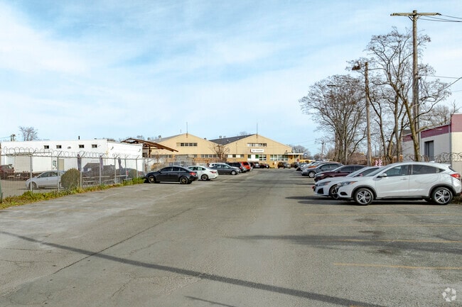


Property Detail
80 Logan St
BRID-000650-000025C
Greater Bridgeport
Industrialgeneral
Connecticut
ILI
25-c
AE The base floodplain where base flood elevations are provided. AE Zones are now used on new format FIRMs instead of A1-A30 Zones.
5.28 AC
2025
Bridgeport
2025
Westchester/So Connecticut
074400
Bridgeport-Stamford-Danbury, CT
31,195 SF
NEARBY LISTINGS FOR SALE OR LEASE
DEMOGRAPHICS near 80 Logan St
1 mile
3 mile
5 mile
2025 Total Population
15,481
132,992
252,450
2030 Population
15,798
135,935
259,379
Pop Growth 2025-2030
+ 2.05%
+ 2.21%
+ 2.74%
Average Age
37
39
40
2025 Total Households
5,622
48,889
93,886
HH Growth 2025-2030
+ 2.22%
+ 2.37%
+ 2.84%
Median Household Inc
$50,734
$58,732
$76,737
Avg Household Size
2.60
2.60
2.60
2025 Avg HH Vehicles
1.00
1.00
2.00
Median Home Value
$279,366
$320,116
$363,937
Median Year Built
1948
1949
1954
Nearby Places
Map Layers
Map Styles
 Street
 Aerial
Transit
 Traffic
 Biking
Places
Listings with unknown addresses are not visible on the map
- Restaurants
- Banks
- Shops
- Fitness
- Groceries
PUBLIC TRANSPORTATION
COMMUTER RAIL
Bridgeport Station (New Haven Line - Shore Line East, Shore Line East - Shore Line East)
Drive
Walk
Distance
Bridgeport Station (New Haven Line - Shore Line East, Shore Line East - Shore Line East)
6 min
2.3 mi
Stratford Station (New Haven Line - Metro-North Commuter Railroad Company (Metro-North))
Drive
Walk
Distance
Stratford Station (New Haven Line - Metro-North Commuter Railroad Company (Metro-North))
5 min
2.4 mi
AIRPORT
Tweed/New Haven
Drive
Walk
Distance
Tweed/New Haven
34 min
20.9 mi
Westchester County
Drive
Walk
Distance
Westchester County
56 min
36.8 mi
Long Island MacArthur
Drive
Walk
Distance
Long Island MacArthur
113 min
37.0 mi
Freight Ports
Port of New Haven
Drive
Walk
Distance
Port of New Haven
29 min
18.1 mi
Nearby Properties
Address
Land Use
TOTAL SIZE
Lot Size
Zoning
Address
Land Use
TOTAL SIZE
Lot Size
Zoning
Address
Land Use
TOTAL SIZE
Lot Size
Zoning
22.85 AC
Address
Land Use
TOTAL SIZE
Lot Size
Zoning
23.95 AC
RB
Address
Land Use
TOTAL SIZE
Lot Size
Zoning
145,000 SF
15.70 AC
ILI
Address
Land Use
TOTAL SIZE
Lot Size
Zoning
39,031 SF
451.38 AC
ADD
Address
Land Use
TOTAL SIZE
Lot Size
Zoning
111 AC
RA
Address
Land Use
TOTAL SIZE
Lot Size
Zoning
4.14 AC
MUEM
Address
Land Use
TOTAL SIZE
Lot Size
Zoning
178,265 SF
6.92 AC
Address
Land Use
TOTAL SIZE
Lot Size
Zoning
83,122 SF
4.39 AC
Address
Land Use
TOTAL SIZE
Lot Size
Zoning
288,875 SF
1.57 AC
MUEM
Address
Land Use
TOTAL SIZE
Lot Size
Zoning
146,351 SF
8.86 AC
Address
Land Use
TOTAL SIZE
Lot Size
Zoning
497,430 SF
4.16 AC
DCB
Address
Land Use
TOTAL SIZE
Lot Size
Zoning
23 AC
RC
Address
Land Use
TOTAL SIZE
Lot Size
Zoning
162,376 SF
7.82 AC
Address
Land Use
TOTAL SIZE
Lot Size
Zoning
10.66 AC
ORR
Address
Land Use
TOTAL SIZE
Lot Size
Zoning
585,480 SF
3.66 AC
Address
Land Use
TOTAL SIZE
Lot Size
Zoning
493,114 SF
2.20 AC
DCB
Address
Land Use
TOTAL SIZE
Lot Size
Zoning
23.70 AC
RB
Address
Land Use
TOTAL SIZE
Lot Size
Zoning
92,318 SF
5.33 AC
Address
Land Use
TOTAL SIZE
Lot Size
Zoning
368,000 SF
18.69 AC
D-17
Address
Land Use
TOTAL SIZE
Lot Size
Zoning
216,972 SF
2.53 AC
DCB
Address
Land Use
TOTAL SIZE
Lot Size
Zoning
225,264 SF
28.22 AC
MC
Address
Land Use
TOTAL SIZE
Lot Size
Zoning
5.31 AC
RC
Address
Land Use
TOTAL SIZE
Lot Size
Zoning
204,000 SF
1.84 AC
MUEM
Address
Land Use
TOTAL SIZE
Lot Size
Zoning
7.52 AC
RC
Address
Land Use
TOTAL SIZE
Lot Size
Zoning
110,506 SF
0.06 AC
RBB
Address
Land Use
TOTAL SIZE
Lot Size
Zoning
2.40 AC
DCB
Address
Land Use
TOTAL SIZE
Lot Size
Zoning
2 AC
DCB
Address
Land Use
TOTAL SIZE
Lot Size
Zoning
722 SF
47.10 AC
RM-1
Address
Land Use
TOTAL SIZE
Lot Size
Zoning
630 SF
107.70 AC
RA
The World's #1 Commercial Real Estate Marketplace
Connect with us
© 2026 CoStar Group
The information above has been obtained from sources believed reliable. While we do not doubt its accuracy we have not verified it and make no guarantee, warranty or representation about it. It is your responsibility to independently confirm its accuracy and completeness. Any projections, opinions, assumptions, or estimates used are for example only and do not represent the current or future performance of the property. The value of this transaction to you depends on tax and other factors which should be evaluated by your tax, financial, and legal advisors. You and your advisors should conduct a careful, independent investigation of the property to determine to your satisfaction the suitability of the property for your needs.