Property Record
80 N Main St, Coupeville, WA 98239
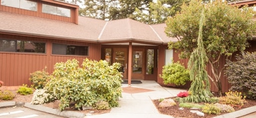

Property Detail
80 N Main St
Oak Harbor, WA
LOT 2 C-SP 96-01 V3 SP P120 AF#96019357 EX W101 TGW PT ALEXANDER DLC DESC: BG PT WLN MAIN ST TOWN OF COUPEVILLE 566 S OF SLN LIBBEY TR V7 P216 SD PT 33 W OF ELN SD DLC N88*W299 S1*W22 N88*W10 S1*W78.00 S88*E309 TO SD WLN MAIN ST N1*E ALG SD W
R13233-134-3870
Island
Commercialnec
Washington
B and X Area of moderate flood hazard, usually the area between the limits of the 100-year and 500-year floods.
2
2025
1.07 AC
2025
Seattle North/Everett
971000
Other Market Areas
5,722 SF
NEARBY LISTINGS FOR SALE OR LEASE
DEMOGRAPHICS near 80 N Main St
1 mile
3 mile
5 mile
2025 Total Population
1,816
5,426
14,425
2030 Population
1,766
5,314
14,201
Pop Growth 2025-2030
(2.75%)
(2.06%)
(1.55%)
Average Age
49
48
45
2025 Total Households
821
2,338
5,900
HH Growth 2025-2030
(3.05%)
(2.31%)
(1.73%)
Median Household Inc
$80,388
$95,088
$92,113
Avg Household Size
2.10
2.30
2.40
2025 Avg HH Vehicles
2.00
2.00
2.00
Median Home Value
$580,739
$623,184
$635,010
Median Year Built
1981
1984
1986
Nearby Places
Map Layers
Map Styles
 Street
 Aerial
Layers
 Traffic
 Biking
Places
Listings with unknown addresses are not visible on the map
- Restaurants
- Banks
- Shops
- Fitness
- Groceries
PUBLIC TRANSPORTATION
AIRPORT
Seattle Paine Field International
Drive
Walk
Distance
Seattle Paine Field International
75 min
36.0 mi
Freight Ports
Drive
Walk
Distance
51 min
30.8 mi
Nearby Properties
Address
Land Use
TOTAL SIZE
Lot Size
Zoning
Address
Land Use
TOTAL SIZE
Lot Size
Zoning
129,866 SF
10.15 AC
CPUD
Address
Land Use
TOTAL SIZE
Lot Size
Zoning
54,024 SF
13.83 AC
Address
Land Use
TOTAL SIZE
Lot Size
Zoning
91,385 SF
3.55 AC
CP
Address
Land Use
TOTAL SIZE
Lot Size
Zoning
89,880 SF
5.98 AC
CP
Address
Land Use
TOTAL SIZE
Lot Size
Zoning
60,141 SF
1.53 AC
CP
Address
Land Use
TOTAL SIZE
Lot Size
Zoning
51,716 SF
13.56 AC
CP
Address
Land Use
TOTAL SIZE
Lot Size
Zoning
34,334 SF
3.85 AC
CP
Address
Land Use
TOTAL SIZE
Lot Size
Zoning
30,975 SF
3.22 AC
CP
Address
Land Use
TOTAL SIZE
Lot Size
Zoning
20,552 SF
0.92 AC
CP
Address
Land Use
TOTAL SIZE
Lot Size
Zoning
46,322 SF
4.57 AC
CP
Address
Land Use
TOTAL SIZE
Lot Size
Zoning
16,307 SF
1.84 AC
CP
Address
Land Use
TOTAL SIZE
Lot Size
Zoning
1,038 SF
1.74 AC
CP
Address
Land Use
TOTAL SIZE
Lot Size
Zoning
10,744 SF
3.87 AC
CP
Address
Land Use
TOTAL SIZE
Lot Size
Zoning
7,089 SF
0.38 AC
CP
Address
Land Use
TOTAL SIZE
Lot Size
Zoning
20,596 SF
1.49 AC
CP
Address
Land Use
TOTAL SIZE
Lot Size
Zoning
16,981 SF
1.25 AC
CP
Address
Land Use
TOTAL SIZE
Lot Size
Zoning
6,066 SF
0.57 AC
CP
Address
Land Use
TOTAL SIZE
Lot Size
Zoning
8,793 SF
164.40 AC
R
Address
Land Use
TOTAL SIZE
Lot Size
Zoning
14,424 SF
8.89 AC
20
Address
Land Use
TOTAL SIZE
Lot Size
Zoning
8,534 SF
1.73 AC
50
Address
Land Use
TOTAL SIZE
Lot Size
Zoning
12,342 SF
2.15 AC
CP
Address
Land Use
TOTAL SIZE
Lot Size
Zoning
4,542 SF
1.48 AC
Address
Land Use
TOTAL SIZE
Lot Size
Zoning
16,995 SF
10.94 AC
Address
Land Use
TOTAL SIZE
Lot Size
Zoning
1,820 SF
16.50 AC
60
Address
Land Use
TOTAL SIZE
Lot Size
Zoning
12,365 SF
1.14 AC
CP
Address
Land Use
TOTAL SIZE
Lot Size
Zoning
5,979 SF
3.75 AC
CP
Address
Land Use
TOTAL SIZE
Lot Size
Zoning
22,323 SF
4.72 AC
10
Address
Land Use
TOTAL SIZE
Lot Size
Zoning
91.74 AC
32
Address
Land Use
TOTAL SIZE
Lot Size
Zoning
2,800 SF
0.44 AC
CP
Address
Land Use
TOTAL SIZE
Lot Size
Zoning
17,016 SF
2.50 AC
20
The World's #1 Commercial Real Estate Marketplace
Connect with us
© 2026 CoStar Group
The information above has been obtained from sources believed reliable. While we do not doubt its accuracy we have not verified it and make no guarantee, warranty or representation about it. It is your responsibility to independently confirm its accuracy and completeness. Any projections, opinions, assumptions, or estimates used are for example only and do not represent the current or future performance of the property. The value of this transaction to you depends on tax and other factors which should be evaluated by your tax, financial, and legal advisors. You and your advisors should conduct a careful, independent investigation of the property to determine to your satisfaction the suitability of the property for your needs.