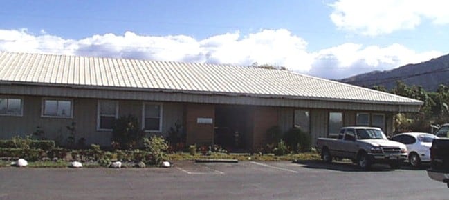
Property Record
80 Pakana St, Wailuku, HI 96793


NEARBY LISTINGS FOR SALE OR LEASE
Property Detail
80 Pakana St
Kahului-Wailuku, HI
Waiko Baseyard File Plan 2403
2-3-5-027-019-0000
FROM: 3502-09 38,226 SF LOT 19 F/D: NEW; LOT 19 FP 2403
Industrialgeneral
Maui
X
Hawaii
1500030393F
19
2024
0.88 AC
2025
Central Maui
030800
Hawaii
5,000 SF
DEMOGRAPHICS near 80 Pakana St
1 Mile
3 Mile
5 Mile
2024 Total Population
3,490
38,305
54,080
2029 Population
3,470
37,593
53,208
Pop Growth 2024-2029
(0.57%)
(1.86%)
(1.61%)
Average Age
37
40
40
2024 Total Households
1,000
11,020
15,875
HH Growth 2024-2029
(1.40%)
(2.47%)
(2.11%)
Median Household Inc
$104,592
$82,521
$81,257
Avg Household Size
3.30
3.10
3.10
2024 Avg HH Vehicles
2.00
2.00
2.00
Median Home Value
$707,539
$698,372
$680,837
Median Year Built
2003
1988
1986
Nearby Places
Map Layers
Map Styles
 Street
 Aerial
- Restaurants
- Banks
- Shops
- Fitness
- Groceries
PUBLIC TRANSPORTATION
AIRPORT
Kahului
DRIVE
WALK
Distance
Kahului
14 min
7.0 mi
Nearby Properties
Address
Land Use
TOTAL SIZE
Lot Size
Zoning
Address
Land Use
TOTAL SIZE
Lot Size
Zoning
14.34 AC
500
Address
Land Use
TOTAL SIZE
Lot Size
Zoning
43,434 SF
13.89 AC
410
Address
Land Use
TOTAL SIZE
Lot Size
Zoning
103,221 SF
12.93 AC
720
Address
Land Use
TOTAL SIZE
Lot Size
Zoning
19.54 AC
720
Address
Land Use
TOTAL SIZE
Lot Size
Zoning
24,848 SF
11.41 AC
500
Address
Land Use
TOTAL SIZE
Lot Size
Zoning
552,589 SF
24.60 AC
420
Address
Land Use
TOTAL SIZE
Lot Size
Zoning
72,377 SF
6.06 AC
720
Address
Land Use
TOTAL SIZE
Lot Size
Zoning
53,684 SF
119.45 AC
Address
Land Use
TOTAL SIZE
Lot Size
Zoning
1.83 AC
Address
Land Use
TOTAL SIZE
Lot Size
Zoning
94,025 SF
0.84 AC
370
Address
Land Use
TOTAL SIZE
Lot Size
Zoning
69,340 SF
5.33 AC
320
Address
Land Use
TOTAL SIZE
Lot Size
Zoning
103,520 SF
4.50 AC
720
Address
Land Use
TOTAL SIZE
Lot Size
Zoning
2.01 AC
Address
Land Use
TOTAL SIZE
Lot Size
Zoning
42,501 SF
2.59 AC
420
Address
Land Use
TOTAL SIZE
Lot Size
Zoning
191,383 SF
12.82 AC
420
Address
Land Use
TOTAL SIZE
Lot Size
Zoning
Address
Land Use
TOTAL SIZE
Lot Size
Zoning
42,672 SF
4.50 AC
720
Address
Land Use
TOTAL SIZE
Lot Size
Zoning
10.52 AC
120
Address
Land Use
TOTAL SIZE
Lot Size
Zoning
53,632 SF
9.10 AC
420
Address
Land Use
TOTAL SIZE
Lot Size
Zoning
401,351 SF
240.57 AC
Address
Land Use
TOTAL SIZE
Lot Size
Zoning
8.92 AC
120
Address
Land Use
TOTAL SIZE
Lot Size
Zoning
43,847 SF
8.69 AC
020
Address
Land Use
TOTAL SIZE
Lot Size
Zoning
49,573 SF
1.39 AC
370
Address
Land Use
TOTAL SIZE
Lot Size
Zoning
39,814 SF
3.26 AC
720
Address
Land Use
TOTAL SIZE
Lot Size
Zoning
40,796 SF
0.96 AC
380
Address
Land Use
TOTAL SIZE
Lot Size
Zoning
43,291 SF
6.28 AC
320
Address
Land Use
TOTAL SIZE
Lot Size
Zoning
24,100 SF
3.91 AC
720
Address
Land Use
TOTAL SIZE
Lot Size
Zoning
14,550 SF
1.89 AC
Address
Land Use
TOTAL SIZE
Lot Size
Zoning
159,392 SF
7.08 AC
420
Address
Land Use
TOTAL SIZE
Lot Size
Zoning
26,301 SF
1.97 AC
720
The World's #1 Commercial Real Estate Marketplace
Connect with us
© 2026 CoStar Group
The information above has been obtained from sources believed reliable. While we do not doubt its accuracy we have not verified it and make no guarantee, warranty or representation about it. It is your responsibility to independently confirm its accuracy and completeness. Any projections, opinions, assumptions, or estimates used are for example only and do not represent the current or future performance of the property. The value of this transaction to you depends on tax and other factors which should be evaluated by your tax, financial, and legal advisors. You and your advisors should conduct a careful, independent investigation of the property to determine to your satisfaction the suitability of the property for your needs.