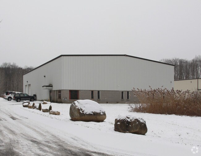
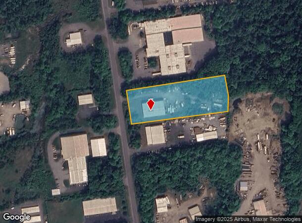
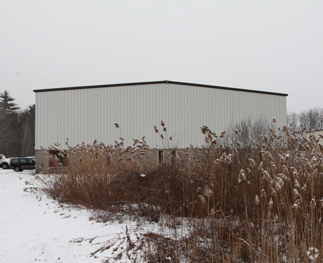
Property Record
80 Park Rd, Queensbury, NY 12804
NEARBY LISTINGS FOR SALE OR LEASE
Property Detail
80 Park Rd
Glens Falls, NY
LOT 41
534489-137-000-0002-013-000-0000
Washington
Warehouse
New York
2025
13.000
2024
2.65 AC
080302
Washington County
10,000 SF
Albany/Schenectady/Troy
DEMOGRAPHICS near 80 Park Rd
1 Mile
3 Mile
5 Mile
2024 Total Population
205
13,253
49,159
2029 Population
205
13,086
48,758
Pop Growth 2024-2029
0.00%
(1.26%)
(0.82%)
Average Age
46
43
43
2024 Total Households
89
5,829
21,814
HH Growth 2024-2029
0.00%
(1.30%)
(0.83%)
Median Household Inc
$96,666
$66,950
$64,248
Avg Household Size
2.30
2.20
2.20
2024 Avg HH Vehicles
2.00
2.00
2.00
Median Home Value
$233,333
$193,413
$185,617
Median Year Built
1991
1975
1966
Nearby Places
Map Layers
Map Styles
 Street
 Aerial
- Restaurants
- Banks
- Shops
- Fitness
- Groceries
PUBLIC TRANSPORTATION
COMMUTER RAIL
DRIVE
WALK
Distance
15 min
6.6 mi
Freight Ports
Albany, NY Port
DRIVE
WALK
Distance
Albany, NY Port
81 min
60.6 mi
Nearby Properties
Address
Land Use
TOTAL SIZE
Lot Size
Zoning
Address
Land Use
TOTAL SIZE
Lot Size
Zoning
27,660 SF
130.13 AC
O
Address
Land Use
TOTAL SIZE
Lot Size
Zoning
82,922 SF
8.03 AC
I
Address
Land Use
TOTAL SIZE
Lot Size
Zoning
29,108 SF
22.48 AC
MDR
Address
Land Use
TOTAL SIZE
Lot Size
Zoning
5,440 SF
510.06 AC
CLI
Address
Land Use
TOTAL SIZE
Lot Size
Zoning
7,823 SF
27.33 AC
LDR25
Address
Land Use
TOTAL SIZE
Lot Size
Zoning
8,042 SF
39.64 AC
O
Address
Land Use
TOTAL SIZE
Lot Size
Zoning
156,550 SF
33.27 AC
CI
Address
Land Use
TOTAL SIZE
Lot Size
Zoning
7,788 SF
25.34 AC
LDR25
Address
Land Use
TOTAL SIZE
Lot Size
Zoning
20,250 SF
46.97 AC
HI
Address
Land Use
TOTAL SIZE
Lot Size
Zoning
121,153 SF
24.13 AC
CI
Address
Land Use
TOTAL SIZE
Lot Size
Zoning
18,133 SF
29.71 AC
LDR25
Address
Land Use
TOTAL SIZE
Lot Size
Zoning
9,678 SF
11.46 AC
O
Address
Land Use
TOTAL SIZE
Lot Size
Zoning
53,216 SF
14.20 AC
CLI
Address
Land Use
TOTAL SIZE
Lot Size
Zoning
176,238 SF
28.98 AC
CLI
Address
Land Use
TOTAL SIZE
Lot Size
Zoning
150,882 SF
8 AC
LI
Address
Land Use
TOTAL SIZE
Lot Size
Zoning
119,455 SF
66.60 AC
LDR25
Address
Land Use
TOTAL SIZE
Lot Size
Zoning
141,480 SF
29.05 AC
RA
Address
Land Use
TOTAL SIZE
Lot Size
Zoning
60,000 SF
15.96 AC
CLI
Address
Land Use
TOTAL SIZE
Lot Size
Zoning
55,417 SF
12.88 AC
O
Address
Land Use
TOTAL SIZE
Lot Size
Zoning
9,424 SF
4.57 AC
R-M
Address
Land Use
TOTAL SIZE
Lot Size
Zoning
19,317 SF
12.97 AC
CLI
Address
Land Use
TOTAL SIZE
Lot Size
Zoning
103,300 SF
26.61 AC
LI
Address
Land Use
TOTAL SIZE
Lot Size
Zoning
6,832 SF
12.57 AC
O
Address
Land Use
TOTAL SIZE
Lot Size
Zoning
5,664 SF
6.74 AC
PUD
Address
Land Use
TOTAL SIZE
Lot Size
Zoning
33,270 SF
68.64 AC
RA1A
Address
Land Use
TOTAL SIZE
Lot Size
Zoning
600 SF
62.72 AC
HI
Address
Land Use
TOTAL SIZE
Lot Size
Zoning
75,156 SF
2.78 AC
RA
Address
Land Use
TOTAL SIZE
Lot Size
Zoning
36,249 SF
5.40 AC
COM1A
Address
Land Use
TOTAL SIZE
Lot Size
Zoning
136,449 SF
14.92 AC
LDR25
Address
Land Use
TOTAL SIZE
Lot Size
Zoning
16,800 SF
0.66 AC
CLI
The World's #1 Commercial Real Estate Marketplace
Connect with us
© 2026 CoStar Group
The information above has been obtained from sources believed reliable. While we do not doubt its accuracy we have not verified it and make no guarantee, warranty or representation about it. It is your responsibility to independently confirm its accuracy and completeness. Any projections, opinions, assumptions, or estimates used are for example only and do not represent the current or future performance of the property. The value of this transaction to you depends on tax and other factors which should be evaluated by your tax, financial, and legal advisors. You and your advisors should conduct a careful, independent investigation of the property to determine to your satisfaction the suitability of the property for your needs.