Property Record
80 W Highway Mex Tex Plz, Mineola, TX 75773


NEARBY LISTINGS FOR SALE OR LEASE
Property Detail
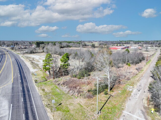
80 W Highway Mex Tex Plz
R24219
Yarbrough S
Commercialnec
ABS 0658; YARBROUGH S; TRACT 218; 4.4503 ACRES
X
Wood
48467C0225C
Texas
2024
4.45 AC
2024
Texas East Area
950800
Other Market Areas
1,197 SF
DEMOGRAPHICS near 80 W Highway Mex Tex Plz
1 Mile
3 Mile
5 Mile
2024 Total Population
693
8,847
12,295
2029 Population
762
9,896
13,658
Pop Growth 2024-2029
+ 9.96%
+ 11.86%
+ 11.09%
Average Age
41
43
44
2024 Total Households
256
3,443
4,794
HH Growth 2024-2029
+ 9.77%
+ 11.94%
+ 11.08%
Median Household Inc
$51,875
$45,115
$50,665
Avg Household Size
2.60
2.50
2.50
2024 Avg HH Vehicles
2.00
2.00
2.00
Median Home Value
$133,823
$140,464
$159,470
Median Year Built
1986
1989
1989
Nearby Places
Map Layers
Map Styles
 Street
 Aerial
- Restaurants
- Banks
- Shops
- Fitness
- Groceries
PUBLIC TRANSPORTATION
COMMUTER RAIL
Mineola (Texas Eagle - Amtrak)
DRIVE
WALK
Distance
Mineola (Texas Eagle - Amtrak)
3 min
2.0 mi
AIRPORT
Tyler Pounds Regional
DRIVE
WALK
Distance
Tyler Pounds Regional
36 min
27.5 mi
Freight Ports
Port of Shreveport
DRIVE
WALK
Distance
Port of Shreveport
141 min
126.1 mi
SALE & LEASE HISTORY
LISTING DATE
SALE/LEASE

Jan 31, 2025
For Lease
Nearby Properties
Address
Land Use
TOTAL SIZE
Lot Size
Zoning
Address
Land Use
TOTAL SIZE
Lot Size
Zoning
90,026 SF
25.72 AC
Address
Land Use
TOTAL SIZE
Lot Size
Zoning
138,125 SF
27.97 AC
Address
Land Use
TOTAL SIZE
Lot Size
Zoning
68,715 SF
3.69 AC
Address
Land Use
TOTAL SIZE
Lot Size
Zoning
55,614 SF
3.49 AC
Address
Land Use
TOTAL SIZE
Lot Size
Zoning
106,466 SF
52.34 AC
Address
Land Use
TOTAL SIZE
Lot Size
Zoning
31,880 SF
12.58 AC
Address
Land Use
TOTAL SIZE
Lot Size
Zoning
154,539 SF
19.19 AC
Address
Land Use
TOTAL SIZE
Lot Size
Zoning
2,319 SF
588.60 AC
Address
Land Use
TOTAL SIZE
Lot Size
Zoning
6,083 SF
122.96 AC
Address
Land Use
TOTAL SIZE
Lot Size
Zoning
28,248 SF
21.30 AC
Address
Land Use
TOTAL SIZE
Lot Size
Zoning
7,844 SF
62.98 AC
Address
Land Use
TOTAL SIZE
Lot Size
Zoning
4,703 SF
255.77 AC
Address
Land Use
TOTAL SIZE
Lot Size
Zoning
8,675 SF
159.35 AC
Address
Land Use
TOTAL SIZE
Lot Size
Zoning
7,044 SF
1.84 AC
Address
Land Use
TOTAL SIZE
Lot Size
Zoning
15,466 SF
1.60 AC
Address
Land Use
TOTAL SIZE
Lot Size
Zoning
54,489 SF
3.19 AC
Address
Land Use
TOTAL SIZE
Lot Size
Zoning
18,583 SF
2.08 AC
Address
Land Use
TOTAL SIZE
Lot Size
Zoning
18,150 SF
2.50 AC
Address
Land Use
TOTAL SIZE
Lot Size
Zoning
23,642 SF
4.45 AC
Address
Land Use
TOTAL SIZE
Lot Size
Zoning
28,602 SF
1.53 AC
Address
Land Use
TOTAL SIZE
Lot Size
Zoning
7,800 SF
243.10 AC
Address
Land Use
TOTAL SIZE
Lot Size
Zoning
17,320 SF
9.87 AC
Address
Land Use
TOTAL SIZE
Lot Size
Zoning
6,035 SF
4.41 AC
Address
Land Use
TOTAL SIZE
Lot Size
Zoning
19,593 SF
2.65 AC
Address
Land Use
TOTAL SIZE
Lot Size
Zoning
20,188 SF
0.42 AC
Address
Land Use
TOTAL SIZE
Lot Size
Zoning
31,032 SF
2.53 AC
Address
Land Use
TOTAL SIZE
Lot Size
Zoning
24,096 SF
0.71 AC
Address
Land Use
TOTAL SIZE
Lot Size
Zoning
13,624 SF
4.33 AC
Address
Land Use
TOTAL SIZE
Lot Size
Zoning
19,093 SF
7.17 AC
Address
Land Use
TOTAL SIZE
Lot Size
Zoning
13,200 SF
21.39 AC
The World's #1 Commercial Real Estate Marketplace
Connect with us
© 2026 CoStar Group
The information above has been obtained from sources believed reliable. While we do not doubt its accuracy we have not verified it and make no guarantee, warranty or representation about it. It is your responsibility to independently confirm its accuracy and completeness. Any projections, opinions, assumptions, or estimates used are for example only and do not represent the current or future performance of the property. The value of this transaction to you depends on tax and other factors which should be evaluated by your tax, financial, and legal advisors. You and your advisors should conduct a careful, independent investigation of the property to determine to your satisfaction the suitability of the property for your needs.