Property Record
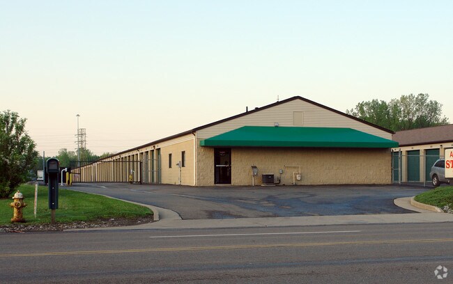
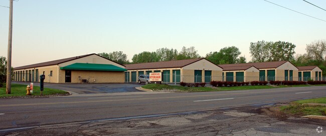
80 W Waterloo Rd, Akron, OH 44319
Property Detail
80 W Waterloo Rd
73-00188
TR 11 NW CREEK N OF INTERSTATE
Warehouse
Summit
A Areas with a 1% annual chance of flooding and a 26% chance of flooding over the life of a 30-year mortgage.
Ohio
2023
6.73 AC
2025
Akron
508301
Cleveland
83,510 SF
Akron, OH
NEARBY LISTINGS FOR SALE OR LEASE
-
-
View all Akron listings for sale on LoopNet.com
DEMOGRAPHICS near 80 W Waterloo Rd
1 mile
3 mile
5 mile
2025 Total Population
5,720
73,642
172,905
2030 Population
5,671
74,009
173,928
Pop Growth 2025-2030
(0.86%)
+ 0.50%
+ 0.59%
Average Age
43
40
40
2025 Total Households
2,624
32,006
74,342
HH Growth 2025-2030
(0.91%)
+ 0.43%
+ 0.55%
Median Household Inc
$49,171
$47,319
$47,670
Avg Household Size
2.20
2.20
2.20
2025 Avg HH Vehicles
2.00
2.00
2.00
Median Home Value
$132,088
$121,296
$132,614
Median Year Built
1952
1953
1954
Nearby Places
Map Layers
Map Styles
 Street
 Aerial
Transit
 Traffic
 Biking
Places
Listings with unknown addresses are not visible on the map
- Restaurants
- Banks
- Shops
- Fitness
- Groceries
Nearby Properties
Address
Land Use
TOTAL SIZE
Lot Size
Zoning
Address
Land Use
TOTAL SIZE
Lot Size
Zoning
Address
Land Use
TOTAL SIZE
Lot Size
Zoning
203,458 SF
10.41 AC
Address
Land Use
TOTAL SIZE
Lot Size
Zoning
9.19 AC
Address
Land Use
TOTAL SIZE
Lot Size
Zoning
91,678 SF
5.24 AC
Address
Land Use
TOTAL SIZE
Lot Size
Zoning
423,125 SF
5.57 AC
Address
Land Use
TOTAL SIZE
Lot Size
Zoning
57,369 SF
93.97 AC
Address
Land Use
TOTAL SIZE
Lot Size
Zoning
Address
Land Use
TOTAL SIZE
Lot Size
Zoning
227,634 SF
21.46 AC
Address
Land Use
TOTAL SIZE
Lot Size
Zoning
Address
Land Use
TOTAL SIZE
Lot Size
Zoning
Address
Land Use
TOTAL SIZE
Lot Size
Zoning
184,791 SF
3.25 AC
Address
Land Use
TOTAL SIZE
Lot Size
Zoning
154,926 SF
12.38 AC
Address
Land Use
TOTAL SIZE
Lot Size
Zoning
127,297 SF
6.03 AC
Address
Land Use
TOTAL SIZE
Lot Size
Zoning
121,006 SF
6.09 AC
Address
Land Use
TOTAL SIZE
Lot Size
Zoning
22,977 SF
263.47 AC
Address
Land Use
TOTAL SIZE
Lot Size
Zoning
57,180 SF
6.67 AC
Address
Land Use
TOTAL SIZE
Lot Size
Zoning
Address
Land Use
TOTAL SIZE
Lot Size
Zoning
148.10 AC
Address
Land Use
TOTAL SIZE
Lot Size
Zoning
51,520 SF
2.70 AC
Address
Land Use
TOTAL SIZE
Lot Size
Zoning
52,640 SF
0.42 AC
Address
Land Use
TOTAL SIZE
Lot Size
Zoning
Address
Land Use
TOTAL SIZE
Lot Size
Zoning
203,059 SF
55.62 AC
Address
Land Use
TOTAL SIZE
Lot Size
Zoning
232,425 SF
13.37 AC
Address
Land Use
TOTAL SIZE
Lot Size
Zoning
258,686 SF
19.52 AC
Address
Land Use
TOTAL SIZE
Lot Size
Zoning
81,108 SF
3.86 AC
Address
Land Use
TOTAL SIZE
Lot Size
Zoning
65,436 SF
34.63 AC
Address
Land Use
TOTAL SIZE
Lot Size
Zoning
130,893 SF
11.70 AC
Address
Land Use
TOTAL SIZE
Lot Size
Zoning
59,492 SF
5.51 AC
Address
Land Use
TOTAL SIZE
Lot Size
Zoning
Address
Land Use
TOTAL SIZE
Lot Size
Zoning
16,604 SF
248.86 AC
The World's #1 Commercial Real Estate Marketplace
Connect with us
© 2026 CoStar Group
The information above has been obtained from sources believed reliable. While we do not doubt its accuracy we have not verified it and make no guarantee, warranty or representation about it. It is your responsibility to independently confirm its accuracy and completeness. Any projections, opinions, assumptions, or estimates used are for example only and do not represent the current or future performance of the property. The value of this transaction to you depends on tax and other factors which should be evaluated by your tax, financial, and legal advisors. You and your advisors should conduct a careful, independent investigation of the property to determine to your satisfaction the suitability of the property for your needs.