Property Record
800 E Main St, Weatherford, OK 73096

NEARBY LISTINGS FOR SALE OR LEASE
Property Detail
800 E Main St
0710-00-000-000-0-017-70
Weatherford City Tracts
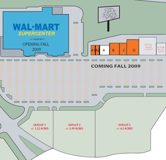
Wholesaleoutletdiscountstore
WEATHERFORD CITY TRACTS IRREG TR PT E-10, 283'N X687'W X 388'S APPROX 5 ACS 8-12-14
X
Custer
40039C0515E
Oklahoma
2024
5 AC
2025
Oklahoma West Area
960701
Other Market Areas
52,130 SF
Weatherford, OK
DEMOGRAPHICS near 800 E Main St
1 Mile
3 Mile
5 Mile
2024 Total Population
2,850
13,515
14,369
2029 Population
2,794
13,220
14,047
Pop Growth 2024-2029
(1.96%)
(2.18%)
(2.24%)
Average Age
34
34
34
2024 Total Households
1,066
5,259
5,585
HH Growth 2024-2029
(1.97%)
(2.30%)
(2.35%)
Median Household Inc
$53,644
$54,982
$56,397
Avg Household Size
2.30
2.30
2.30
2024 Avg HH Vehicles
2.00
2.00
2.00
Median Home Value
$188,766
$209,375
$215,079
Median Year Built
1975
1982
1983
Nearby Places
Map Layers
Map Styles
 Street
 Aerial
- Restaurants
- Banks
- Shops
- Fitness
- Groceries
Nearby Properties
Address
Land Use
TOTAL SIZE
Lot Size
Zoning
Address
Land Use
TOTAL SIZE
Lot Size
Zoning
152,845 SF
20.19 AC
Address
Land Use
TOTAL SIZE
Lot Size
Zoning
22,590 SF
10.50 AC
Address
Land Use
TOTAL SIZE
Lot Size
Zoning
8,000 SF
34.36 AC
Address
Land Use
TOTAL SIZE
Lot Size
Zoning
63,328 SF
2.56 AC
Address
Land Use
TOTAL SIZE
Lot Size
Zoning
11,284 SF
0.72 AC
Address
Land Use
TOTAL SIZE
Lot Size
Zoning
43,320 SF
7.03 AC
Address
Land Use
TOTAL SIZE
Lot Size
Zoning
8,694 SF
3 AC
Address
Land Use
TOTAL SIZE
Lot Size
Zoning
19,839 SF
60 AC
NP
Address
Land Use
TOTAL SIZE
Lot Size
Zoning
57,132 SF
6.26 AC
Address
Land Use
TOTAL SIZE
Lot Size
Zoning
11,070 SF
5.37 AC
Address
Land Use
TOTAL SIZE
Lot Size
Zoning
9,120 SF
1.40 AC
Address
Land Use
TOTAL SIZE
Lot Size
Zoning
10,920 SF
6.91 AC
Address
Land Use
TOTAL SIZE
Lot Size
Zoning
12,600 SF
8.84 AC
Address
Land Use
TOTAL SIZE
Lot Size
Zoning
6,016 SF
7.90 AC
Address
Land Use
TOTAL SIZE
Lot Size
Zoning
22,842 SF
1.66 AC
Address
Land Use
TOTAL SIZE
Lot Size
Zoning
40,053 SF
1.77 AC
Address
Land Use
TOTAL SIZE
Lot Size
Zoning
30,044 SF
4.03 AC
Address
Land Use
TOTAL SIZE
Lot Size
Zoning
9,880 SF
2.54 AC
Address
Land Use
TOTAL SIZE
Lot Size
Zoning
3,640 SF
13.07 AC
Address
Land Use
TOTAL SIZE
Lot Size
Zoning
19,188 SF
3.43 AC
Address
Land Use
TOTAL SIZE
Lot Size
Zoning
2,361 SF
14.05 AC
Address
Land Use
TOTAL SIZE
Lot Size
Zoning
75,088 SF
4.20 AC
Address
Land Use
TOTAL SIZE
Lot Size
Zoning
39,652 SF
4.10 AC
Address
Land Use
TOTAL SIZE
Lot Size
Zoning
2,816 SF
20.06 AC
NP
Address
Land Use
TOTAL SIZE
Lot Size
Zoning
11,296 SF
1.64 AC
Address
Land Use
TOTAL SIZE
Lot Size
Zoning
14,650 SF
1.19 AC
Address
Land Use
TOTAL SIZE
Lot Size
Zoning
20,146 SF
1.03 AC
Address
Land Use
TOTAL SIZE
Lot Size
Zoning
27,310 SF
2.90 AC
Address
Land Use
TOTAL SIZE
Lot Size
Zoning
The World's #1 Commercial Real Estate Marketplace
Connect with us
© 2026 CoStar Group
The information above has been obtained from sources believed reliable. While we do not doubt its accuracy we have not verified it and make no guarantee, warranty or representation about it. It is your responsibility to independently confirm its accuracy and completeness. Any projections, opinions, assumptions, or estimates used are for example only and do not represent the current or future performance of the property. The value of this transaction to you depends on tax and other factors which should be evaluated by your tax, financial, and legal advisors. You and your advisors should conduct a careful, independent investigation of the property to determine to your satisfaction the suitability of the property for your needs.