Property Record
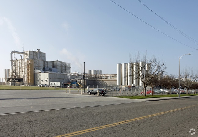
800 E Paige Ave, Tulare, CA 93274


Property Detail
800 E Paige Ave
181-100-032-000
PARCEL3 PM3427 MB35 PG29 & POR PCL4 PM307 MB4 PG7
Lightindustrial
Tulare
B and X Area of moderate flood hazard, usually the area between the limits of the 100-year and 500-year floods.
California
2025
40.36 AC
2025
Tulare
002901
Visalia/Porterville
453,531 SF
Visalia, CA
NEARBY LISTINGS FOR SALE OR LEASE
DEMOGRAPHICS near 800 E Paige Ave
1 mile
3 mile
5 mile
2025 Total Population
4,811
62,121
78,884
2030 Population
4,913
63,582
80,823
Pop Growth 2025-2030
+ 2.12%
+ 2.35%
+ 2.46%
Average Age
35
34
35
2025 Total Households
1,387
18,275
23,337
HH Growth 2025-2030
+ 2.09%
+ 2.25%
+ 2.38%
Median Household Inc
$58,730
$69,951
$74,415
Avg Household Size
3.30
3.30
3.30
2025 Avg HH Vehicles
2.00
2.00
2.00
Median Home Value
$265,371
$332,430
$348,726
Median Year Built
1986
1984
1988
Nearby Places
Map Layers
Map Styles
 Street
 Aerial
Layers
 Traffic
 Biking
Places
Listings with unknown addresses are not visible on the map
- Restaurants
- Banks
- Shops
- Fitness
- Groceries
Nearby Properties
Address
Land Use
TOTAL SIZE
Lot Size
Zoning
Address
Land Use
TOTAL SIZE
Lot Size
Zoning
490,197 SF
27.65 AC
M-2
Address
Land Use
TOTAL SIZE
Lot Size
Zoning
15.61 AC
PL
Address
Land Use
TOTAL SIZE
Lot Size
Zoning
276,459 SF
14.50 AC
M-2
Address
Land Use
TOTAL SIZE
Lot Size
Zoning
118,913 SF
10.57 AC
C-3
Address
Land Use
TOTAL SIZE
Lot Size
Zoning
3,645 SF
12.77 AC
C-3
Address
Land Use
TOTAL SIZE
Lot Size
Zoning
47,670 SF
17.92 AC
M-2
Address
Land Use
TOTAL SIZE
Lot Size
Zoning
31,408 SF
2.75 AC
C-4
Address
Land Use
TOTAL SIZE
Lot Size
Zoning
123,000 SF
8.08 AC
Address
Land Use
TOTAL SIZE
Lot Size
Zoning
84,070 SF
5.10 AC
RM2
Address
Land Use
TOTAL SIZE
Lot Size
Zoning
51,484 SF
1.85 AC
C3D
Address
Land Use
TOTAL SIZE
Lot Size
Zoning
62,008 SF
4.17 AC
R-M-2
Address
Land Use
TOTAL SIZE
Lot Size
Zoning
88,948 SF
81.19 AC
C-4
Address
Land Use
TOTAL SIZE
Lot Size
Zoning
33,080 SF
1.62 AC
C2
Address
Land Use
TOTAL SIZE
Lot Size
Zoning
4.67 AC
Address
Land Use
TOTAL SIZE
Lot Size
Zoning
89,912 SF
4.69 AC
C-4D
Address
Land Use
TOTAL SIZE
Lot Size
Zoning
43,192 SF
2.68 AC
M-1
Address
Land Use
TOTAL SIZE
Lot Size
Zoning
51,220 SF
1.56 AC
C3
Address
Land Use
TOTAL SIZE
Lot Size
Zoning
92,093 SF
9.48 AC
M-2
Address
Land Use
TOTAL SIZE
Lot Size
Zoning
74,340 SF
5.41 AC
M-1
Address
Land Use
TOTAL SIZE
Lot Size
Zoning
33,306 SF
2.62 AC
R-1-8
Address
Land Use
TOTAL SIZE
Lot Size
Zoning
21,165 SF
1.63 AC
C2
Address
Land Use
TOTAL SIZE
Lot Size
Zoning
3.43 AC
Address
Land Use
TOTAL SIZE
Lot Size
Zoning
42,685 SF
2.89 AC
R-M-2
Address
Land Use
TOTAL SIZE
Lot Size
Zoning
5.62 AC
Address
Land Use
TOTAL SIZE
Lot Size
Zoning
57,225 SF
2.76 AC
R-1-8
The World's #1 Commercial Real Estate Marketplace
Connect with us
© 2026 CoStar Group
The information above has been obtained from sources believed reliable. While we do not doubt its accuracy we have not verified it and make no guarantee, warranty or representation about it. It is your responsibility to independently confirm its accuracy and completeness. Any projections, opinions, assumptions, or estimates used are for example only and do not represent the current or future performance of the property. The value of this transaction to you depends on tax and other factors which should be evaluated by your tax, financial, and legal advisors. You and your advisors should conduct a careful, independent investigation of the property to determine to your satisfaction the suitability of the property for your needs.