Property Record
800 Hackberry Dr, Colorado Springs, CO 80911


NEARBY LISTINGS FOR SALE OR LEASE
-
-
View all Colorado Springs listings for lease on LoopNet.com
Property Detail
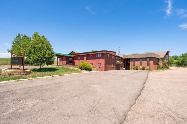
800 Hackberry Dr
65123-00-002
Monument Add
Religious
PART OF E2SW4 AS DES IN BK 1911-992, WD 238395 SEC 12-15-66
AE
El Paso
08041C0763G
Colorado
0
1.43 AC
2025
Southeast
004200
Colorado Springs
13,137 SF
Colorado Springs, CO
DEMOGRAPHICS near 800 Hackberry Dr
1 mile
3 mile
5 mile
2024 Total Population
13,282
52,160
154,038
2029 Population
13,518
53,437
160,444
Pop Growth 2024-2029
+ 1.78%
+ 2.45%
+ 4.16%
Average Age
38
36
34
2024 Total Households
4,703
17,227
51,817
HH Growth 2024-2029
+ 1.98%
+ 2.66%
+ 4.51%
Median Household Inc
$75,296
$69,351
$66,722
Avg Household Size
2.70
2.80
2.80
2024 Avg HH Vehicles
2.00
2.00
2.00
Median Home Value
$306,998
$304,240
$316,258
Median Year Built
1981
1982
1989
Nearby Places
Map Layers
Map Styles
 Street
 Aerial
Transit
 Traffic
 Biking
Places
Listings with unknown addresses are not visible on the map
- Restaurants
- Banks
- Shops
- Fitness
- Groceries
PUBLIC TRANSPORTATION
AIRPORT
City of Colorado Springs Municipal
Drive
Walk
Distance
City of Colorado Springs Municipal
21 min
9.2 mi
SALE & LEASE HISTORY
LISTING DATE
SALE/LEASE

Aug 05, 2024
For Lease
Nearby Properties
Address
Land Use
TOTAL SIZE
Lot Size
Zoning
Address
Land Use
TOTAL SIZE
Lot Size
Zoning
241,806 SF
937.06 AC
A-5 CAD-O
Address
Land Use
TOTAL SIZE
Lot Size
Zoning
3,486,127 SF
69.25 AC
APD APZ1 A
Address
Land Use
TOTAL SIZE
Lot Size
Zoning
89,487 SF
Address
Land Use
TOTAL SIZE
Lot Size
Zoning
78,815 SF
Address
Land Use
TOTAL SIZE
Lot Size
Zoning
48,255 SF
17.35 AC
A-5 CAD-O
Address
Land Use
TOTAL SIZE
Lot Size
Zoning
278,331 SF
324.19 AC
Address
Land Use
TOTAL SIZE
Lot Size
Zoning
778.79 AC
APD AO RPZ
Address
Land Use
TOTAL SIZE
Lot Size
Zoning
34,984 SF
14.31 AC
A-5
Address
Land Use
TOTAL SIZE
Lot Size
Zoning
91,446 SF
12.60 AC
BP AO
Address
Land Use
TOTAL SIZE
Lot Size
Zoning
92.06 AC
APD APZ1 A
Address
Land Use
TOTAL SIZE
Lot Size
Zoning
130,569 SF
3.23 AC
Address
Land Use
TOTAL SIZE
Lot Size
Zoning
22,596 SF
3.93 AC
R-5 UV AO
Address
Land Use
TOTAL SIZE
Lot Size
Zoning
50,992 SF
10.27 AC
PDZ AO
Address
Land Use
TOTAL SIZE
Lot Size
Zoning
131,040 SF
8.50 AC
BP/CR AO
Address
Land Use
TOTAL SIZE
Lot Size
Zoning
92,000 SF
9.56 AC
MX-M UV AO
Address
Land Use
TOTAL SIZE
Lot Size
Zoning
66,640 SF
6.87 AC
MX-M CU AO
Address
Land Use
TOTAL SIZE
Lot Size
Zoning
322,147 SF
35.10 AC
I-2 CAD-O
Address
Land Use
TOTAL SIZE
Lot Size
Zoning
43,914 SF
9.36 AC
A-5 CAD-O
Address
Land Use
TOTAL SIZE
Lot Size
Zoning
207,858 SF
18.08 AC
C-2 R-2
Address
Land Use
TOTAL SIZE
Lot Size
Zoning
109,200 SF
6.13 AC
BP/CR AO
Address
Land Use
TOTAL SIZE
Lot Size
Zoning
21.30 AC
Address
Land Use
TOTAL SIZE
Lot Size
Zoning
168.20 AC
APD APZ1 A
Address
Land Use
TOTAL SIZE
Lot Size
Zoning
2.09 AC
MX-M CU AO
Address
Land Use
TOTAL SIZE
Lot Size
Zoning
19,308 SF
2.69 AC
RM-30 CAD-
Address
Land Use
TOTAL SIZE
Lot Size
Zoning
131,040 SF
9.68 AC
BP AO
Address
Land Use
TOTAL SIZE
Lot Size
Zoning
163,073 SF
14.57 AC
PUD
Address
Land Use
TOTAL SIZE
Lot Size
Zoning
278,331 SF
6.39 AC
Address
Land Use
TOTAL SIZE
Lot Size
Zoning
99,960 SF
8.21 AC
BP AO
Address
Land Use
TOTAL SIZE
Lot Size
Zoning
12.69 AC
APD RPZ AO
Address
Land Use
TOTAL SIZE
Lot Size
Zoning
8,252 SF
44.09 AC
A-5
The World's #1 Commercial Real Estate Marketplace
Connect with us
© 2026 CoStar Group
The information above has been obtained from sources believed reliable. While we do not doubt its accuracy we have not verified it and make no guarantee, warranty or representation about it. It is your responsibility to independently confirm its accuracy and completeness. Any projections, opinions, assumptions, or estimates used are for example only and do not represent the current or future performance of the property. The value of this transaction to you depends on tax and other factors which should be evaluated by your tax, financial, and legal advisors. You and your advisors should conduct a careful, independent investigation of the property to determine to your satisfaction the suitability of the property for your needs.