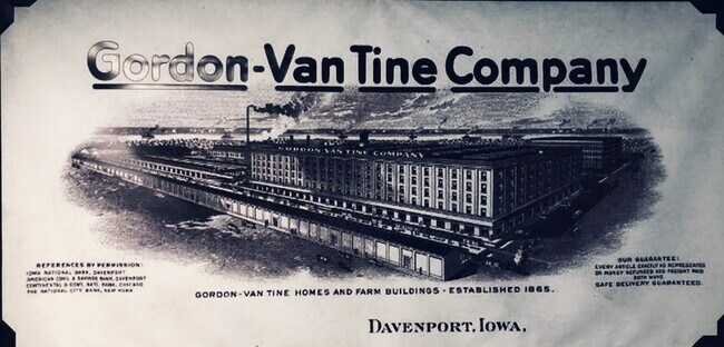
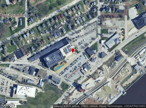
Property Record
800 Isabel Bloom Way, Davenport, IA 52803

NEARBY LISTINGS FOR SALE OR LEASE
Property Detail
800 Isabel Bloom Way
F0061A03
Wetmore's Add
Apartment
WETMORE'S ADD BLOCK: 3 WETMORES ADDITION PT BLK 3 PARCEL 3 PER SURVEY 2016-20496
AE
Scott
19163C0365H
Iowa
2025
0.15 AC
2025
Greater Davenport
010600
Davenport/Moline/Rock Island
20,465 SF
Davenport-Moline-Rock Island, IA-IL
DEMOGRAPHICS near 800 Isabel Bloom Way
1 Mile
3 Mile
5 Mile
2024 Total Population
10,654
93,616
188,812
2029 Population
10,860
92,822
186,736
Pop Growth 2024-2029
+ 1.93%
(0.85%)
(1.10%)
Average Age
35
39
40
2024 Total Households
4,845
39,236
79,353
HH Growth 2024-2029
+ 2.54%
(0.84%)
(1.13%)
Median Household Inc
$36,360
$50,713
$56,526
Avg Household Size
2.00
2.20
2.30
2024 Avg HH Vehicles
1.00
2.00
2.00
Median Home Value
$93,213
$126,264
$149,469
Median Year Built
1947
1948
1959
Nearby Places
Map Layers
Map Styles
 Street
 Aerial
- Restaurants
- Banks
- Shops
- Fitness
- Groceries
PUBLIC TRANSPORTATION
AIRPORT
Quad Cities International
DRIVE
WALK
Distance
Quad Cities International
20 min
10.8 mi
Freight Ports
Port Milwaukee
DRIVE
WALK
Distance
Port Milwaukee
243 min
211.4 mi
SALE & LEASE HISTORY
LISTING DATE
SALE/LEASE

Aug 25, 2021
For Lease
Nearby Properties
Address
Land Use
TOTAL SIZE
Lot Size
Zoning
Address
Land Use
TOTAL SIZE
Lot Size
Zoning
7,934 SF
8.41 AC
Address
Land Use
TOTAL SIZE
Lot Size
Zoning
3,516 SF
26.74 AC
Address
Land Use
TOTAL SIZE
Lot Size
Zoning
157,798 SF
25.37 AC
Address
Land Use
TOTAL SIZE
Lot Size
Zoning
197,194 SF
5.14 AC
Address
Land Use
TOTAL SIZE
Lot Size
Zoning
253,608 SF
9.29 AC
Address
Land Use
TOTAL SIZE
Lot Size
Zoning
3,500 SF
1.54 AC
Address
Land Use
TOTAL SIZE
Lot Size
Zoning
190,832 SF
3.88 AC
Address
Land Use
TOTAL SIZE
Lot Size
Zoning
63,359 SF
12.01 AC
Address
Land Use
TOTAL SIZE
Lot Size
Zoning
472,569 SF
47.24 AC
Address
Land Use
TOTAL SIZE
Lot Size
Zoning
61,623 SF
2.18 AC
Address
Land Use
TOTAL SIZE
Lot Size
Zoning
76,853 SF
0.56 AC
Address
Land Use
TOTAL SIZE
Lot Size
Zoning
4,944 SF
17.91 AC
Address
Land Use
TOTAL SIZE
Lot Size
Zoning
26,472 SF
17.67 AC
Address
Land Use
TOTAL SIZE
Lot Size
Zoning
77,187 SF
0.88 AC
Address
Land Use
TOTAL SIZE
Lot Size
Zoning
76,808 SF
1.94 AC
Address
Land Use
TOTAL SIZE
Lot Size
Zoning
27,312 SF
15.04 AC
Address
Land Use
TOTAL SIZE
Lot Size
Zoning
70,098 SF
9.72 AC
Address
Land Use
TOTAL SIZE
Lot Size
Zoning
104,415 SF
5.89 AC
Address
Land Use
TOTAL SIZE
Lot Size
Zoning
9,658 SF
8.07 AC
Address
Land Use
TOTAL SIZE
Lot Size
Zoning
153,329 SF
2.35 AC
Address
Land Use
TOTAL SIZE
Lot Size
Zoning
96,529 SF
3.52 AC
Address
Land Use
TOTAL SIZE
Lot Size
Zoning
72,554 SF
0.38 AC
Address
Land Use
TOTAL SIZE
Lot Size
Zoning
65,958 SF
15.04 AC
Address
Land Use
TOTAL SIZE
Lot Size
Zoning
115,968 SF
2.93 AC
Address
Land Use
TOTAL SIZE
Lot Size
Zoning
50,880 SF
11.36 AC
Address
Land Use
TOTAL SIZE
Lot Size
Zoning
54,644 SF
2.41 AC
Address
Land Use
TOTAL SIZE
Lot Size
Zoning
10,724 SF
1.51 AC
Address
Land Use
TOTAL SIZE
Lot Size
Zoning
32,725 SF
0.99 AC
Address
Land Use
TOTAL SIZE
Lot Size
Zoning
54,026 SF
The World's #1 Commercial Real Estate Marketplace
Connect with us
© 2025 CoStar Group
The information above has been obtained from sources believed reliable. While we do not doubt its accuracy we have not verified it and make no guarantee, warranty or representation about it. It is your responsibility to independently confirm its accuracy and completeness. Any projections, opinions, assumptions, or estimates used are for example only and do not represent the current or future performance of the property. The value of this transaction to you depends on tax and other factors which should be evaluated by your tax, financial, and legal advisors. You and your advisors should conduct a careful, independent investigation of the property to determine to your satisfaction the suitability of the property for your needs.