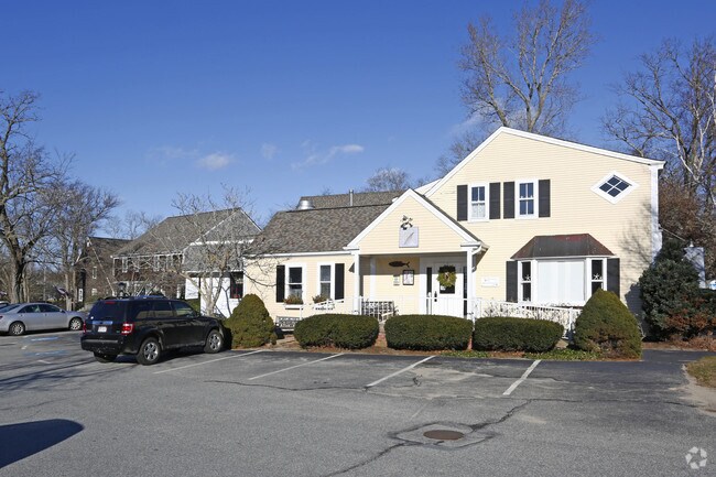
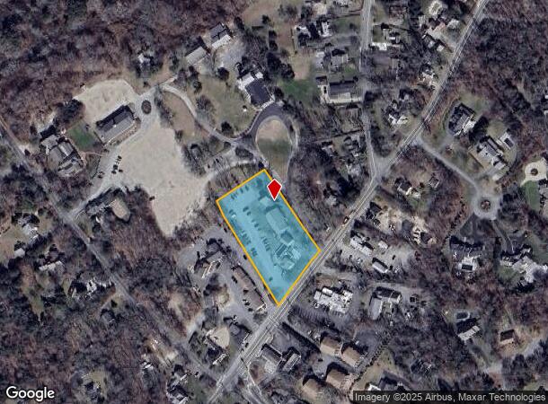
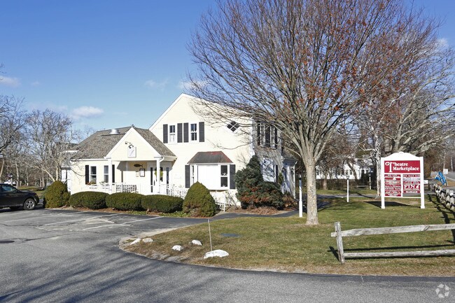
Property Record
800 Main St, Dennis, MA 02638
NEARBY LISTINGS FOR SALE OR LEASE
-
-
View all Dennis listings for sale on LoopNet.com
Property Detail
800 Main St
Regionalshoppingcenterormallwithanchorstore
Barnstable
X
Massachusetts
25001C0577J
1.59 AC
2025
Cape Cod
2025
Other Market Areas
011300
Barnstable Town, MA
10,495 SF
DENN-000351-000000-000009
DEMOGRAPHICS near 800 Main St
1 mile
3 mile
5 mile
2024 Total Population
2,049
12,029
27,807
2029 Population
2,156
12,312
28,510
Pop Growth 2024-2029
+ 5.22%
+ 2.35%
+ 2.53%
Average Age
57
55
52
2024 Total Households
1,011
5,900
12,813
HH Growth 2024-2029
+ 4.95%
+ 2.07%
+ 2.29%
Median Household Inc
$108,443
$95,250
$89,264
Avg Household Size
2.00
2.00
2.10
2024 Avg HH Vehicles
2.00
2.00
2.00
Median Home Value
$739,939
$494,230
$466,418
Median Year Built
1974
1977
1976
Nearby Places
Map Layers
Map Styles
 Street
 Aerial
Transit
 Traffic
 Biking
Places
Listings with unknown addresses are not visible on the map
- Restaurants
- Banks
- Shops
- Fitness
- Groceries
PUBLIC TRANSPORTATION
COMMUTER RAIL
Hyannis (CapeFLYER - Cape Cod Regional Transit Authority)
Drive
Walk
Distance
Hyannis (CapeFLYER - Cape Cod Regional Transit Authority)
16 min
8.5 mi
Freight Ports
Port of New Bedford Harbor
Drive
Walk
Distance
Port of New Bedford Harbor
79 min
55.2 mi
SALE & LEASE HISTORY
LISTING DATE
SALE/LEASE

Sep 23, 2016
For Sale
Nearby Properties
Address
Land Use
TOTAL SIZE
Lot Size
Zoning
Address
Land Use
TOTAL SIZE
Lot Size
Zoning
12.72 AC
R-60
Address
Land Use
TOTAL SIZE
Lot Size
Zoning
1,228 SF
10.54 AC
Address
Land Use
TOTAL SIZE
Lot Size
Zoning
10,551 SF
1.22 AC
DCPC
Address
Land Use
TOTAL SIZE
Lot Size
Zoning
5,693 SF
5 AC
Address
Land Use
TOTAL SIZE
Lot Size
Zoning
9,344 SF
1.96 AC
DCPC
Address
Land Use
TOTAL SIZE
Lot Size
Zoning
34.40 AC
Address
Land Use
TOTAL SIZE
Lot Size
Zoning
11,674 SF
0.15 AC
DCPC
Address
Land Use
TOTAL SIZE
Lot Size
Zoning
9,741 SF
3.83 AC
DCPC
Address
Land Use
TOTAL SIZE
Lot Size
Zoning
3.71 AC
Address
Land Use
TOTAL SIZE
Lot Size
Zoning
6,517 SF
0.14 AC
DCPC
Address
Land Use
TOTAL SIZE
Lot Size
Zoning
6,030 SF
2.10 AC
DCPC
Address
Land Use
TOTAL SIZE
Lot Size
Zoning
5.11 AC
R-60
Address
Land Use
TOTAL SIZE
Lot Size
Zoning
2.93 AC
R-60
Address
Land Use
TOTAL SIZE
Lot Size
Zoning
1,616 SF
9.23 AC
DCPC
Address
Land Use
TOTAL SIZE
Lot Size
Zoning
10,841 SF
1.69 AC
Address
Land Use
TOTAL SIZE
Lot Size
Zoning
6,784 SF
1.31 AC
Address
Land Use
TOTAL SIZE
Lot Size
Zoning
4,912 SF
6.70 AC
R-60
Address
Land Use
TOTAL SIZE
Lot Size
Zoning
320 SF
9.01 AC
Address
Land Use
TOTAL SIZE
Lot Size
Zoning
7,522 SF
1.93 AC
R-60
Address
Land Use
TOTAL SIZE
Lot Size
Zoning
5.42 AC
Address
Land Use
TOTAL SIZE
Lot Size
Zoning
5,689 SF
1.21 AC
Address
Land Use
TOTAL SIZE
Lot Size
Zoning
6,092 SF
0.97 AC
Address
Land Use
TOTAL SIZE
Lot Size
Zoning
2,955 SF
23.93 AC
R-60
Address
Land Use
TOTAL SIZE
Lot Size
Zoning
4,084 SF
6.96 AC
R-60
Address
Land Use
TOTAL SIZE
Lot Size
Zoning
163.08 AC
Address
Land Use
TOTAL SIZE
Lot Size
Zoning
Address
Land Use
TOTAL SIZE
Lot Size
Zoning
3,573 SF
2.38 AC
R-40
Address
Land Use
TOTAL SIZE
Lot Size
Zoning
5,194 SF
0.57 AC
Address
Land Use
TOTAL SIZE
Lot Size
Zoning
8,840 SF
1.65 AC
R-60
Address
Land Use
TOTAL SIZE
Lot Size
Zoning
18.49 AC
The World's #1 Commercial Real Estate Marketplace
Connect with us
© 2026 CoStar Group
The information above has been obtained from sources believed reliable. While we do not doubt its accuracy we have not verified it and make no guarantee, warranty or representation about it. It is your responsibility to independently confirm its accuracy and completeness. Any projections, opinions, assumptions, or estimates used are for example only and do not represent the current or future performance of the property. The value of this transaction to you depends on tax and other factors which should be evaluated by your tax, financial, and legal advisors. You and your advisors should conduct a careful, independent investigation of the property to determine to your satisfaction the suitability of the property for your needs.