Property Record
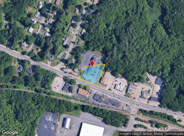
800 Main St, Holden, MA 01520


NEARBY LISTINGS FOR SALE OR LEASE
Property Detail
800 Main St
Departmentstore
Worcester
X
Massachusetts
25027C0605F
0.68 AC
2025
Outlying Worcester
2025
Boston
728300
Worcester, MA
20,651 SF
HOLD-000175-000000-000034
DEMOGRAPHICS near 800 Main St
1 mile
3 mile
5 mile
2024 Total Population
3,990
31,175
89,885
2029 Population
3,990
31,062
89,058
Pop Growth 2024-2029
0.00%
(0.36%)
(0.92%)
Average Age
43
42
41
2024 Total Households
1,431
11,645
34,231
HH Growth 2024-2029
0.00%
(0.40%)
(0.97%)
Median Household Inc
$130,000
$114,222
$91,479
Avg Household Size
2.70
2.60
2.50
2024 Avg HH Vehicles
2.00
2.00
2.00
Median Home Value
$437,965
$396,465
$358,956
Median Year Built
1975
1969
1957
Nearby Places
Map Layers
Map Styles
 Street
 Aerial
Transit
 Traffic
 Biking
Places
Listings with unknown addresses are not visible on the map
- Restaurants
- Banks
- Shops
- Fitness
- Groceries
PUBLIC TRANSPORTATION
COMMUTER RAIL
Drive
Walk
Distance
14 min
7.3 mi
Worcester (Framingham/Worcester Line - Massachusetts Bay Transportation Authority Commuter Rail (Purple Line))
Drive
Walk
Distance
Worcester (Framingham/Worcester Line - Massachusetts Bay Transportation Authority Commuter Rail (Purple Line))
15 min
7.3 mi
AIRPORT
Worcester Regional
Drive
Walk
Distance
Worcester Regional
19 min
8.4 mi
Freight Ports
Port of Boston
Drive
Walk
Distance
Port of Boston
74 min
47.8 mi
SALE & LEASE HISTORY
LISTING DATE
SALE/LEASE

Sep 25, 2016
For Lease
Jan 18, 2022
For Lease
Feb 14, 2023
For Lease
Nearby Properties
Address
Land Use
TOTAL SIZE
Lot Size
Zoning
Address
Land Use
TOTAL SIZE
Lot Size
Zoning
126,849 SF
15.18 AC
R15
Address
Land Use
TOTAL SIZE
Lot Size
Zoning
291,410 SF
21.73 AC
RL-7
Address
Land Use
TOTAL SIZE
Lot Size
Zoning
44,584 SF
90.22 AC
Address
Land Use
TOTAL SIZE
Lot Size
Zoning
199,870 SF
90.11 AC
R10
Address
Land Use
TOTAL SIZE
Lot Size
Zoning
96,541 SF
5.24 AC
MG-5
Address
Land Use
TOTAL SIZE
Lot Size
Zoning
29.20 AC
RS-7
Address
Land Use
TOTAL SIZE
Lot Size
Zoning
83,889 SF
12.47 AC
R20
Address
Land Use
TOTAL SIZE
Lot Size
Zoning
77,273 SF
20.79 AC
R15
Address
Land Use
TOTAL SIZE
Lot Size
Zoning
47.19 AC
RL-7
Address
Land Use
TOTAL SIZE
Lot Size
Zoning
99,584 SF
5.72 AC
RS-7
Address
Land Use
TOTAL SIZE
Lot Size
Zoning
59,178 SF
10.06 AC
R10
Address
Land Use
TOTAL SIZE
Lot Size
Zoning
5.46 AC
BL-1
Address
Land Use
TOTAL SIZE
Lot Size
Zoning
160,842 SF
9.76 AC
RS-7
Address
Land Use
TOTAL SIZE
Lot Size
Zoning
3.65 AC
MG-.5
Address
Land Use
TOTAL SIZE
Lot Size
Zoning
64,306 SF
6.42 AC
MG-.5
Address
Land Use
TOTAL SIZE
Lot Size
Zoning
95,000 SF
19.97 AC
C
Address
Land Use
TOTAL SIZE
Lot Size
Zoning
80,953 SF
7 AC
BL-1
Address
Land Use
TOTAL SIZE
Lot Size
Zoning
17.91 AC
RS-7
Address
Land Use
TOTAL SIZE
Lot Size
Zoning
44,628 SF
21.51 AC
C
Address
Land Use
TOTAL SIZE
Lot Size
Zoning
91,857 SF
10.08 AC
MG05
Address
Land Use
TOTAL SIZE
Lot Size
Zoning
24,898 SF
2.93 AC
C
Address
Land Use
TOTAL SIZE
Lot Size
Zoning
12,234 SF
6.35 AC
R10
Address
Land Use
TOTAL SIZE
Lot Size
Zoning
1,529 SF
48.30 AC
Address
Land Use
TOTAL SIZE
Lot Size
Zoning
102,300 SF
5.54 AC
MG-.5
Address
Land Use
TOTAL SIZE
Lot Size
Zoning
18,888 SF
10.71 AC
RL-7
Address
Land Use
TOTAL SIZE
Lot Size
Zoning
58,034 SF
2.67 AC
Address
Land Use
TOTAL SIZE
Lot Size
Zoning
65,070 SF
11 AC
RS-7
Address
Land Use
TOTAL SIZE
Lot Size
Zoning
34,286 SF
19.33 AC
R20
Address
Land Use
TOTAL SIZE
Lot Size
Zoning
52,939 SF
16.11 AC
RL-7
Address
Land Use
TOTAL SIZE
Lot Size
Zoning
18.90 AC
RS-7
The World's #1 Commercial Real Estate Marketplace
Connect with us
© 2026 CoStar Group
The information above has been obtained from sources believed reliable. While we do not doubt its accuracy we have not verified it and make no guarantee, warranty or representation about it. It is your responsibility to independently confirm its accuracy and completeness. Any projections, opinions, assumptions, or estimates used are for example only and do not represent the current or future performance of the property. The value of this transaction to you depends on tax and other factors which should be evaluated by your tax, financial, and legal advisors. You and your advisors should conduct a careful, independent investigation of the property to determine to your satisfaction the suitability of the property for your needs.