Property Record
800 N Black Branch Rd, Elizabethtown, KY 42701


NEARBY LISTINGS FOR SALE OR LEASE
Property Detail
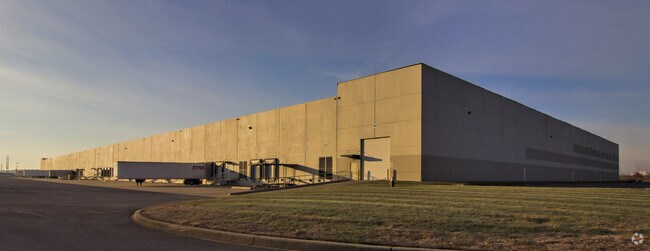
800 N Black Branch Rd
Elizabethtown, KY
T J Patterson Ind Park
167-00-00-025
T J PATTERSON IND PARK LT
Commercialnec
Hardin
X
Kentucky
21093C0291D
26.76 AC
2025
Kentucky West Area
2025
Other Market Areas
001701
DEMOGRAPHICS near 800 N Black Branch Rd
1 Mile
3 Mile
5 Mile
2024 Total Population
351
7,647
34,924
2029 Population
360
7,810
35,935
Pop Growth 2024-2029
+ 2.56%
+ 2.13%
+ 2.89%
Average Age
37
40
40
2024 Total Households
132
2,941
14,122
HH Growth 2024-2029
+ 2.27%
+ 2.04%
+ 2.85%
Median Household Inc
$56,922
$65,803
$57,906
Avg Household Size
2.60
2.60
2.40
2024 Avg HH Vehicles
2.00
2.00
2.00
Median Home Value
$157,257
$190,887
$190,195
Median Year Built
1986
1990
1988
Nearby Places
Map Layers
Map Styles
 Street
 Aerial
- Restaurants
- Banks
- Shops
- Fitness
- Groceries
Nearby Properties
Address
Land Use
TOTAL SIZE
Lot Size
Zoning
Address
Land Use
TOTAL SIZE
Lot Size
Zoning
Address
Land Use
TOTAL SIZE
Lot Size
Zoning
Address
Land Use
TOTAL SIZE
Lot Size
Zoning
Address
Land Use
TOTAL SIZE
Lot Size
Zoning
216.32 AC
Address
Land Use
TOTAL SIZE
Lot Size
Zoning
Address
Land Use
TOTAL SIZE
Lot Size
Zoning
Address
Land Use
TOTAL SIZE
Lot Size
Zoning
Address
Land Use
TOTAL SIZE
Lot Size
Zoning
2,275 SF
38.60 AC
Address
Land Use
TOTAL SIZE
Lot Size
Zoning
130.58 AC
Address
Land Use
TOTAL SIZE
Lot Size
Zoning
Address
Land Use
TOTAL SIZE
Lot Size
Zoning
Address
Land Use
TOTAL SIZE
Lot Size
Zoning
107.94 AC
Address
Land Use
TOTAL SIZE
Lot Size
Zoning
Address
Land Use
TOTAL SIZE
Lot Size
Zoning
Address
Land Use
TOTAL SIZE
Lot Size
Zoning
22.06 AC
Address
Land Use
TOTAL SIZE
Lot Size
Zoning
57.23 AC
Address
Land Use
TOTAL SIZE
Lot Size
Zoning
23.19 AC
Address
Land Use
TOTAL SIZE
Lot Size
Zoning
11.57 AC
Address
Land Use
TOTAL SIZE
Lot Size
Zoning
Address
Land Use
TOTAL SIZE
Lot Size
Zoning
31.26 AC
Address
Land Use
TOTAL SIZE
Lot Size
Zoning
53.54 AC
Address
Land Use
TOTAL SIZE
Lot Size
Zoning
Address
Land Use
TOTAL SIZE
Lot Size
Zoning
10.82 AC
Address
Land Use
TOTAL SIZE
Lot Size
Zoning
Address
Land Use
TOTAL SIZE
Lot Size
Zoning
Address
Land Use
TOTAL SIZE
Lot Size
Zoning
5,000 SF
215.84 AC
Address
Land Use
TOTAL SIZE
Lot Size
Zoning
35.20 AC
Address
Land Use
TOTAL SIZE
Lot Size
Zoning
The World's #1 Commercial Real Estate Marketplace
Connect with us
© 2026 CoStar Group
The information above has been obtained from sources believed reliable. While we do not doubt its accuracy we have not verified it and make no guarantee, warranty or representation about it. It is your responsibility to independently confirm its accuracy and completeness. Any projections, opinions, assumptions, or estimates used are for example only and do not represent the current or future performance of the property. The value of this transaction to you depends on tax and other factors which should be evaluated by your tax, financial, and legal advisors. You and your advisors should conduct a careful, independent investigation of the property to determine to your satisfaction the suitability of the property for your needs.