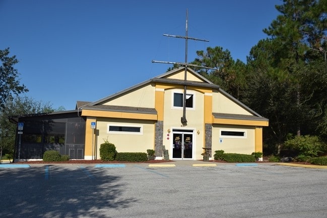
Property Record
800 N Highway 27, Minneola, FL 34715
NEARBY LISTINGS FOR SALE OR LEASE
Property Detail
800 N Highway 27
Orlando-Kissimmee-Sanford, FL
Minneola Grace Pointe Sub
07-22-26-0075-000-00100
MINNEOLA GRACE POINTE SUB LOT 1 PB 44 PG 9 ORB 2255 PG 0256
Municipalproperty
Lake
X
Florida
12069C0560E
1
0
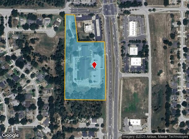
7.51 AC
2026
Lake County
031309
Orlando
40,798 SF
DEMOGRAPHICS near 800 N Highway 27
1 Mile
3 Mile
5 Mile
2024 Total Population
5,941
41,332
79,485
2029 Population
7,015
48,556
93,255
Pop Growth 2024-2029
+ 18.08%
+ 17.48%
+ 17.32%
Average Age
37
40
41
2024 Total Households
1,990
14,916
28,797
HH Growth 2024-2029
+ 17.69%
+ 17.19%
+ 17.08%
Median Household Inc
$87,106
$82,492
$81,584
Avg Household Size
3.00
2.70
2.70
2024 Avg HH Vehicles
2.00
2.00
2.00
Median Home Value
$321,867
$322,855
$322,221
Median Year Built
2005
2003
2004
Nearby Places
Map Layers
Map Styles
 Street
 Aerial
- Restaurants
- Banks
- Shops
- Fitness
- Groceries
PUBLIC TRANSPORTATION
AIRPORT
Orlando International
DRIVE
WALK
Distance
Orlando International
47 min
35.6 mi
Freight Ports
Port of Tampa Bay
DRIVE
WALK
Distance
Port of Tampa Bay
103 min
77.7 mi
SALE & LEASE HISTORY
LISTING DATE
SALE/LEASE

Oct 10, 2017
For Sale
Mar 30, 2023
For Sale
Jun 21, 2018
For Sale
Jun 21, 2018
For Lease
Feb 08, 2019
For Sale
Feb 06, 2019
For Sale
Dec 08, 2021
For Sale
Nearby Properties
Address
Land Use
TOTAL SIZE
Lot Size
Zoning
Address
Land Use
TOTAL SIZE
Lot Size
Zoning
403,970 SF
30.99 AC
PUD
Address
Land Use
TOTAL SIZE
Lot Size
Zoning
337,218 SF
16.38 AC
Address
Land Use
TOTAL SIZE
Lot Size
Zoning
269,594 SF
25.23 AC
PUD
Address
Land Use
TOTAL SIZE
Lot Size
Zoning
2,000 SF
63.78 AC
Address
Land Use
TOTAL SIZE
Lot Size
Zoning
142,824 SF
9.90 AC
C2
Address
Land Use
TOTAL SIZE
Lot Size
Zoning
203,762 SF
18.28 AC
R1
Address
Land Use
TOTAL SIZE
Lot Size
Zoning
95,182 SF
12.34 AC
PUD
Address
Land Use
TOTAL SIZE
Lot Size
Zoning
87,951 SF
5.88 AC
Address
Land Use
TOTAL SIZE
Lot Size
Zoning
80,774 SF
6.61 AC
Address
Land Use
TOTAL SIZE
Lot Size
Zoning
128,174 SF
9.88 AC
B1
Address
Land Use
TOTAL SIZE
Lot Size
Zoning
80,546 SF
6.75 AC
B1
Address
Land Use
TOTAL SIZE
Lot Size
Zoning
62,415 SF
10.19 AC
Address
Land Use
TOTAL SIZE
Lot Size
Zoning
74,375 SF
6.69 AC
Address
Land Use
TOTAL SIZE
Lot Size
Zoning
123,387 SF
47.51 AC
R3
Address
Land Use
TOTAL SIZE
Lot Size
Zoning
55,754 SF
9.14 AC
R2
Address
Land Use
TOTAL SIZE
Lot Size
Zoning
2,000 SF
19.45 AC
Address
Land Use
TOTAL SIZE
Lot Size
Zoning
30,926 SF
0.38 AC
Address
Land Use
TOTAL SIZE
Lot Size
Zoning
81,188 SF
7.70 AC
C2
Address
Land Use
TOTAL SIZE
Lot Size
Zoning
73,040 SF
4.89 AC
I1
Address
Land Use
TOTAL SIZE
Lot Size
Zoning
52,788 SF
3.21 AC
R2
Address
Land Use
TOTAL SIZE
Lot Size
Zoning
95,176 SF
11.02 AC
PUD
Address
Land Use
TOTAL SIZE
Lot Size
Zoning
102,584 SF
9.21 AC
R3
Address
Land Use
TOTAL SIZE
Lot Size
Zoning
24,910 SF
3.44 AC
CBD
Address
Land Use
TOTAL SIZE
Lot Size
Zoning
29,892 SF
2.46 AC
R3
Address
Land Use
TOTAL SIZE
Lot Size
Zoning
44,277 SF
3.44 AC
C2
Address
Land Use
TOTAL SIZE
Lot Size
Zoning
48,344 SF
6.03 AC
Address
Land Use
TOTAL SIZE
Lot Size
Zoning
34,840 SF
2.97 AC
C2
Address
Land Use
TOTAL SIZE
Lot Size
Zoning
28,836 SF
2.34 AC
Address
Land Use
TOTAL SIZE
Lot Size
Zoning
35,042 SF
2.59 AC
CBD
The World's #1 Commercial Real Estate Marketplace
Connect with us
© 2026 CoStar Group
The information above has been obtained from sources believed reliable. While we do not doubt its accuracy we have not verified it and make no guarantee, warranty or representation about it. It is your responsibility to independently confirm its accuracy and completeness. Any projections, opinions, assumptions, or estimates used are for example only and do not represent the current or future performance of the property. The value of this transaction to you depends on tax and other factors which should be evaluated by your tax, financial, and legal advisors. You and your advisors should conduct a careful, independent investigation of the property to determine to your satisfaction the suitability of the property for your needs.