Property Record
800 N State College Blvd, Fullerton, CA 92831


NEARBY LISTINGS FOR SALE OR LEASE
Property Detail
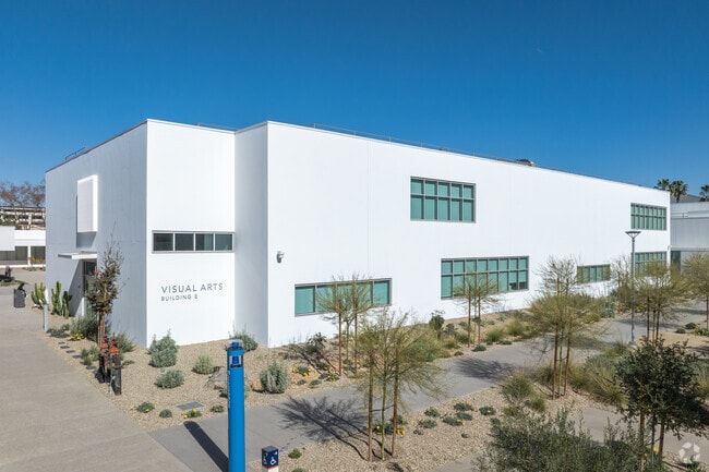
800 N State College Blvd
029-180-35
S TWP 3 RGE 10 SEC 25 SEC 25 T 3 R 10 POR SW1/4
Taxexempt
Orange
X
California
06059C0044J
69.86 AC
0
Fullerton
2025
Orange County (California)
011504
Anaheim-Santa Ana-Irvine, CA
DEMOGRAPHICS near 800 N State College Blvd
1 Mile
3 Mile
5 Mile
2024 Total Population
27,125
187,568
463,076
2029 Population
26,653
185,047
456,854
Pop Growth 2024-2029
(1.74%)
(1.34%)
(1.34%)
Average Age
35
38
39
2024 Total Households
8,890
60,872
146,742
HH Growth 2024-2029
(1.97%)
(1.48%)
(1.50%)
Median Household Inc
$70,883
$89,549
$94,720
Avg Household Size
2.70
2.90
3.00
2024 Avg HH Vehicles
2.00
2.00
2.00
Median Home Value
$753,175
$757,455
$762,794
Median Year Built
1968
1970
1971
Nearby Places
Map Layers
Map Styles
 Street
 Aerial
- Restaurants
- Banks
- Shops
- Fitness
- Groceries
PUBLIC TRANSPORTATION
COMMUTER RAIL
Fullerton (91 Line - Southern California Regional Rail Authority (Metrolink), Orange County Line - Southern California Regional Rail Authority (Metrolink))
DRIVE
WALK
Distance
Fullerton (91 Line - Southern California Regional Rail Authority (Metrolink), Orange County Line - Southern California Regional Rail Authority (Metrolink))
7 min
3.1 mi
Anaheim Canyon (Inland Empire-Orange County Line - Southern California Regional Rail Authority (Metrolink))
DRIVE
WALK
Distance
Anaheim Canyon (Inland Empire-Orange County Line - Southern California Regional Rail Authority (Metrolink))
10 min
4.5 mi
AIRPORT
John Wayne/Orange County
DRIVE
WALK
Distance
John Wayne/Orange County
22 min
17.1 mi
Long Beach (Daugherty Field)
DRIVE
WALK
Distance
Long Beach (Daugherty Field)
33 min
23.1 mi
Ontario International
DRIVE
WALK
Distance
Ontario International
35 min
26.7 mi
Freight Ports
Port of Long Beach
DRIVE
WALK
Distance
Port of Long Beach
38 min
26.0 mi
Nearby Properties
Address
Land Use
TOTAL SIZE
Lot Size
Zoning
Address
Land Use
TOTAL SIZE
Lot Size
Zoning
Address
Land Use
TOTAL SIZE
Lot Size
Zoning
0.02 AC
Address
Land Use
TOTAL SIZE
Lot Size
Zoning
Address
Land Use
TOTAL SIZE
Lot Size
Zoning
Address
Land Use
TOTAL SIZE
Lot Size
Zoning
Address
Land Use
TOTAL SIZE
Lot Size
Zoning
325,249 SF
19.20 AC
R3R
Address
Land Use
TOTAL SIZE
Lot Size
Zoning
29.16 AC
Address
Land Use
TOTAL SIZE
Lot Size
Zoning
3.14 AC
Address
Land Use
TOTAL SIZE
Lot Size
Zoning
Address
Land Use
TOTAL SIZE
Lot Size
Zoning
Address
Land Use
TOTAL SIZE
Lot Size
Zoning
47,520 SF
1.92 AC
C
Address
Land Use
TOTAL SIZE
Lot Size
Zoning
Address
Land Use
TOTAL SIZE
Lot Size
Zoning
Address
Land Use
TOTAL SIZE
Lot Size
Zoning
Address
Land Use
TOTAL SIZE
Lot Size
Zoning
26.38 AC
Address
Land Use
TOTAL SIZE
Lot Size
Zoning
Address
Land Use
TOTAL SIZE
Lot Size
Zoning
Address
Land Use
TOTAL SIZE
Lot Size
Zoning
Address
Land Use
TOTAL SIZE
Lot Size
Zoning
Address
Land Use
TOTAL SIZE
Lot Size
Zoning
18.65 AC
Address
Land Use
TOTAL SIZE
Lot Size
Zoning
12,040 SF
1.82 AC
Address
Land Use
TOTAL SIZE
Lot Size
Zoning
198,208 SF
11.62 AC
Address
Land Use
TOTAL SIZE
Lot Size
Zoning
12.72 AC
Address
Land Use
TOTAL SIZE
Lot Size
Zoning
Address
Land Use
TOTAL SIZE
Lot Size
Zoning
10.43 AC
Address
Land Use
TOTAL SIZE
Lot Size
Zoning
Address
Land Use
TOTAL SIZE
Lot Size
Zoning
13.27 AC
Address
Land Use
TOTAL SIZE
Lot Size
Zoning
19.38 AC
Address
Land Use
TOTAL SIZE
Lot Size
Zoning
232,305 SF
10.78 AC
The World's #1 Commercial Real Estate Marketplace
Connect with us
© 2025 CoStar Group
The information above has been obtained from sources believed reliable. While we do not doubt its accuracy we have not verified it and make no guarantee, warranty or representation about it. It is your responsibility to independently confirm its accuracy and completeness. Any projections, opinions, assumptions, or estimates used are for example only and do not represent the current or future performance of the property. The value of this transaction to you depends on tax and other factors which should be evaluated by your tax, financial, and legal advisors. You and your advisors should conduct a careful, independent investigation of the property to determine to your satisfaction the suitability of the property for your needs.