Property Record
800 Ne State Route 291, Lees Summit, MO 64086
NEARBY LISTINGS FOR SALE OR LEASE
Property Detail
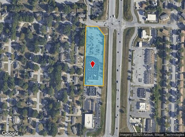
800 Ne State Route 291
Kansas City, MO-KS
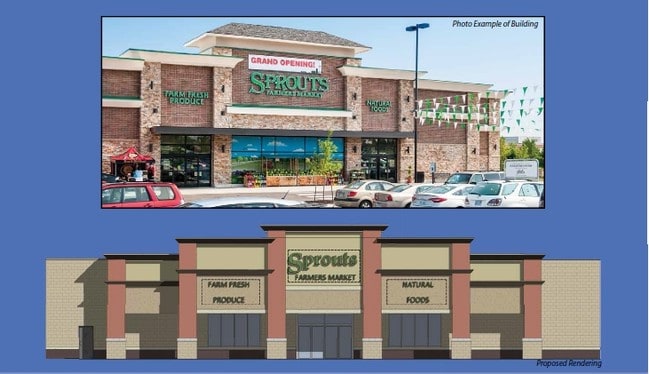
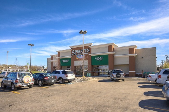
Amc-Midland Plaza
52-840-06-21-00-0-00-000
A REPLAT OF AMC-MIDLAND PLAZA TRS. I,II,III LOT 3
Storebuilding
Jackson
X
Missouri
29095C0436G
3
2024
2.53 AC
2025
Southeast Jackson County
017900
Kansas City
26,696 SF
DEMOGRAPHICS near 800 Ne State Route 291
1 Mile
3 Mile
5 Mile
2024 Total Population
12,808
50,580
84,172
2029 Population
12,696
50,148
83,860
Pop Growth 2024-2029
(0.87%)
(0.85%)
(0.37%)
Average Age
38
40
40
2024 Total Households
5,370
20,479
32,442
HH Growth 2024-2029
(0.91%)
(0.78%)
(0.41%)
Median Household Inc
$73,678
$88,284
$97,407
Avg Household Size
2.30
2.40
2.50
2024 Avg HH Vehicles
2.00
2.00
2.00
Median Home Value
$226,849
$242,914
$282,188
Median Year Built
1984
1985
1990
Nearby Places
Map Layers
Map Styles
 Street
 Aerial
- Restaurants
- Banks
- Shops
- Fitness
- Groceries
PUBLIC TRANSPORTATION
COMMUTER RAIL
DRIVE
WALK
Distance
5 min
1.8 mi
AIRPORT
Kansas City International
DRIVE
WALK
Distance
Kansas City International
56 min
42.0 mi
SALE & LEASE HISTORY
LISTING DATE
SALE/LEASE

Jul 16, 2018
For Sale
Dec 05, 2016
For Sale
Dec 01, 2017
For Sale
Nearby Properties
Address
Land Use
TOTAL SIZE
Lot Size
Zoning
Address
Land Use
TOTAL SIZE
Lot Size
Zoning
474,121 SF
40.14 AC
Address
Land Use
TOTAL SIZE
Lot Size
Zoning
264,963 SF
Address
Land Use
TOTAL SIZE
Lot Size
Zoning
535,500 SF
54.13 AC
Address
Land Use
TOTAL SIZE
Lot Size
Zoning
480,000 SF
45.89 AC
Address
Land Use
TOTAL SIZE
Lot Size
Zoning
246,379 SF
51.99 AC
Address
Land Use
TOTAL SIZE
Lot Size
Zoning
438,125 SF
Address
Land Use
TOTAL SIZE
Lot Size
Zoning
107,210 SF
17.13 AC
Address
Land Use
TOTAL SIZE
Lot Size
Zoning
67,891 SF
464.50 AC
Address
Land Use
TOTAL SIZE
Lot Size
Zoning
246,384 SF
22 AC
Address
Land Use
TOTAL SIZE
Lot Size
Zoning
195,589 SF
47.72 AC
Address
Land Use
TOTAL SIZE
Lot Size
Zoning
209,098 SF
Address
Land Use
TOTAL SIZE
Lot Size
Zoning
339,970 SF
Address
Land Use
TOTAL SIZE
Lot Size
Zoning
52,030 SF
11.81 AC
Address
Land Use
TOTAL SIZE
Lot Size
Zoning
227,052 SF
12.78 AC
Address
Land Use
TOTAL SIZE
Lot Size
Zoning
100,573 SF
2.89 AC
Address
Land Use
TOTAL SIZE
Lot Size
Zoning
104,368 SF
13.90 AC
Address
Land Use
TOTAL SIZE
Lot Size
Zoning
248,600 SF
Address
Land Use
TOTAL SIZE
Lot Size
Zoning
383,280 SF
0.91 AC
Address
Land Use
TOTAL SIZE
Lot Size
Zoning
140,377 SF
27 AC
Address
Land Use
TOTAL SIZE
Lot Size
Zoning
563,000 SF
40.34 AC
Address
Land Use
TOTAL SIZE
Lot Size
Zoning
96,980 SF
66.45 AC
Address
Land Use
TOTAL SIZE
Lot Size
Zoning
165,827 SF
14.49 AC
Address
Land Use
TOTAL SIZE
Lot Size
Zoning
72,168 SF
Address
Land Use
TOTAL SIZE
Lot Size
Zoning
195,586 SF
20.91 AC
Address
Land Use
TOTAL SIZE
Lot Size
Zoning
136,224 SF
15.25 AC
Address
Land Use
TOTAL SIZE
Lot Size
Zoning
104,704 SF
11.28 AC
Address
Land Use
TOTAL SIZE
Lot Size
Zoning
126,081 SF
21 AC
Address
Land Use
TOTAL SIZE
Lot Size
Zoning
192,014 SF
20.95 AC
Address
Land Use
TOTAL SIZE
Lot Size
Zoning
82,704 SF
148.69 AC
Address
Land Use
TOTAL SIZE
Lot Size
Zoning
125,609 SF
9.32 AC
The World's #1 Commercial Real Estate Marketplace
Connect with us
© 2026 CoStar Group
The information above has been obtained from sources believed reliable. While we do not doubt its accuracy we have not verified it and make no guarantee, warranty or representation about it. It is your responsibility to independently confirm its accuracy and completeness. Any projections, opinions, assumptions, or estimates used are for example only and do not represent the current or future performance of the property. The value of this transaction to you depends on tax and other factors which should be evaluated by your tax, financial, and legal advisors. You and your advisors should conduct a careful, independent investigation of the property to determine to your satisfaction the suitability of the property for your needs.