Property Record
1500 Mitcheldean Dr, Webster, NY 14580
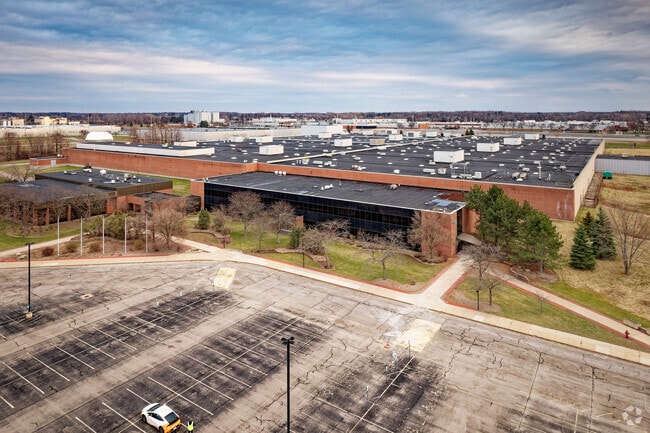

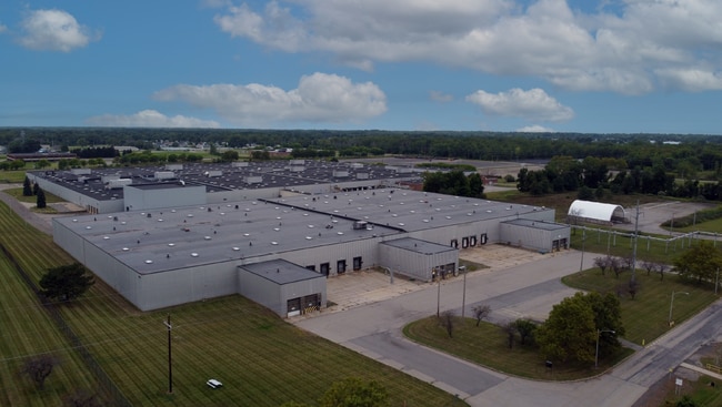

Property Detail
1500 Mitcheldean Dr
Rochester, NY
MONROE
265401 065.15-1-1
New York
Manufacturinglight
1.000
2025
84.26 AC
2025
Northeast
011210
Rochester
10,573 SF
NEARBY LISTINGS FOR SALE OR LEASE
DEMOGRAPHICS near 1500 Mitcheldean Dr
1 mile
3 mile
5 mile
2025 Total Population
1,183
28,094
51,566
2030 Population
1,204
28,019
51,210
Pop Growth 2025-2030
+ 1.78%
(0.27%)
(0.69%)
Average Age
44
44
44
2025 Total Households
461
11,732
21,250
HH Growth 2025-2030
+ 1.95%
(0.34%)
(0.75%)
Median Household Inc
$111,440
$93,259
$98,482
Avg Household Size
2.50
2.30
2.40
2025 Avg HH Vehicles
2.00
2.00
2.00
Median Home Value
$337,640
$298,741
$289,470
Median Year Built
2000
1986
1986
Nearby Places
Map Layers
Map Styles
 Street
 Aerial
Layers
 Traffic
 Biking
Places
Listings with unknown addresses are not visible on the map
- Restaurants
- Banks
- Shops
- Fitness
- Groceries
PUBLIC TRANSPORTATION
AIRPORT
Frederick Douglass/Greater Rochester International
Drive
Walk
Distance
Frederick Douglass/Greater Rochester International
29 min
18.1 mi
SALE & LEASE HISTORY
LISTING DATE
SALE/LEASE

Dec 09, 2024
For Lease
Aug 08, 2022
For Lease
Nearby Properties
Address
Land Use
TOTAL SIZE
Lot Size
Zoning
Address
Land Use
TOTAL SIZE
Lot Size
Zoning
120,974 SF
42.70 AC
06
Address
Land Use
TOTAL SIZE
Lot Size
Zoning
9,383 SF
37.70 AC
Address
Land Use
TOTAL SIZE
Lot Size
Zoning
78,944 SF
379.99 AC
06 - INDUS
Address
Land Use
TOTAL SIZE
Lot Size
Zoning
78,944 SF
379.99 AC
06 - INDUS
Address
Land Use
TOTAL SIZE
Lot Size
Zoning
32,868 SF
46.85 AC
Address
Land Use
TOTAL SIZE
Lot Size
Zoning
119.63 AC
I
Address
Land Use
TOTAL SIZE
Lot Size
Zoning
5,400 SF
37.90 AC
Address
Land Use
TOTAL SIZE
Lot Size
Zoning
110.41 AC
Address
Land Use
TOTAL SIZE
Lot Size
Zoning
168,660 SF
42.78 AC
Address
Land Use
TOTAL SIZE
Lot Size
Zoning
98,258 SF
28.47 AC
23550
Address
Land Use
TOTAL SIZE
Lot Size
Zoning
185,429 SF
5.81 AC
Address
Land Use
TOTAL SIZE
Lot Size
Zoning
20,162 SF
19.71 AC
06 - INDUS
Address
Land Use
TOTAL SIZE
Lot Size
Zoning
80,405 SF
15.14 AC
Address
Land Use
TOTAL SIZE
Lot Size
Zoning
2,617 SF
27.13 AC
Address
Land Use
TOTAL SIZE
Lot Size
Zoning
150,591 SF
18.18 AC
I
Address
Land Use
TOTAL SIZE
Lot Size
Zoning
7,424 SF
41.69 AC
Address
Land Use
TOTAL SIZE
Lot Size
Zoning
11,862 SF
35.80 AC
26340
Address
Land Use
TOTAL SIZE
Lot Size
Zoning
6,376 SF
243.71 AC
Address
Land Use
TOTAL SIZE
Lot Size
Zoning
97,055 SF
15.73 AC
Address
Land Use
TOTAL SIZE
Lot Size
Zoning
96,891 SF
37.91 AC
Address
Land Use
TOTAL SIZE
Lot Size
Zoning
129,951 SF
29.16 AC
Address
Land Use
TOTAL SIZE
Lot Size
Zoning
8,526 SF
26.46 AC
Address
Land Use
TOTAL SIZE
Lot Size
Zoning
Address
Land Use
TOTAL SIZE
Lot Size
Zoning
127,521 SF
13.16 AC
Address
Land Use
TOTAL SIZE
Lot Size
Zoning
82,349 SF
13.96 AC
Address
Land Use
TOTAL SIZE
Lot Size
Zoning
104,934 SF
17.03 AC
01 - NOT Z
Address
Land Use
TOTAL SIZE
Lot Size
Zoning
2,898 SF
7.50 AC
06
Address
Land Use
TOTAL SIZE
Lot Size
Zoning
19,314 SF
8.90 AC
53710
Address
Land Use
TOTAL SIZE
Lot Size
Zoning
The World's #1 Commercial Real Estate Marketplace
Connect with us
© 2026 CoStar Group
The information above has been obtained from sources believed reliable. While we do not doubt its accuracy we have not verified it and make no guarantee, warranty or representation about it. It is your responsibility to independently confirm its accuracy and completeness. Any projections, opinions, assumptions, or estimates used are for example only and do not represent the current or future performance of the property. The value of this transaction to you depends on tax and other factors which should be evaluated by your tax, financial, and legal advisors. You and your advisors should conduct a careful, independent investigation of the property to determine to your satisfaction the suitability of the property for your needs.