Property Record
800 Research Dr, Woodland Park, CO 80863


Save to a Folder
{{folder.Name}}
{{folder.ListingIds.length}} Properties
{{folder.ListingIds.length}} Property
Create a New Folder
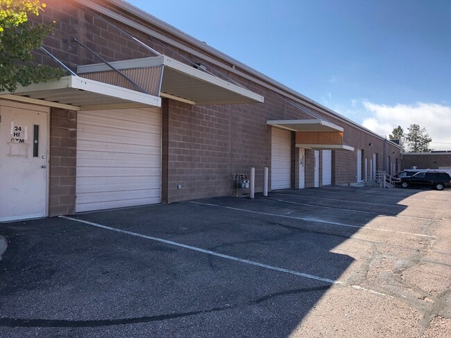
This Property Is For Sale
Current Lease Availabilities
Property Detail
800 Research Dr
R0000247
L1 TAMARAC RESEARCH & DEVEL
Multitenantindustrial
Teller
WP
Colorado
AE The base floodplain where base flood elevations are provided. AE Zones are now used on new format FIRMs instead of A1-A30 Zones.
1
2025
6.04 AC
2025
Teller County
010108
Colorado Springs
35,209 SF
Colorado Springs, CO
NEARBY LISTINGS FOR SALE OR LEASE
DEMOGRAPHICS near 800 Research Dr
1 mile
3 mile
5 mile
2025 Total Population
3,309
9,926
12,404
2030 Population
3,254
9,809
12,299
Pop Growth 2025-2030
(1.66%)
(1.18%)
(0.85%)
Average Age
45
46
46
2025 Total Households
1,320
4,121
5,159
HH Growth 2025-2030
(1.82%)
(1.21%)
(0.89%)
Median Household Inc
$106,156
$100,989
$99,944
Avg Household Size
2.50
2.40
2.40
2025 Avg HH Vehicles
3.00
2.00
2.00
Median Home Value
$616,398
$571,719
$572,292
Median Year Built
1988
1987
1987
Nearby Places
Map Layers
Map Styles
 Street
 Aerial
Layers
 Traffic
 Biking
Places
Listings with unknown addresses are not visible on the map
- Restaurants
- Banks
- Shops
- Fitness
- Groceries
PUBLIC TRANSPORTATION
AIRPORT
City of Colorado Springs Municipal
Drive
Walk
Distance
City of Colorado Springs Municipal
52 min
31.0 mi
Nearby Properties
Address
Land Use
TOTAL SIZE
Lot Size
Zoning
Address
Land Use
TOTAL SIZE
Lot Size
Zoning
41,542 SF
145.43 AC
Address
Land Use
TOTAL SIZE
Lot Size
Zoning
31,654 SF
Address
Land Use
TOTAL SIZE
Lot Size
Zoning
20,398 SF
Address
Land Use
TOTAL SIZE
Lot Size
Zoning
54,600 SF
6.70 AC
WP
Address
Land Use
TOTAL SIZE
Lot Size
Zoning
8,645 SF
3.09 AC
WP
Address
Land Use
TOTAL SIZE
Lot Size
Zoning
13,221 SF
1.53 AC
Address
Land Use
TOTAL SIZE
Lot Size
Zoning
4,200 SF
153.57 AC
A1
Address
Land Use
TOTAL SIZE
Lot Size
Zoning
18,325 SF
2.10 AC
WP
Address
Land Use
TOTAL SIZE
Lot Size
Zoning
33,680 SF
1.30 AC
WP
Address
Land Use
TOTAL SIZE
Lot Size
Zoning
32,146 SF
2.06 AC
Address
Land Use
TOTAL SIZE
Lot Size
Zoning
5,041 SF
2.49 AC
WP
Address
Land Use
TOTAL SIZE
Lot Size
Zoning
12,839 SF
5.94 AC
WP
Address
Land Use
TOTAL SIZE
Lot Size
Zoning
21,970 SF
5.24 AC
Address
Land Use
TOTAL SIZE
Lot Size
Zoning
16,458 SF
16.04 AC
A1
Address
Land Use
TOTAL SIZE
Lot Size
Zoning
23,056 SF
2.46 AC
Address
Land Use
TOTAL SIZE
Lot Size
Zoning
12,527 SF
63.97 AC
A1PUD
Address
Land Use
TOTAL SIZE
Lot Size
Zoning
32,400 SF
7 AC
A1HSCLI
Address
Land Use
TOTAL SIZE
Lot Size
Zoning
1,192 SF
1.60 AC
C1
Address
Land Use
TOTAL SIZE
Lot Size
Zoning
8,798 SF
4.88 AC
WPPUD
Address
Land Use
TOTAL SIZE
Lot Size
Zoning
2,560 SF
3.80 AC
WP
Address
Land Use
TOTAL SIZE
Lot Size
Zoning
10,581 SF
1.14 AC
WP
Address
Land Use
TOTAL SIZE
Lot Size
Zoning
12,300 SF
0.58 AC
WP
Address
Land Use
TOTAL SIZE
Lot Size
Zoning
1,480 SF
40 AC
A-5
Address
Land Use
TOTAL SIZE
Lot Size
Zoning
9,982 SF
1.12 AC
WP
Address
Land Use
TOTAL SIZE
Lot Size
Zoning
14,171 SF
1.37 AC
WP
Address
Land Use
TOTAL SIZE
Lot Size
Zoning
11,700 SF
0.55 AC
WP
Address
Land Use
TOTAL SIZE
Lot Size
Zoning
14,376 SF
1.52 AC
R1HSCLI
Address
Land Use
TOTAL SIZE
Lot Size
Zoning
2,435 SF
1.89 AC
Address
Land Use
TOTAL SIZE
Lot Size
Zoning
11,829 SF
2.69 AC
R1
The World's #1 Commercial Real Estate Marketplace
Connect with us
© 2026 CoStar Group
The information above has been obtained from sources believed reliable. While we do not doubt its accuracy we have not verified it and make no guarantee, warranty or representation about it. It is your responsibility to independently confirm its accuracy and completeness. Any projections, opinions, assumptions, or estimates used are for example only and do not represent the current or future performance of the property. The value of this transaction to you depends on tax and other factors which should be evaluated by your tax, financial, and legal advisors. You and your advisors should conduct a careful, independent investigation of the property to determine to your satisfaction the suitability of the property for your needs.